
FB-11 Bus Route Map
View the FB-11 route map and see all FB-11 stops along the route. The map of FB-11 shows where the bus travels and the location of each stop, making it easy to understand the entire route at a glance.
Explore Stadtwerke Bad Nauheim routes on the map and see where Stadtwerke Bad Nauheim bus services operate. Use the FB-11 map to find bus stops and see how the FB-11 connects different areas along its trip.
All FB-11 stops on the map are displayed in route order, helping you follow the FB-11 bus from the first stop to the last.
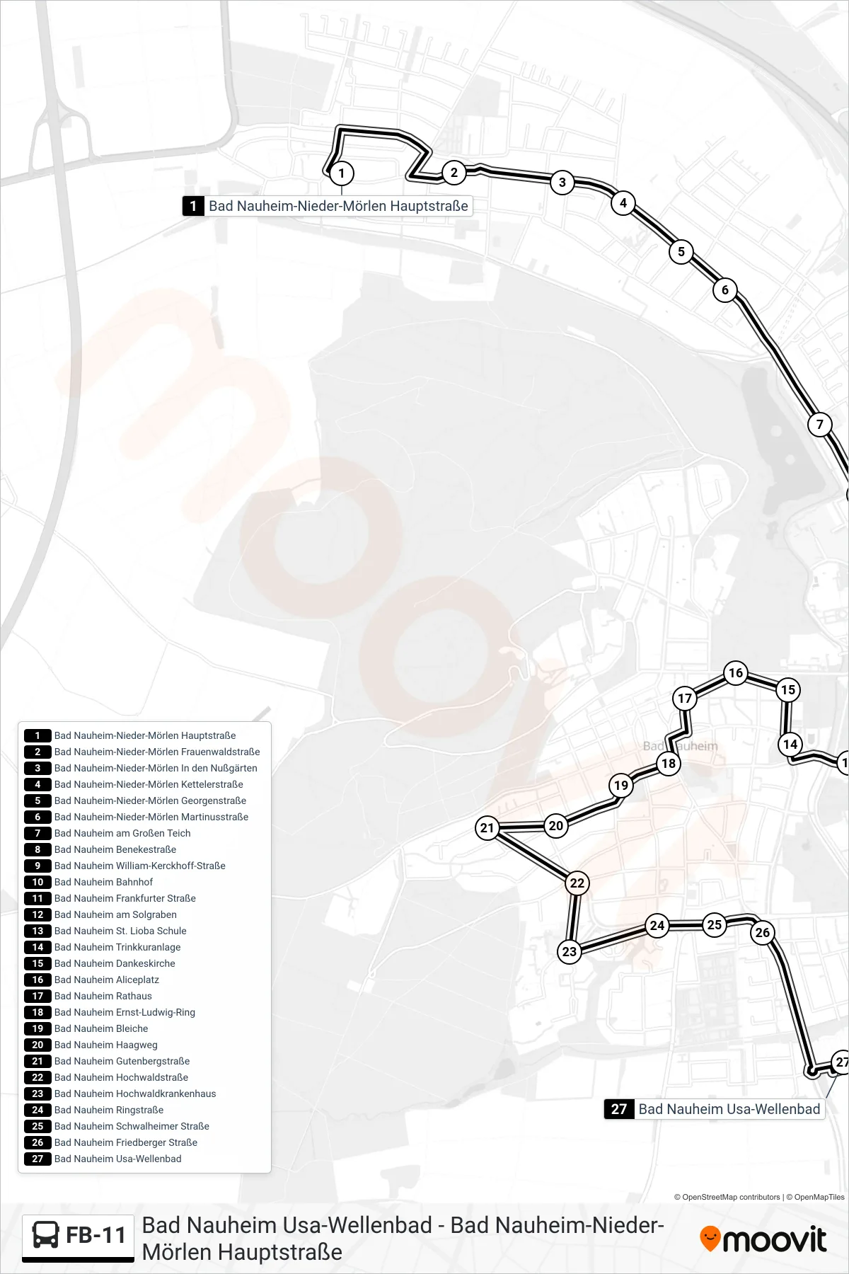
Stops list (FB-11 - Bad Nauheim Usa-Wellenbad)
- Bad Nauheim-Nieder-Mörlen Hauptstraße
- Bad Nauheim-Nieder-Mörlen Frauenwaldstraße
- Bad Nauheim-Nieder-Mörlen In den Nußgärten
- Bad Nauheim-Nieder-Mörlen Kettelerstraße
- Bad Nauheim-Nieder-Mörlen Georgenstraße
- Bad Nauheim-Nieder-Mörlen Martinusstraße
- Bad Nauheim am Großen Teich
- Bad Nauheim Benekestraße
- Bad Nauheim William-Kerckhoff-Straße
- Bad Nauheim Bahnhof
- Bad Nauheim Frankfurter Straße
- Bad Nauheim am Solgraben
- Bad Nauheim St. Lioba Schule
- Bad Nauheim Trinkkuranlage
- Bad Nauheim Dankeskirche
- Bad Nauheim Aliceplatz
- Bad Nauheim Rathaus
- Bad Nauheim Ernst-Ludwig-Ring
- Bad Nauheim Bleiche
- Bad Nauheim Haagweg
- Bad Nauheim Gutenbergstraße
- Bad Nauheim Hochwaldstraße
- Bad Nauheim Hochwaldkrankenhaus
- Bad Nauheim Ringstraße
- Bad Nauheim Schwalheimer Straße
- Bad Nauheim Friedberger Straße
- Bad Nauheim Usa-Wellenbad