
FM Bus Route Map
View the FM route map and see all FM stops along the route. The map of FM shows where the bus travels and the location of each stop, making it easy to understand the entire route at a glance.
Explore HEAG mobiBus GmbH + Co. KG routes on the map and see where HEAG mobiBus GmbH + Co. KG bus services operate. Use the FM map to find bus stops and see how the FM connects different areas along its trip.
All FM stops on the map are displayed in route order, helping you follow the FM bus from the first stop to the last.
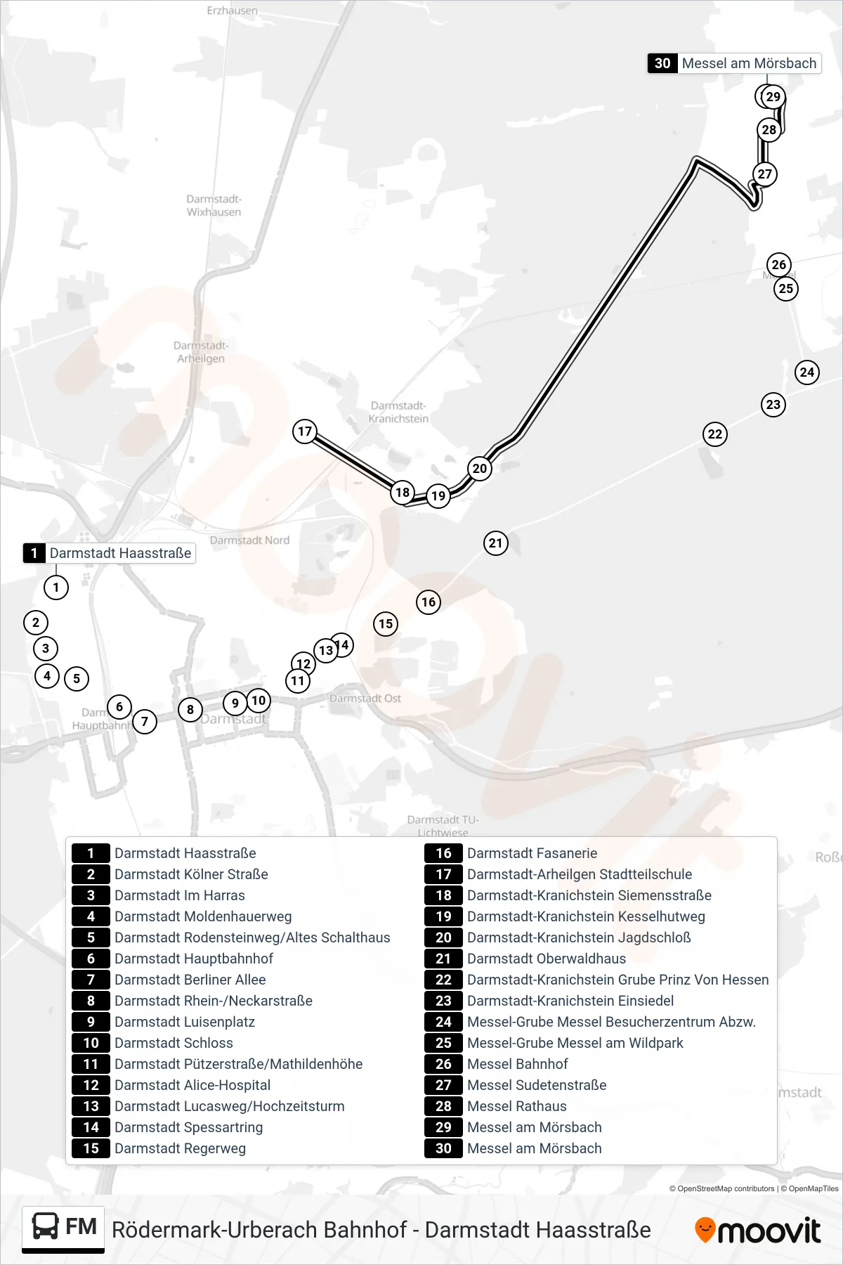
Stops list (FM - Messel am Mörsbach)
- Darmstadt Haasstraße
- Darmstadt Kölner Straße
- Darmstadt Im Harras
- Darmstadt Moldenhauerweg
- Darmstadt Rodensteinweg/Altes Schalthaus
- Darmstadt Hauptbahnhof
- Darmstadt Berliner Allee
- Darmstadt Rhein-/Neckarstraße
- Darmstadt Luisenplatz
- Darmstadt Schloss
- Darmstadt Pützerstraße/Mathildenhöhe
- Darmstadt Alice-Hospital
- Darmstadt Lucasweg/Hochzeitsturm
- Darmstadt Spessartring
- Darmstadt Regerweg
- Darmstadt Fasanerie
- Darmstadt-Arheilgen Stadtteilschule
- Darmstadt-Kranichstein Siemensstraße
- Darmstadt-Kranichstein Kesselhutweg
- Darmstadt-Kranichstein Jagdschloß
- Darmstadt Oberwaldhaus
- Darmstadt-Kranichstein Grube Prinz Von Hessen
- Darmstadt-Kranichstein Einsiedel
- Messel-Grube Messel Besucherzentrum Abzw.
- Messel-Grube Messel am Wildpark
- Messel Bahnhof
- Messel Sudetenstraße
- Messel Rathaus
- Messel am Mörsbach
- Messel am Mörsbach