
G Bus Route Map
View the G route map and see all G stops along the route. The map of G shows where the bus travels and the location of each stop, making it easy to understand the entire route at a glance.
Explore Astuce (Métropole Rouen Normandie) routes on the map and see where Astuce (Métropole Rouen Normandie) bus services operate. Use the G map to find bus stops and see how the G connects different areas along its trip.
All G stops on the map are displayed in route order, helping you follow the G bus from the first stop to the last.
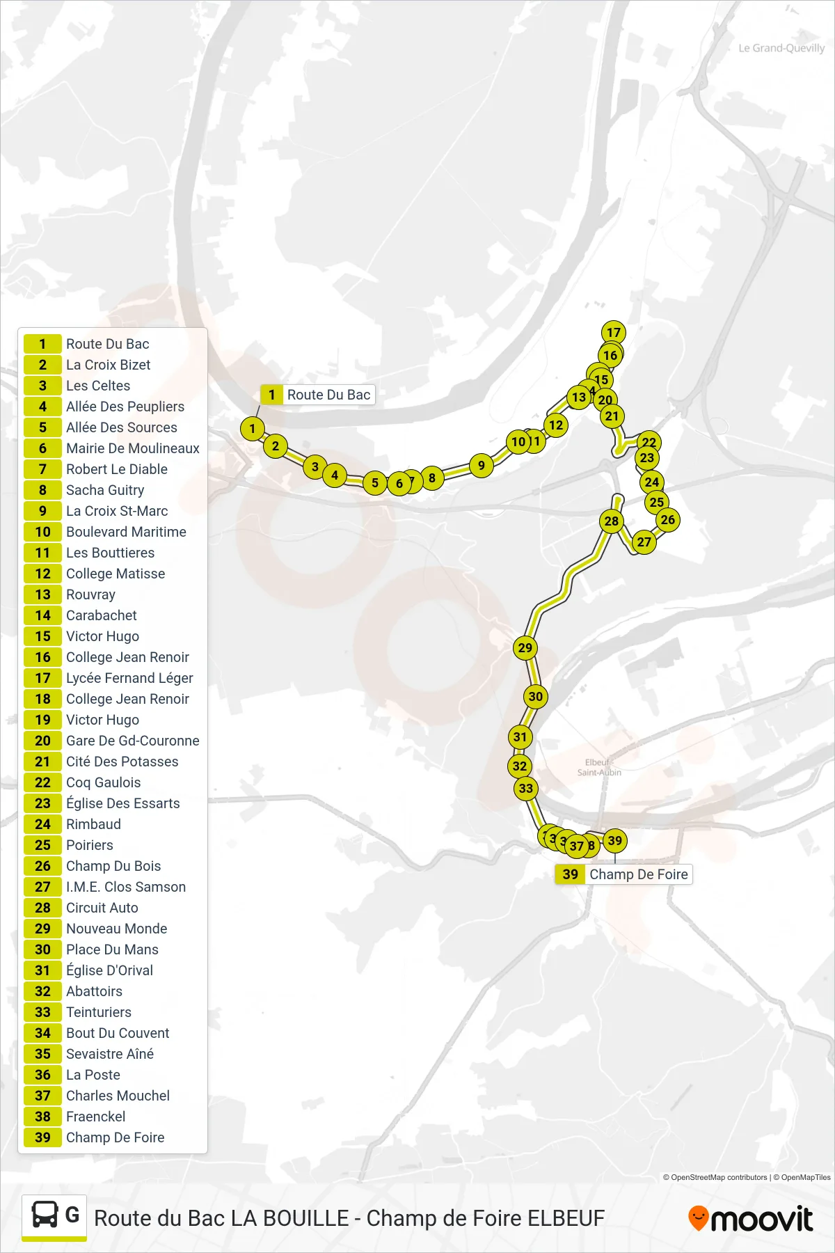
Stops list (G - Champ De Foire)
- Route Du Bac
- La Croix Bizet
- Les Celtes
- Allée Des Peupliers
- Allée Des Sources
- Mairie De Moulineaux
- Robert Le Diable
- Sacha Guitry
- La Croix St-Marc
- Boulevard Maritime
- Les Bouttieres
- College Matisse
- Rouvray
- Carabachet
- Victor Hugo
- College Jean Renoir
- Lycée Fernand Léger
- College Jean Renoir
- Victor Hugo
- Gare De Gd-Couronne
- Cité Des Potasses
- Coq Gaulois
- Église Des Essarts
- Rimbaud
- Poiriers
- Champ Du Bois
- I.M.E. Clos Samson
- Circuit Auto
- Nouveau Monde
- Place Du Mans
- Église D'Orival
- Abattoirs
- Teinturiers
- Bout Du Couvent
- Sevaistre Aîné
- La Poste
- Charles Mouchel
- Fraenckel
- Champ De Foire