
GI-21 Bus Route Map
View the GI-21 route map and see all GI-21 stops along the route. The map of GI-21 shows where the bus travels and the location of each stop, making it easy to understand the entire route at a glance.
Explore VGO Gießen routes on the map and see where VGO Gießen bus services operate. Use the GI-21 map to find bus stops and see how the GI-21 connects different areas along its trip.
All GI-21 stops on the map are displayed in route order, helping you follow the GI-21 bus from the first stop to the last.
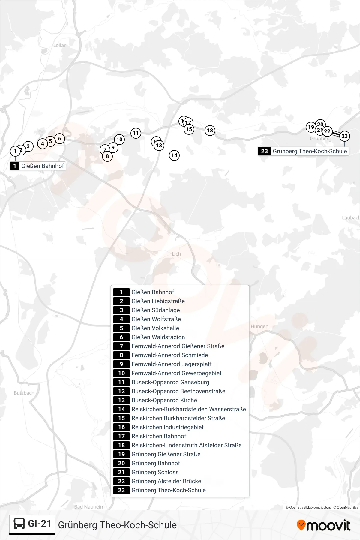
Stops list (GI-21 - Grünberg Theo-Koch-Schule)
- Gießen Bahnhof
- Gießen Liebigstraße
- Gießen Südanlage
- Gießen Wolfstraße
- Gießen Volkshalle
- Gießen Waldstadion
- Fernwald-Annerod Gießener Straße
- Fernwald-Annerod Schmiede
- Fernwald-Annerod Jägersplatt
- Fernwald-Annerod Gewerbegebiet
- Buseck-Oppenrod Ganseburg
- Buseck-Oppenrod Beethovenstraße
- Buseck-Oppenrod Kirche
- Reiskirchen-Burkhardsfelden Wasserstraße
- Reiskirchen Burkhardsfelder Straße
- Reiskirchen Industriegebiet
- Reiskirchen Bahnhof
- Reiskirchen-Lindenstruth Alsfelder Straße
- Grünberg Gießener Straße
- Grünberg Bahnhof
- Grünberg Schloss
- Grünberg Alsfelder Brücke
- Grünberg Theo-Koch-Schule
Change direction
- Route Map - GI-21 - Grünberg Bahnhof
- Route Map - GI-21 - Reiskirchen Bahnhof
- Route Map - GI-21 - Reiskirchen-Hattenrod Licher Straße
- Route Map - GI-21 - Reiskirchen-Ettingshausen am Bahnhof
- Route Map - GI-21 - Fernwald-Annerod Jägersplatt
- Route Map - GI-21 - Reiskirchen-Lindenstruth Wieseckhalle
- Route Map - GI-21 - Gießen Bahnhof