
H Bus Route Map
View the H route map and see all H stops along the route. The map of H shows where the bus travels and the location of each stop, making it easy to understand the entire route at a glance.
Explore CATA routes on the map and see where CATA bus services operate. Use the H map to find bus stops and see how the H connects different areas along its trip.
All H stops on the map are displayed in route order, helping you follow the H bus from the first stop to the last.
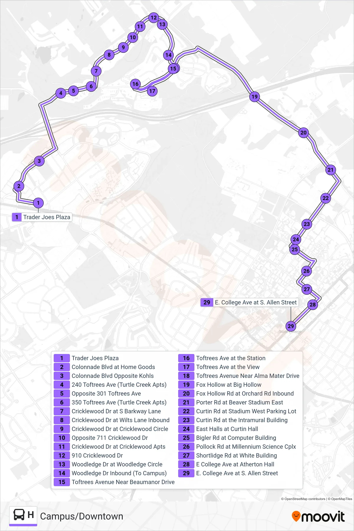
Stops list (H - Campus/Downtown)
- Trader Joes Plaza
- Colonnade Blvd at Home Goods
- Colonnade Blvd Opposite Kohls
- 240 Toftrees Ave (Turtle Creek Apts)
- Opposite 301 Toftrees Ave
- 350 Toftrees Ave (Turtle Creek Apts)
- Cricklewood Dr at S Barkway Lane
- Cricklewood Dr at Wilts Lane Inbound
- Cricklewood Dr at Cricklewood Circle
- Opposite 711 Cricklewood Dr
- Cricklewood Dr at Cricklewood Apts
- 910 Cricklewood Dr
- Woodledge Dr at Woodledge Circle
- Woodledge Dr Inbound (To Campus)
- Toftrees Avenue Near Beaumanor Drive
- Toftrees Ave at the Station
- Toftrees Ave at the View
- Toftrees Avenue Near Alma Mater Drive
- Fox Hollow at Big Hollow
- Fox Hollow Rd at Orchard Rd Inbound
- Porter Rd at Beaver Stadium East
- Curtin Rd at Stadium West Parking Lot
- Curtin Rd at the Intramural Building
- East Halls at Curtin Hall
- Bigler Rd at Computer Building
- Pollock Rd at Millennium Science Cplx
- Shortlidge Rd at White Building
- E College Ave at Atherton Hall
- E. College Ave at S. Allen Street