
H3 Bus Route Map
View the H3 route map and see all H3 stops along the route. The map of H3 shows where the bus travels and the location of each stop, making it easy to understand the entire route at a glance.
Explore Bus Átha Cliath – Dublin Bus routes on the map and see where Bus Átha Cliath – Dublin Bus bus services operate. Use the H3 map to find bus stops and see how the H3 connects different areas along its trip.
All H3 stops on the map are displayed in route order, helping you follow the H3 bus from the first stop to the last.
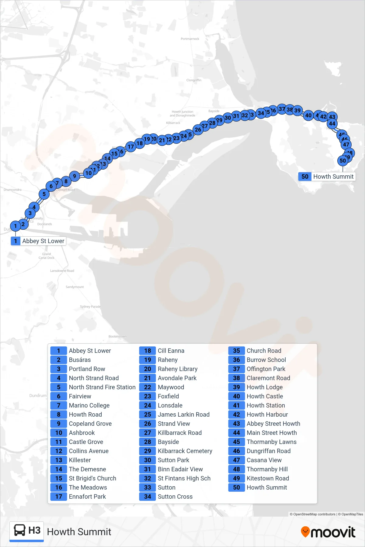
Stops list (H3 - Howth Summit)
- Abbey St Lower
- Busáras
- Portland Row
- North Strand Road
- North Strand Fire Station
- Fairview
- Marino College
- Howth Road
- Copeland Grove
- Ashbrook
- Castle Grove
- Collins Avenue
- Killester
- The Demesne
- St Brigid's Church
- The Meadows
- Ennafort Park
- Cill Eanna
- Raheny
- Raheny Library
- Avondale Park
- Maywood
- Foxfield
- Lonsdale
- James Larkin Road
- Strand View
- Killbarrack Road
- Bayside
- Kilbarrack Cemetery
- Sutton Park
- Binn Eadair View
- St Fintans High Sch
- Sutton
- Sutton Cross
- Church Road
- Burrow School
- Offington Park
- Claremont Road
- Howth Lodge
- Howth Castle
- Howth Station
- Howth Harbour
- Abbey Street Howth
- Main Street Howth
- Thormanby Lawns
- Dungriffan Road
- Casana View
- Thormanby Hill
- Kitestown Road
- Howth Summit