
HOTANTSA Bus Route Map
View the HOTANTSA route map and see all HOTANTSA stops along the route. The map of HOTANTSA shows where the bus travels and the location of each stop, making it easy to understand the entire route at a glance.
Explore Intercity Lines routes on the map and see where Intercity Lines bus services operate. Use the HOTANTSA map to find bus stops and see how the HOTANTSA connects different areas along its trip.
All HOTANTSA stops on the map are displayed in route order, helping you follow the HOTANTSA bus from the first stop to the last.
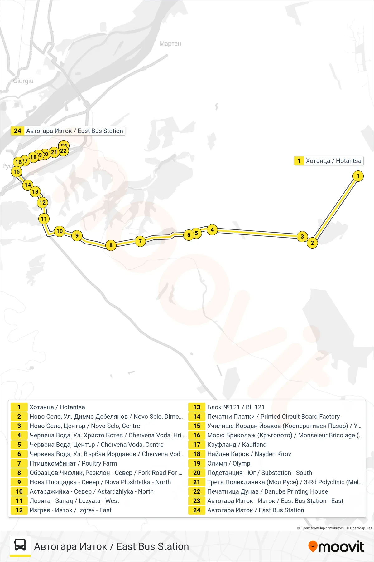
Stops list (HOTANTSA - East Bus Station)
- Hotantsa
- Novo Selo, Dimcho Debelyanov St.
- Novo Selo, Centre
- Chervena Voda, Hristo Botev St.
- Chervena Voda, Centre
- Chervena Voda, Varban Yordanov St.
- Poultry Farm
- Fork Road For Obraztsov Chiflik - North
- Nova Ploshtatka - North
- Astardzhiyka - North
- Vineyards - West
- Izgrev - East
- Bl. 121
- Printed Circuit Board Factory
- Yordan Yovkov High School (Cooperative Market)
- Monsieur Bricolage (The Roundabout)
- Kaufland
- Nayden Kirov
- Olymp
- Substation - South
- 3rd Polyclinic (Mall Of Ruse)
- Pechatnitsa Dunav / Danube Printing House
- East Bus Station - East
- East Bus Station