
J Bus Route Map
View the J route map and see all J stops along the route. The map of J shows where the bus travels and the location of each stop, making it easy to understand the entire route at a glance.
Explore Metro Transit-City of Madison routes on the map and see where Metro Transit-City of Madison bus services operate. Use the J map to find bus stops and see how the J connects different areas along its trip.
All J stops on the map are displayed in route order, helping you follow the J bus from the first stop to the last.
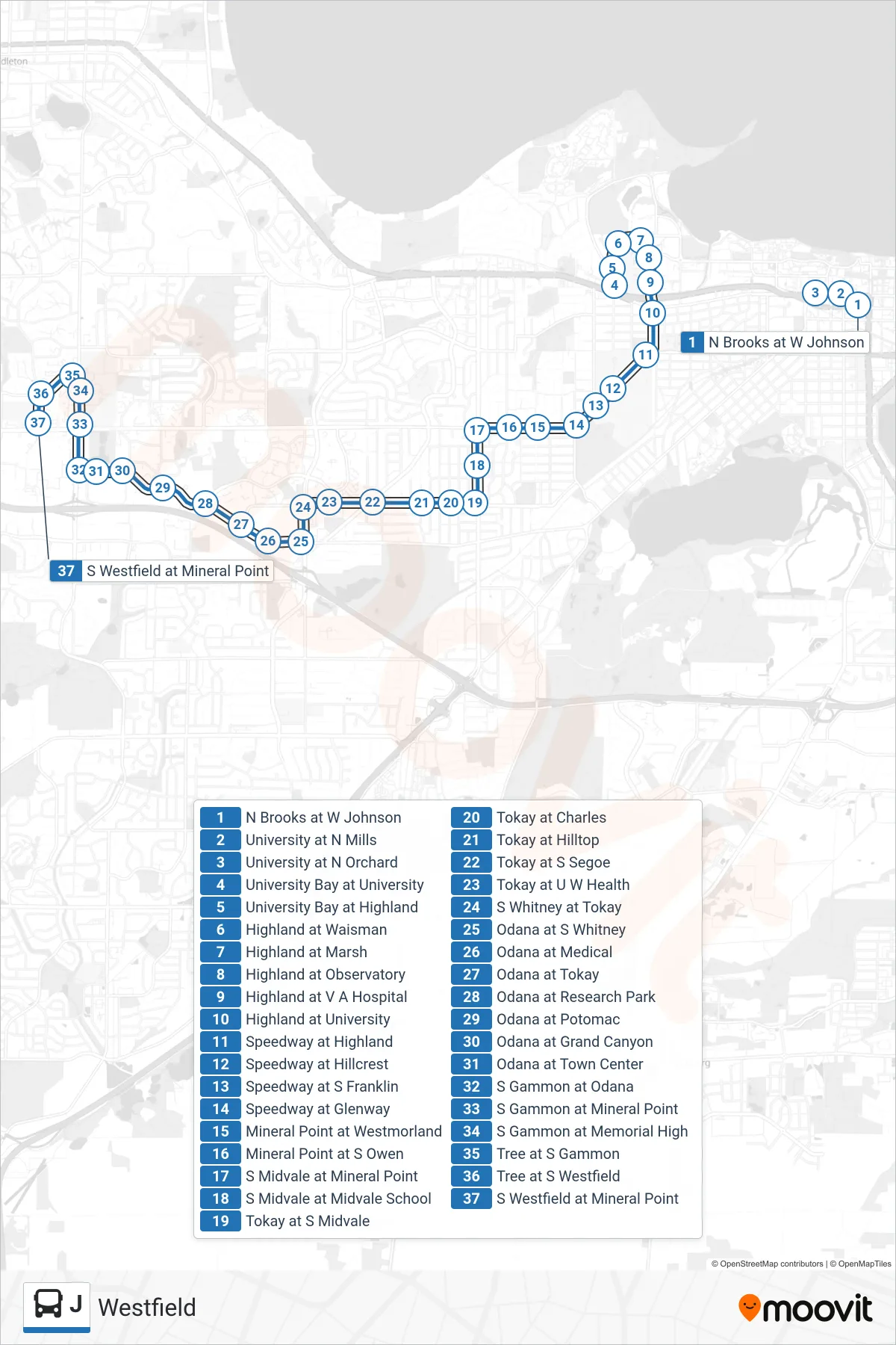
Stops list (J - Westfield)
- N Brooks at W Johnson
- University at N Mills
- University at N Orchard
- University Bay at University
- University Bay at Highland
- Highland at Waisman
- Highland at Marsh
- Highland at Observatory
- Highland at V A Hospital
- Highland at University
- Speedway at Highland
- Speedway at Hillcrest
- Speedway at S Franklin
- Speedway at Glenway
- Mineral Point at Westmorland
- Mineral Point at S Owen
- S Midvale at Mineral Point
- S Midvale at Midvale School
- Tokay at S Midvale
- Tokay at Charles
- Tokay at Hilltop
- Tokay at S Segoe
- Tokay at U W Health
- S Whitney at Tokay
- Odana at S Whitney
- Odana at Medical
- Odana at Tokay
- Odana at Research Park
- Odana at Potomac
- Odana at Grand Canyon
- Odana at Town Center
- S Gammon at Odana
- S Gammon at Mineral Point
- S Gammon at Memorial High
- Tree at S Gammon
- Tree at S Westfield
- S Westfield at Mineral Point