
JEEP Bus Route Map
View the JEEP route map and see all JEEP stops along the route. The map of JEEP shows where the bus travels and the location of each stop, making it easy to understand the entire route at a glance.
Explore LTFRB routes on the map and see where LTFRB bus services operate. Use the JEEP map to find bus stops and see how the JEEP connects different areas along its trip.
All JEEP stops on the map are displayed in route order, helping you follow the JEEP bus from the first stop to the last.
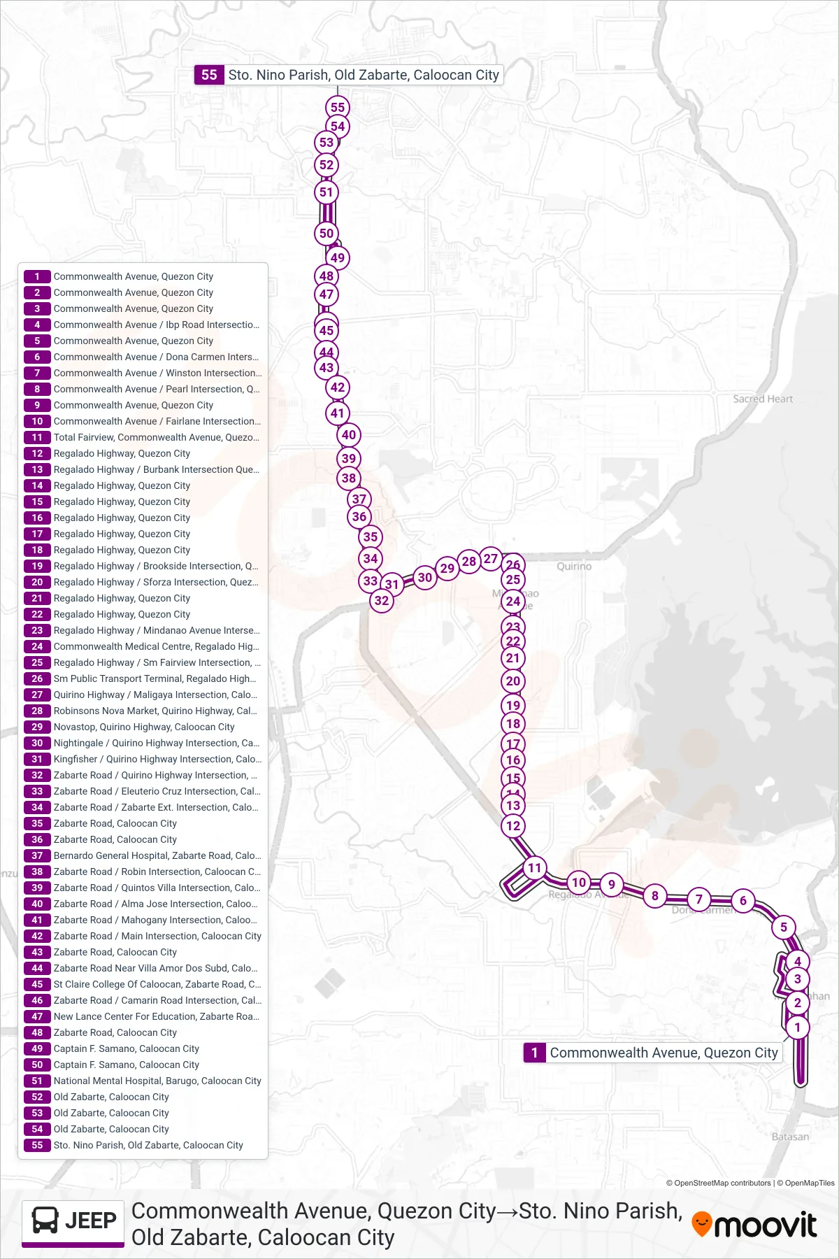
Stops list (JEEP - Commonwealth Avenue, Quezon City→Sto. Nino Parish, Old Zabarte, Caloocan City)
- Commonwealth Avenue, Quezon City
- Commonwealth Avenue, Quezon City
- Commonwealth Avenue, Quezon City
- Commonwealth Avenue / Ibp Road Intersection, Quezon City
- Commonwealth Avenue, Quezon City
- Commonwealth Avenue / Dona Carmen Intersection, Quezon City
- Commonwealth Avenue / Winston Intersection, Quezon City
- Commonwealth Avenue / Pearl Intersection, Quezon City
- Commonwealth Avenue, Quezon City
- Commonwealth Avenue / Fairlane Intersection, Quezon City
- Total Fairview, Commonwealth Avenue, Quezon City
- Regalado Highway, Quezon City
- Regalado Highway / Burbank Intersection Quezon City
- Regalado Highway, Quezon City
- Regalado Highway, Quezon City
- Regalado Highway, Quezon City
- Regalado Highway, Quezon City
- Regalado Highway, Quezon City
- Regalado Highway / Brookside Intersection, Quezon City
- Regalado Highway / Sforza Intersection, Quezon City
- Regalado Highway, Quezon City
- Regalado Highway, Quezon City
- Regalado Highway / Mindanao Avenue Intersection, Quezon City
- Commonwealth Medical Centre, Regalado Highway, Quezon City
- Regalado Highway / Sm Fairview Intersection, Quezon City
- Sm Public Transport Terminal, Regalado Highway, Quezon City
- Quirino Highway / Maligaya Intersection, Caloocan City
- Robinsons Nova Market, Quirino Highway, Caloocan City
- Novastop, Quirino Highway, Caloocan City
- Nightingale / Quirino Highway Intersection, Caloocan City
- Kingfisher / Quirino Highway Intersection, Caloocan City
- Zabarte Road / Quirino Highway Intersection, Caloocan City
- Zabarte Road / Eleuterio Cruz Intersection, Caloocan City
- Zabarte Road / Zabarte Ext. Intersection, Caloocan City
- Zabarte Road, Caloocan City
- Zabarte Road, Caloocan City
- Bernardo General Hospital, Zabarte Road, Caloocan City
- Zabarte Road / Robin Intersection, Caloocan City
- Zabarte Road / Quintos Villa Intersection, Caloocan City
- Zabarte Road / Alma Jose Intersection, Caloocan City
- Zabarte Road / Mahogany Intersection, Caloocan City
- Zabarte Road / Main Intersection, Caloocan City
- Zabarte Road, Caloocan City
- Zabarte Road Near Villa Amor Dos Subd, Caloocan City
- St Claire College Of Caloocan, Zabarte Road, Caloocan City
- Zabarte Road / Camarin Road Intersection, Caloocan City
- New Lance Center For Education, Zabarte Road, Caloocan City
- Zabarte Road, Caloocan City
- Captain F. Samano, Caloocan City
- Captain F. Samano, Caloocan City
- National Mental Hospital, Barugo, Caloocan City
- Old Zabarte, Caloocan City
- Old Zabarte, Caloocan City
- Old Zabarte, Caloocan City
- Sto. Nino Parish, Old Zabarte, Caloocan City