
JEEP Bus Route Map
View the JEEP route map and see all JEEP stops along the route. The map of JEEP shows where the bus travels and the location of each stop, making it easy to understand the entire route at a glance.
Explore LTFRB routes on the map and see where LTFRB bus services operate. Use the JEEP map to find bus stops and see how the JEEP connects different areas along its trip.
All JEEP stops on the map are displayed in route order, helping you follow the JEEP bus from the first stop to the last.
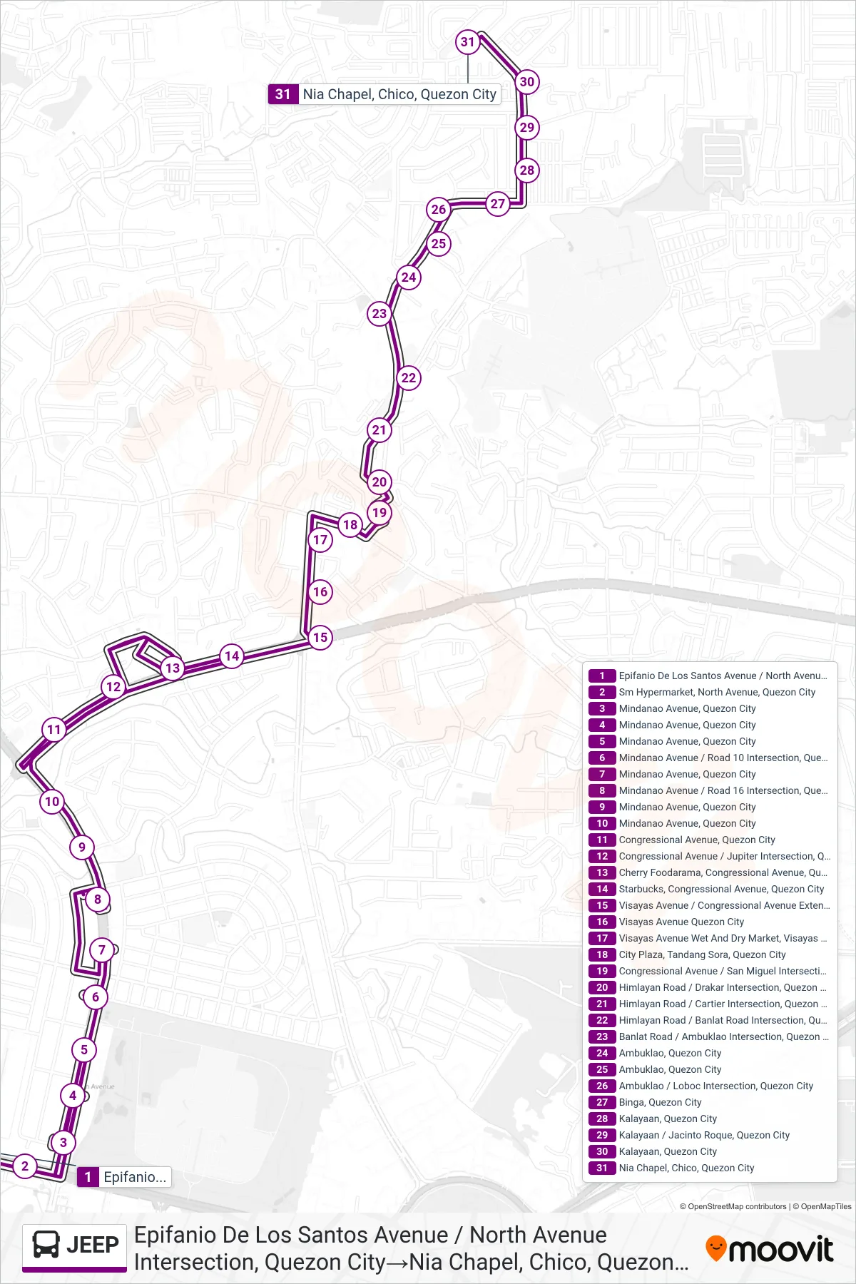
Stops list (JEEP - Epifanio De Los Santos Avenue / North Avenue Intersection, Quezon City→Nia Chapel, Chico, Quezon City)
- Epifanio De Los Santos Avenue / North Avenue Intersection, Quezon City
- Sm Hypermarket, North Avenue, Quezon City
- Mindanao Avenue, Quezon City
- Mindanao Avenue, Quezon City
- Mindanao Avenue, Quezon City
- Mindanao Avenue / Road 10 Intersection, Quezon City
- Mindanao Avenue, Quezon City
- Mindanao Avenue / Road 16 Intersection, Quezon City
- Mindanao Avenue, Quezon City
- Mindanao Avenue, Quezon City
- Congressional Avenue, Quezon City
- Congressional Avenue / Jupiter Intersection, Quezon City
- Cherry Foodarama, Congressional Avenue, Quezon City
- Starbucks, Congressional Avenue, Quezon City
- Visayas Avenue / Congressional Avenue Extension, Quezon City
- Visayas Avenue Quezon City
- Visayas Avenue Wet And Dry Market, Visayas Avenue Quezon City
- City Plaza, Tandang Sora, Quezon City
- Congressional Avenue / San Miguel Intersection, Quezon City
- Himlayan Road / Drakar Intersection, Quezon City
- Himlayan Road / Cartier Intersection, Quezon City
- Himlayan Road / Banlat Road Intersection, Quezon City
- Banlat Road / Ambuklao Intersection, Quezon City
- Ambuklao, Quezon City
- Ambuklao, Quezon City
- Ambuklao / Loboc Intersection, Quezon City
- Binga, Quezon City
- Kalayaan, Quezon City
- Kalayaan / Jacinto Roque, Quezon City
- Kalayaan, Quezon City
- Nia Chapel, Chico, Quezon City