
JFX Bus Route Map
View the JFX route map and see all JFX stops along the route. The map of JFX shows where the bus travels and the location of each stop, making it easy to understand the entire route at a glance.
Explore Chapel Hill Transit routes on the map and see where Chapel Hill Transit bus services operate. Use the JFX map to find bus stops and see how the JFX connects different areas along its trip.
All JFX stops on the map are displayed in route order, helping you follow the JFX bus from the first stop to the last.
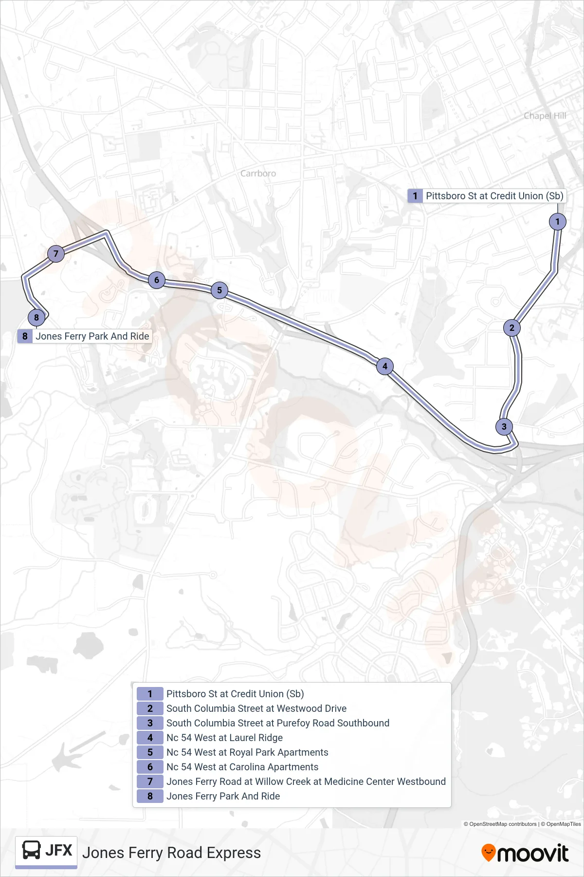
Stops list (JFX - Pittsboro St at Credit Union→Jones Ferry Park And Ride)
- Pittsboro St at Credit Union (Sb)
- South Columbia Street at Westwood Drive
- South Columbia Street at Purefoy Road Southbound
- Nc 54 West at Laurel Ridge
- Nc 54 West at Royal Park Apartments
- Nc 54 West at Carolina Apartments
- Jones Ferry Road at Willow Creek at Medicine Center Westbound
- Jones Ferry Park And Ride