
K Bus Route Map
View the K route map and see all K stops along the route. The map of K shows where the bus travels and the location of each stop, making it easy to understand the entire route at a glance.
Explore SNG Suhl routes on the map and see where SNG Suhl bus services operate. Use the K map to find bus stops and see how the K connects different areas along its trip.
All K stops on the map are displayed in route order, helping you follow the K bus from the first stop to the last.
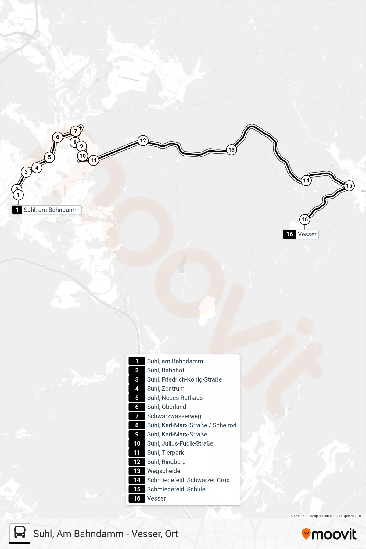
Stops list (K - Vesser)
- Suhl, am Bahndamm
- Suhl, Bahnhof
- Suhl, Friedrich-König-Straße
- Suhl, Zentrum
- Suhl, Neues Rathaus
- Suhl, Oberland
- Schwarzwasserweg
- Suhl, Karl-Marx-Straße / Schelrod
- Suhl, Karl-Marx-Straße
- Suhl, Julius-Fucik-Straße
- Suhl, Tierpark
- Suhl, Ringberg
- Wegscheide
- Schmiedefeld, Schwarzer Crux
- Schmiedefeld, Schule
- Vesser