
L Bus Route Map
View the L route map and see all L stops along the route. The map of L shows where the bus travels and the location of each stop, making it easy to understand the entire route at a glance.
Explore RFTA routes on the map and see where RFTA bus services operate. Use the L map to find bus stops and see how the L connects different areas along its trip.
All L stops on the map are displayed in route order, helping you follow the L bus from the first stop to the last.
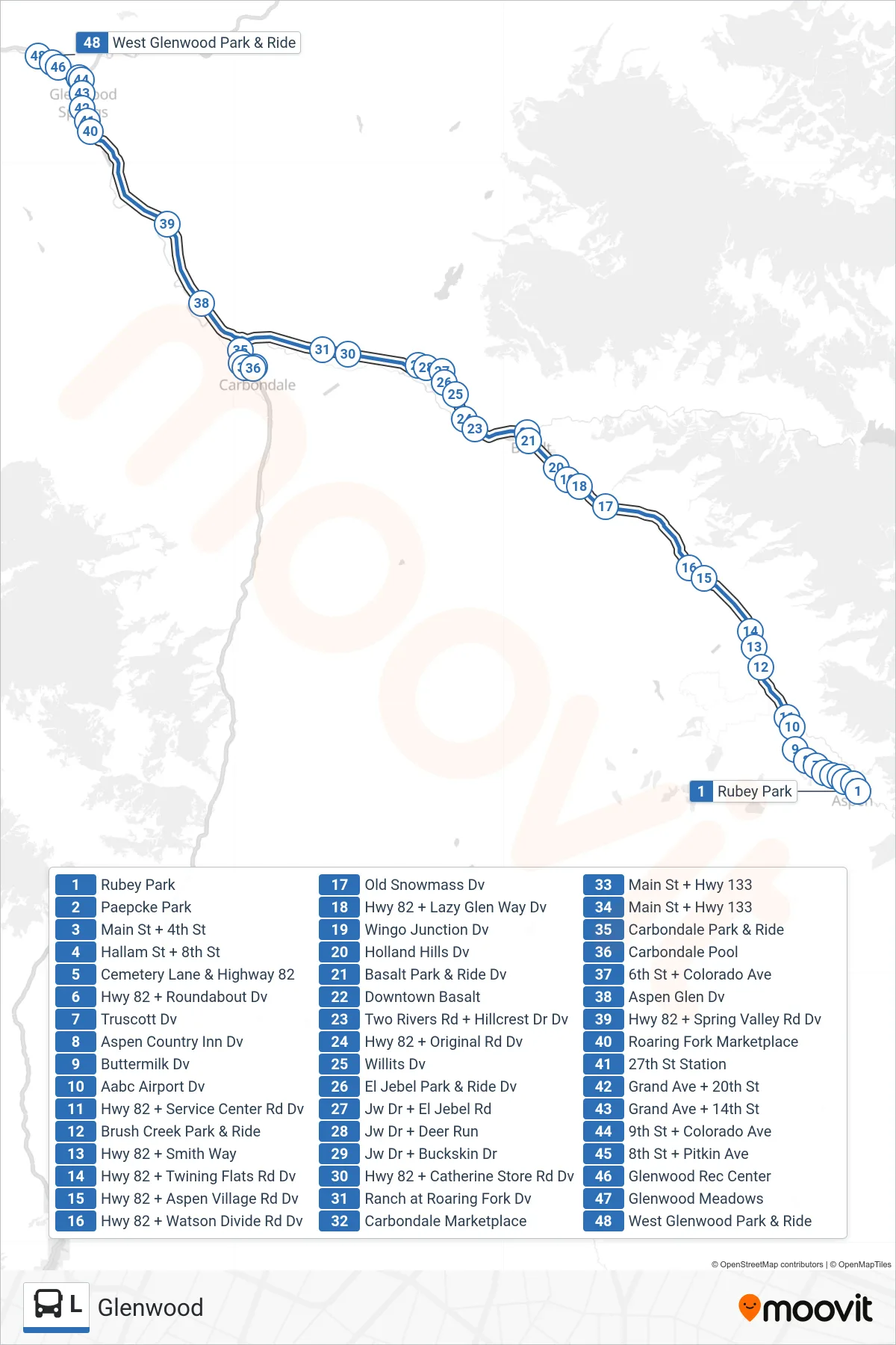
Stops list (L - Glenwood)
- Rubey Park
- Paepcke Park
- Main St + 4th St
- Hallam St + 8th St
- Cemetery Lane & Highway 82
- Hwy 82 + Roundabout Dv
- Truscott Dv
- Aspen Country Inn Dv
- Buttermilk Dv
- Aabc Airport Dv
- Hwy 82 + Service Center Rd Dv
- Brush Creek Park & Ride
- Hwy 82 + Smith Way
- Hwy 82 + Twining Flats Rd Dv
- Hwy 82 + Aspen Village Rd Dv
- Hwy 82 + Watson Divide Rd Dv
- Old Snowmass Dv
- Hwy 82 + Lazy Glen Way Dv
- Wingo Junction Dv
- Holland Hills Dv
- Basalt Park & Ride Dv
- Downtown Basalt
- Two Rivers Rd + Hillcrest Dr Dv
- Hwy 82 + Original Rd Dv
- Willits Dv
- El Jebel Park & Ride Dv
- Jw Dr + El Jebel Rd
- Jw Dr + Deer Run
- Jw Dr + Buckskin Dr
- Hwy 82 + Catherine Store Rd Dv
- Ranch at Roaring Fork Dv
- Carbondale Marketplace
- Main St + Hwy 133
- Main St + Hwy 133
- Carbondale Park & Ride
- Carbondale Pool
- 6th St + Colorado Ave
- Aspen Glen Dv
- Hwy 82 + Spring Valley Rd Dv
- Roaring Fork Marketplace
- 27th St Station
- Grand Ave + 20th St
- Grand Ave + 14th St
- 9th St + Colorado Ave
- 8th St + Pitkin Ave
- Glenwood Rec Center
- Glenwood Meadows
- West Glenwood Park & Ride