
L2 Subway Route Map
View the L2 route map and see all L2 stops along the route. The map of L2 shows where the subway travels and the location of each stop, making it easy to understand the entire route at a glance.
Explore Metrô Rio routes on the map and see where Metrô Rio subway services operate. Use the L2 map to find subway stations and see how the L2 connects different areas along its trip.
All L2 stops on the map are displayed in route order, helping you follow the L2 subway from the first station to the last.
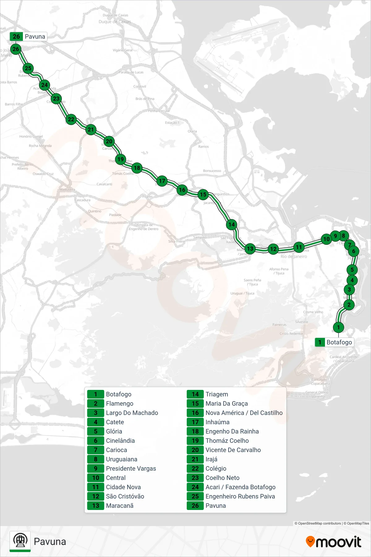
Stops list (L2 - Pavuna)
- Botafogo
- Flamengo
- Largo Do Machado
- Catete
- Glória
- Cinelândia
- Carioca
- Uruguaiana
- Presidente Vargas
- Central
- Cidade Nova
- São Cristóvão
- Maracanã
- Triagem
- Maria Da Graça
- Nova América / Del Castilho
- Inhaúma
- Engenho Da Rainha
- Thomáz Coelho
- Vicente De Carvalho
- Irajá
- Colégio
- Coelho Neto
- Acari / Fazenda Botafogo
- Engenheiro Rubens Paiva
- Pavuna