
L68 Tram Route Map
View the L68 route map and see all L68 stops along the route. The map of L68 shows where the tram travels and the location of each stop, making it easy to understand the entire route at a glance.
Explore routes on the map and see where tram services operate. Use the L68 map to find tram stations and see how the L68 connects different areas along its trip.
All L68 stops on the map are displayed in route order, helping you follow the L68 tram from the first station to the last.
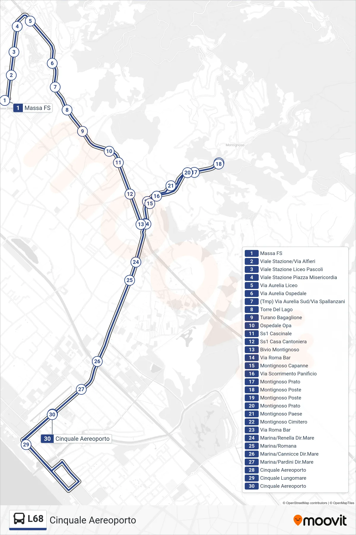
Stops list (L68 - Cinquale Airport)
- Massa Railway Station
- Station Avenue/Via Alfieri
- Station Avenue Pascoli High School
- Station Avenue Misericordia Square
- Via Aurelia High School
- Via Aurelia Hospital
- (Tmp) South Aurelia St/Spallanzani St
- Torre Del Lago
- Turano Bagaglione
- OPA Hospital
- SS1 Cascinale
- SS1 Roadkeeper's House
- Montignoso Junction
- Via Roma Bar
- Montignoso Capanne
- Ring Road Bakery
- Montignoso Prato
- Montignoso Post Office
- Montignoso Post Office
- Montignoso Prato
- Montignoso Village
- Montignoso Cemetery
- Via Roma Bar
- Marina/Renella Direction Sea
- Marina/Romana
- Marina/Cannicce Seaside Direction
- Marina/Pardini Seaside Direction
- Cinquale Airport
- Cinquale Seafront
- Cinquale Airport