
L70 Bus Route Map
View the L70 route map and see all L70 stops along the route. The map of L70 shows where the bus travels and the location of each stop, making it easy to understand the entire route at a glance.
Explore Massa, Carrara and Province - Tuscan Bus Lines routes on the map and see where Massa, Carrara and Province - Tuscan Bus Lines bus services operate. Use the L70 map to find bus stops and see how the L70 connects different areas along its trip.
All L70 stops on the map are displayed in route order, helping you follow the L70 bus from the first stop to the last.
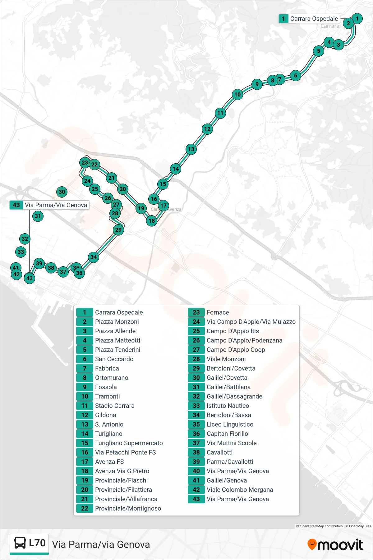
Stops list (L70 - Via Parma/via Genova)
- Carrara Hospital
- Piazza Monzoni
- Allende Square
- Matteotti Square
- Tenderini Square
- San Ceccardo
- Fabbrica
- Ortomurano
- Fossola
- Tramonti
- Carrara Stadium
- Gildona
- Saint Antonio
- Turigliano
- Turigliano Supermarket
- Petacchi Bridge Railway
- Avenza Station
- Avenza Via G.Pietro
- Provincial/Fiaschi
- Provincial/Filattiera
- Provincial/Villafranca
- Provincial Road/Montignoso
- Furnace
- Via Campo D'Appio/Via Mulazzo
- Campo D'Appio Technical Institute
- Campo D'Appio/Podenzana
- Campo D'Appio Coop
- Viale Monzoni
- Bertoloni/Covetta
- Galilei/Covetta
- Galilei/Battilana
- Galilei/Bassagrande
- Nautical Institute
- Bertoloni/Bassa
- Linguistic High School
- Capitan Fiorillo
- Via Muttini Schools
- Cavallotti
- Parma/Cavallotti
- Via Parma/Via Genova
- Galilei/Genova
- Colombo Avenue Morgana
- Via Parma/Via Genova