
LD1 Bus Route Map
View the LD1 route map and see all LD1 stops along the route. The map of LD1 shows where the bus travels and the location of each stop, making it easy to understand the entire route at a glance.
Explore Regional Transportation District routes on the map and see where Regional Transportation District bus services operate. Use the LD1 map to find bus stops and see how the LD1 connects different areas along its trip.
All LD1 stops on the map are displayed in route order, helping you follow the LD1 bus from the first stop to the last.
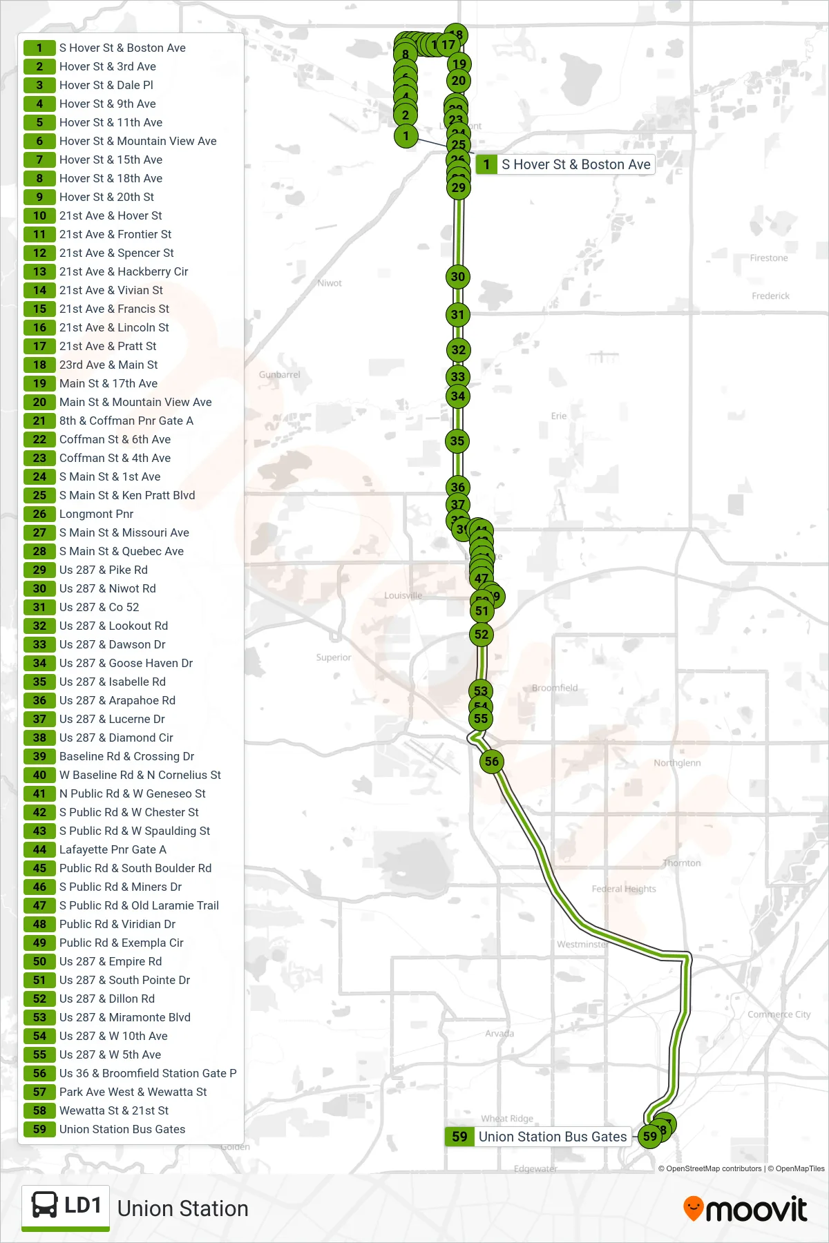
Stops list (LD1 - Union Station)
- S Hover St & Boston Ave
- Hover St & 3rd Ave
- Hover St & Dale Pl
- Hover St & 9th Ave
- Hover St & 11th Ave
- Hover St & Mountain View Ave
- Hover St & 15th Ave
- Hover St & 18th Ave
- Hover St & 20th St
- 21st Ave & Hover St
- 21st Ave & Frontier St
- 21st Ave & Spencer St
- 21st Ave & Hackberry Cir
- 21st Ave & Vivian St
- 21st Ave & Francis St
- 21st Ave & Lincoln St
- 21st Ave & Pratt St
- 23rd Ave & Main St
- Main St & 17th Ave
- Main St & Mountain View Ave
- 8th & Coffman Pnr Gate A
- Coffman St & 6th Ave
- Coffman St & 4th Ave
- S Main St & 1st Ave
- S Main St & Ken Pratt Blvd
- Longmont Pnr
- S Main St & Missouri Ave
- S Main St & Quebec Ave
- Us 287 & Pike Rd
- Us 287 & Niwot Rd
- Us 287 & Co 52
- Us 287 & Lookout Rd
- Us 287 & Dawson Dr
- Us 287 & Goose Haven Dr
- Us 287 & Isabelle Rd
- Us 287 & Arapahoe Rd
- Us 287 & Lucerne Dr
- Us 287 & Diamond Cir
- Baseline Rd & Crossing Dr
- W Baseline Rd & N Cornelius St
- N Public Rd & W Geneseo St
- S Public Rd & W Chester St
- S Public Rd & W Spaulding St
- Lafayette Pnr Gate A
- Public Rd & South Boulder Rd
- S Public Rd & Miners Dr
- S Public Rd & Old Laramie Trail
- Public Rd & Viridian Dr
- Public Rd & Exempla Cir
- Us 287 & Empire Rd
- Us 287 & South Pointe Dr
- Us 287 & Dillon Rd
- Us 287 & Miramonte Blvd
- Us 287 & W 10th Ave
- Us 287 & W 5th Ave
- Us 36 & Broomfield Station Gate P
- Park Ave West & Wewatta St
- Wewatta St & 21st St
- Union Station Bus Gates