
LIGNE 20 Bus Route Map
View the LIGNE 20 route map and see all LIGNE 20 stops along the route. The map of LIGNE 20 shows where the bus travels and the location of each stop, making it easy to understand the entire route at a glance.
Explore KEOLIS routes on the map and see where KEOLIS bus services operate. Use the LIGNE 20 map to find bus stops and see how the LIGNE 20 connects different areas along its trip.
All LIGNE 20 stops on the map are displayed in route order, helping you follow the LIGNE 20 bus from the first stop to the last.
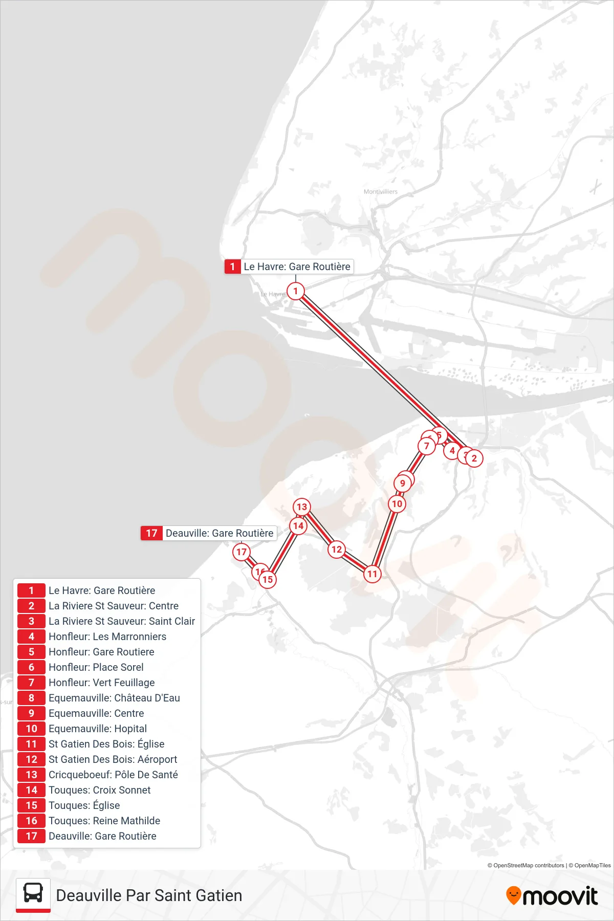
Stops list (LIGNE 20 - Deauville Par Saint Gatien)
- Le Havre: Gare Routière
- La Riviere St Sauveur: Centre
- La Riviere St Sauveur: Saint Clair
- Honfleur: Les Marronniers
- Honfleur: Gare Routiere
- Honfleur: Place Sorel
- Honfleur: Vert Feuillage
- Equemauville: Château D'Eau
- Equemauville: Centre
- Equemauville: Hopital
- St Gatien Des Bois: Église
- St Gatien Des Bois: Aéroport
- Cricqueboeuf: Pôle De Santé
- Touques: Croix Sonnet
- Touques: Église
- Touques: Reine Mathilde
- Deauville: Gare Routière
Change direction
- Route Map - LIGNE 20 - Deauville Gare
- Route Map - LIGNE 20 - Honfleur Par Villerville
- Route Map - LIGNE 20 - Honfleur Par Merville Franceville
- Route Map - LIGNE 20 - Deauville Par Villerville
- Route Map - LIGNE 20 - Caen Express
- Route Map - LIGNE 20 - Cabourg Pasteur
- Route Map - LIGNE 20 - Honfleur Par Touques St Gatien
- Route Map - LIGNE 20 - Dives Sur Mer Port Par Merville
- Route Map - LIGNE 20 - La Riviere St Sauv.Par Honfleur
- Route Map - LIGNE 20 - Caen Gare
- Route Map - LIGNE 20 - Deauville Par Bavent
- Route Map - LIGNE 20 - Le Havre Gare Routiere
- Route Map - LIGNE 20 - Honfleur Vdm
- Route Map - LIGNE 20 - Honfleur Gare
- Route Map - LIGNE 20 - La Riviere St Sauveur
- Route Map - LIGNE 20 - Cabourg Oasis Par Deauville
- Route Map - LIGNE 20 - Honfleur Gare
- Route Map - LIGNE 20 - Le Havre Par Villerville Honfleur