
LVS Bus Route Map
View the LVS route map and see all LVS stops along the route. The map of LVS shows where the bus travels and the location of each stop, making it easy to understand the entire route at a glance.
Explore Adriabus S.p.A. routes on the map and see where Adriabus S.p.A. bus services operate. Use the LVS map to find bus stops and see how the LVS connects different areas along its trip.
All LVS stops on the map are displayed in route order, helping you follow the LVS bus from the first stop to the last.
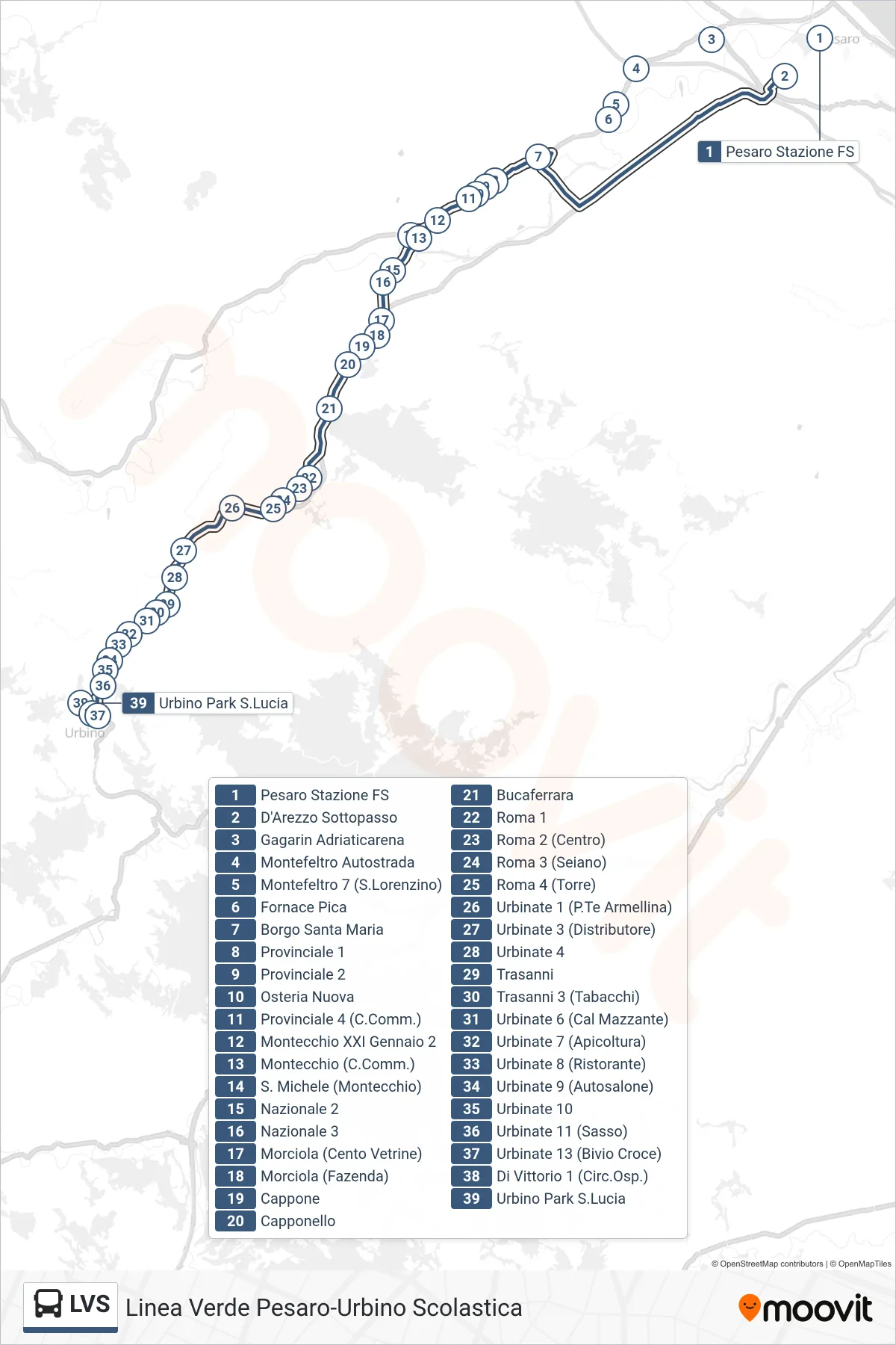
Stops list (LVS - Urbino Park S.Lucia)
- Pesaro Railway Station
- D'Arezzo Underpass
- Gagarin Adriaticarena
- Montefeltro Highway
- Montefeltro 7 (San Lorenzino)
- Pica Furnace
- Santa Maria Borough
- Provincial 1
- Provincial Road 2
- New Tavern
- Provincial Road 4 (Shopping Center)
- Montecchio XXI January 2
- Montecchio (Shopping Center)
- San Michele (Montecchio)
- National 2
- National 3
- Morciola (Cento Vetrine)
- Morciola (Fazenda)
- Cappone
- Capponello
- Bucaferrara
- Roma 1
- Roma 2 (Center)
- Roma 3 (Seiano)
- Roma 4 (Tower)
- Urbinate 1 (Armellina Bridge)
- Urbinate 3 (Gas Station)
- Urbinate 4
- Trasanni
- Trasanni 3 (Tobacco Shop)
- Urbinate 6 (Cal Mazzante)
- Urbinate 7 (Apiary)
- Urbinate 8 (Restaurant)
- Urbinate 9 (Car Dealership)
- Urbinate 10
- Urbinate 11 (Sasso)
- Urbinate 13 (Croce Junction)
- Di Vittorio 1 (Hospital Circuit)
- Urbino Park S.Lucia