
M Bus Route Map
View the M route map and see all M stops along the route. The map of M shows where the bus travels and the location of each stop, making it easy to understand the entire route at a glance.
Explore ATMA S.c.p.a. routes on the map and see where ATMA S.c.p.a. bus services operate. Use the M map to find bus stops and see how the M connects different areas along its trip.
All M stops on the map are displayed in route order, helping you follow the M bus from the first stop to the last.
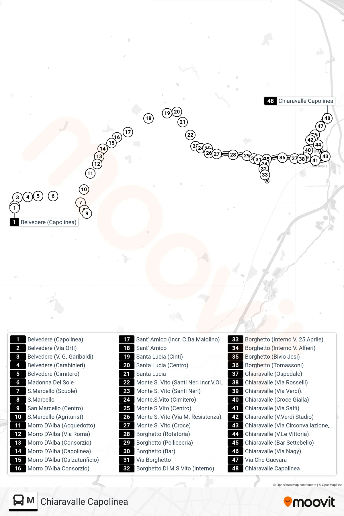
Stops list (M - Chiaravalle Terminal)
- Belvedere (Terminal)
- Belvedere (Orti Street)
- Belvedere (G. Garibaldi Street)
- Belvedere (Police Station)
- Belvedere (Cemetery)
- Madonna Del Sole
- San Marcello (Schools)
- San Marcello
- San Marcello (Center)
- S.Marcello (Agritourism)
- Morro D'Alba (Aqueduct)
- Morro D'Alba (Roma Street)
- Morro D'Alba (Consortium)
- Morro D'Alba (Terminal)
- Morro D'Alba (Shoe Factory)
- Morro D'Alba Consortium
- Sant' Amico (Maiolino District Junction)
- Sant' Amico
- Santa Lucia (Cinti)
- Santa Lucia (Center)
- Saint Lucy
- Monte San Vito (Santi Neri Via Olivella Junction)
- Monte San Vito (Santi Neri)
- Monte San Vito (Cemetery)
- Monte San Vito (Center)
- Monte S. Vito (Resistance Martyrs Street)
- Monte S. Vito (Cross)
- Borghetto (Roundabout)
- Borghetto (Fur Shop)
- Borghetto (Bar)
- Borghetto Street
- Borghetto Di M.S.Vito (Interior)
- Borghetto (25 April Street Interior)
- Borghetto (Inside Alfieri Street)
- Borghetto (Jesi Junction)
- Borghetto (Tomassoni)
- Chiaravalle (Hospital)
- Chiaravalle (Rosselli Street)
- Chiaravalle (Verdi Street)
- Chiaravalle (Yellow Cross)
- Chiaravalle (Saffi Street)
- Chiaravalle (Verdi Stadium)
- Chiaravalle (Ring Road, Municipal Pharmacy)
- Chiaravalle (Victory Avenue)
- Chiaravalle (Bar Settebello)
- Chiaravalle (Nagy Street)
- Che Guevara Street
- Chiaravalle Terminal