
M Tram Route Map
View the M route map and see all M stops along the route. The map of M shows where the tram travels and the location of each stop, making it easy to understand the entire route at a glance.
Explore routes on the map and see where tram services operate. Use the M map to find tram stations and see how the M connects different areas along its trip.
All M stops on the map are displayed in route order, helping you follow the M tram from the first station to the last.
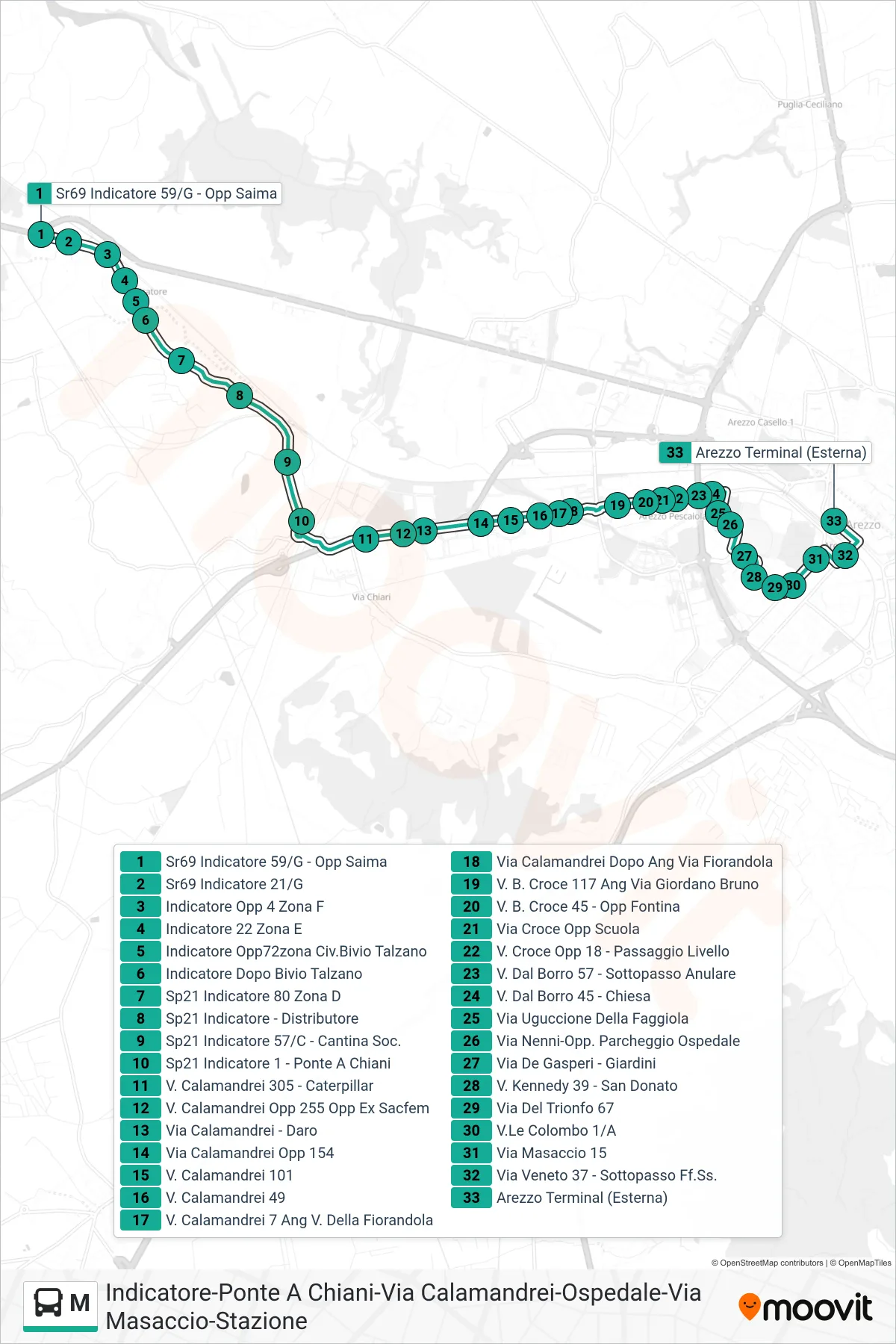
Stops list (M - Arezzo Terminal (External))
- Sr69 Indicatore 59/G - Opp Saima
- Sr69 Indicatore 21/G
- Indicatore Opposite 4 Zone F
- Indicatore 22 Zone E
- Indicatore Opp72 Talzano Junction Area
- Indicator After Talzano Junction
- SP21 Indicatore 80 Zone D
- SP21 Indicatore - Gas Station
- SP21 Indicatore 57/C - Social Winery
- SP21 Indicator 1 - Ponte A Chiani
- 305 Calamandrei Street - Caterpillar
- Via Calamandrei Opposite 255 Ex Sacfem
- Calamandrei Street - Daro
- Via Calamandrei Opposite 154
- Calamandrei Street 101
- Calamandrei St. 49
- Calamandrei 7 Corner Fiorandola Street
- Via Calamandrei After Corner Via Fiorandola
- B. Croce Street 117 Corner Giordano Bruno
- V. B. Croce 45 - Opposite Fontina
- Via Croce Opposite School
- Via Croce Opposite 18 - Level Crossing
- Dal Borro Road 57 - Ring Road Underpass
- V. Dal Borro 45 - Church
- Uguccione Della Faggiola Street
- Via Nenni-Opposite Hospital Parking
- De Gasperi Street - Gardens
- Kennedy St 39 - San Donato
- Via Del Trionfo 67
- Colombo Avenue 1/A
- Masaccio Street 15
- Veneto Street 37 - Railway Underpass
- Arezzo Terminal (External)