
M1 Bus Route Map
View the M1 route map and see all M1 stops along the route. The map of M1 shows where the bus travels and the location of each stop, making it easy to understand the entire route at a glance.
Explore HEAG mobiBus GmbH + Co. KG routes on the map and see where HEAG mobiBus GmbH + Co. KG bus services operate. Use the M1 map to find bus stops and see how the M1 connects different areas along its trip.
All M1 stops on the map are displayed in route order, helping you follow the M1 bus from the first stop to the last.
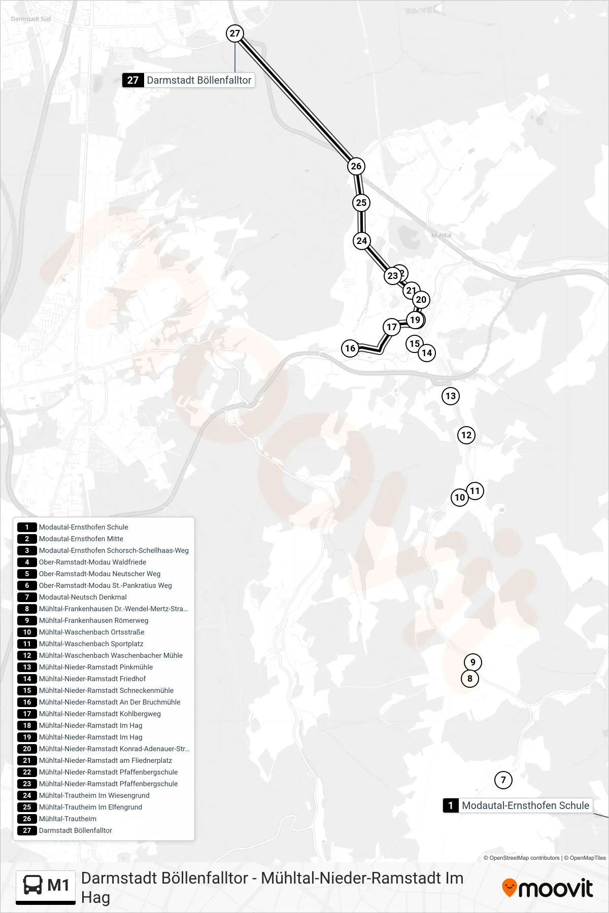
Stops list (M1 - Darmstadt Böllenfalltor)
- Modautal-Ernsthofen Schule
- Modautal-Ernsthofen Mitte
- Modautal-Ernsthofen Schorsch-Schellhaas-Weg
- Ober-Ramstadt-Modau Waldfriede
- Ober-Ramstadt-Modau Neutscher Weg
- Ober-Ramstadt-Modau St.-Pankratius Weg
- Modautal-Neutsch Denkmal
- Mühltal-Frankenhausen Dr.-Wendel-Mertz-Straße
- Mühltal-Frankenhausen Römerweg
- Mühltal-Waschenbach Ortsstraße
- Mühltal-Waschenbach Sportplatz
- Mühltal-Waschenbach Waschenbacher Mühle
- Mühltal-Nieder-Ramstadt Pinkmühle
- Mühltal-Nieder-Ramstadt Friedhof
- Mühltal-Nieder-Ramstadt Schneckenmühle
- Mühltal-Nieder-Ramstadt An Der Bruchmühle
- Mühltal-Nieder-Ramstadt Kohlbergweg
- Mühltal-Nieder-Ramstadt Im Hag
- Mühltal-Nieder-Ramstadt Im Hag
- Mühltal-Nieder-Ramstadt Konrad-Adenauer-Straße
- Mühltal-Nieder-Ramstadt am Fliednerplatz
- Mühltal-Nieder-Ramstadt Pfaffenbergschule
- Mühltal-Nieder-Ramstadt Pfaffenbergschule
- Mühltal-Trautheim Im Wiesengrund
- Mühltal-Trautheim Im Elfengrund
- Mühltal-Trautheim
- Darmstadt Böllenfalltor