
M12 Bus Route Map
View the M12 route map and see all M12 stops along the route. The map of M12 shows where the bus travels and the location of each stop, making it easy to understand the entire route at a glance.
Explore WMATA routes on the map and see where WMATA bus services operate. Use the M12 map to find bus stops and see how the M12 connects different areas along its trip.
All M12 stops on the map are displayed in route order, helping you follow the M12 bus from the first stop to the last.
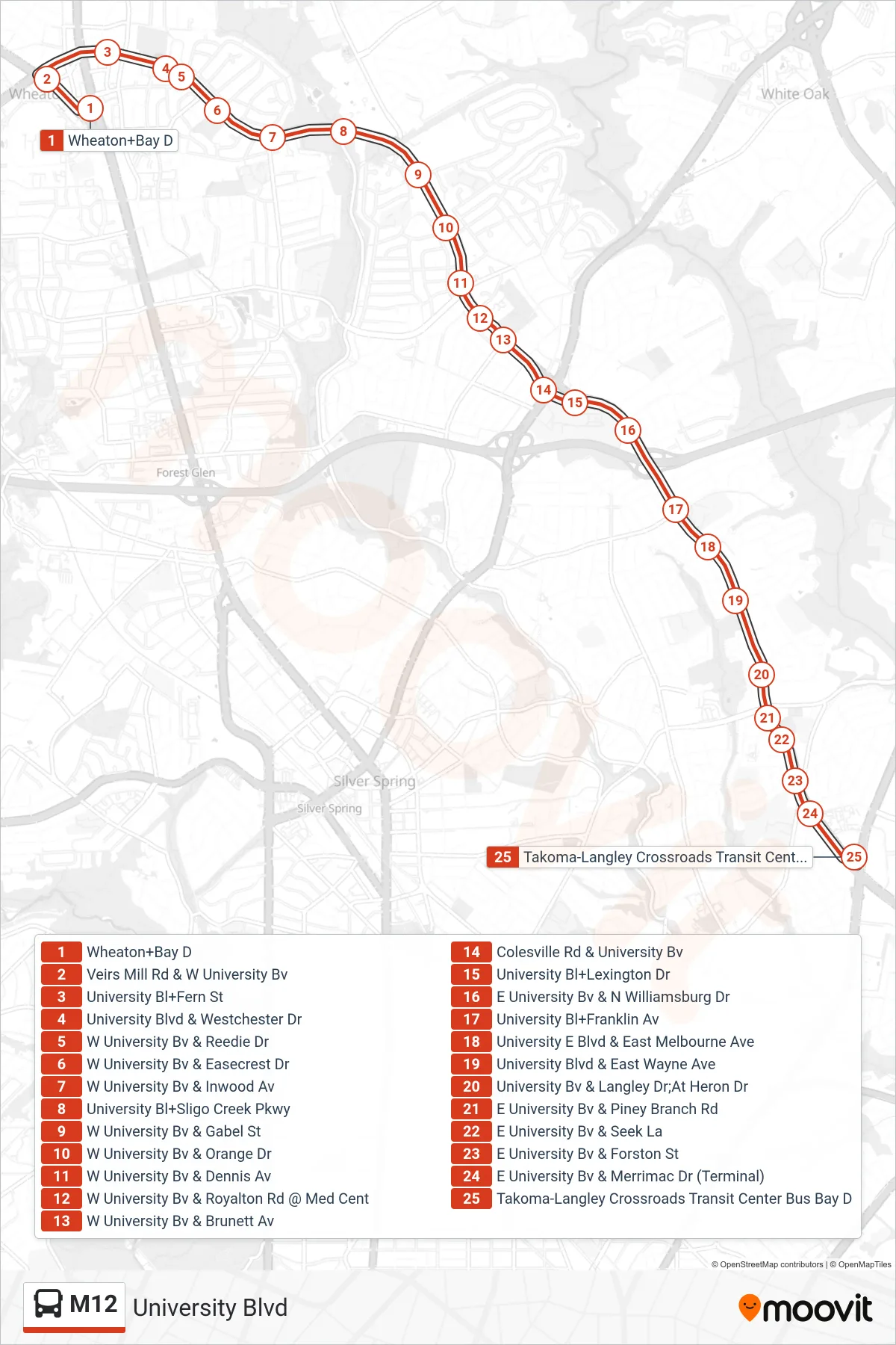
Stops list (M12 - East To Takoma Langley)
- Wheaton+Bay D
- Veirs Mill Rd & W University Bv
- University Bl+Fern St
- University Blvd & Westchester Dr
- W University Bv & Reedie Dr
- W University Bv & Easecrest Dr
- W University Bv & Inwood Av
- University Bl+Sligo Creek Pkwy
- W University Bv & Gabel St
- W University Bv & Orange Dr
- W University Bv & Dennis Av
- W University Bv & Royalton Rd @ Med Cent
- W University Bv & Brunett Av
- Colesville Rd & University Bv
- University Bl+Lexington Dr
- E University Bv & N Williamsburg Dr
- University Bl+Franklin Av
- University E Blvd & East Melbourne Ave
- University Blvd & East Wayne Ave
- University Bv & Langley Dr;At Heron Dr
- E University Bv & Piney Branch Rd
- E University Bv & Seek La
- E University Bv & Forston St
- E University Bv & Merrimac Dr (Terminal)
- Takoma-Langley Crossroads Transit Center Bus Bay D