
M2 Bus Route Map
View the M2 route map and see all M2 stops along the route. The map of M2 shows where the bus travels and the location of each stop, making it easy to understand the entire route at a glance.
Explore The Bus routes on the map and see where The Bus bus services operate. Use the M2 map to find bus stops and see how the M2 connects different areas along its trip.
All M2 stops on the map are displayed in route order, helping you follow the M2 bus from the first stop to the last.
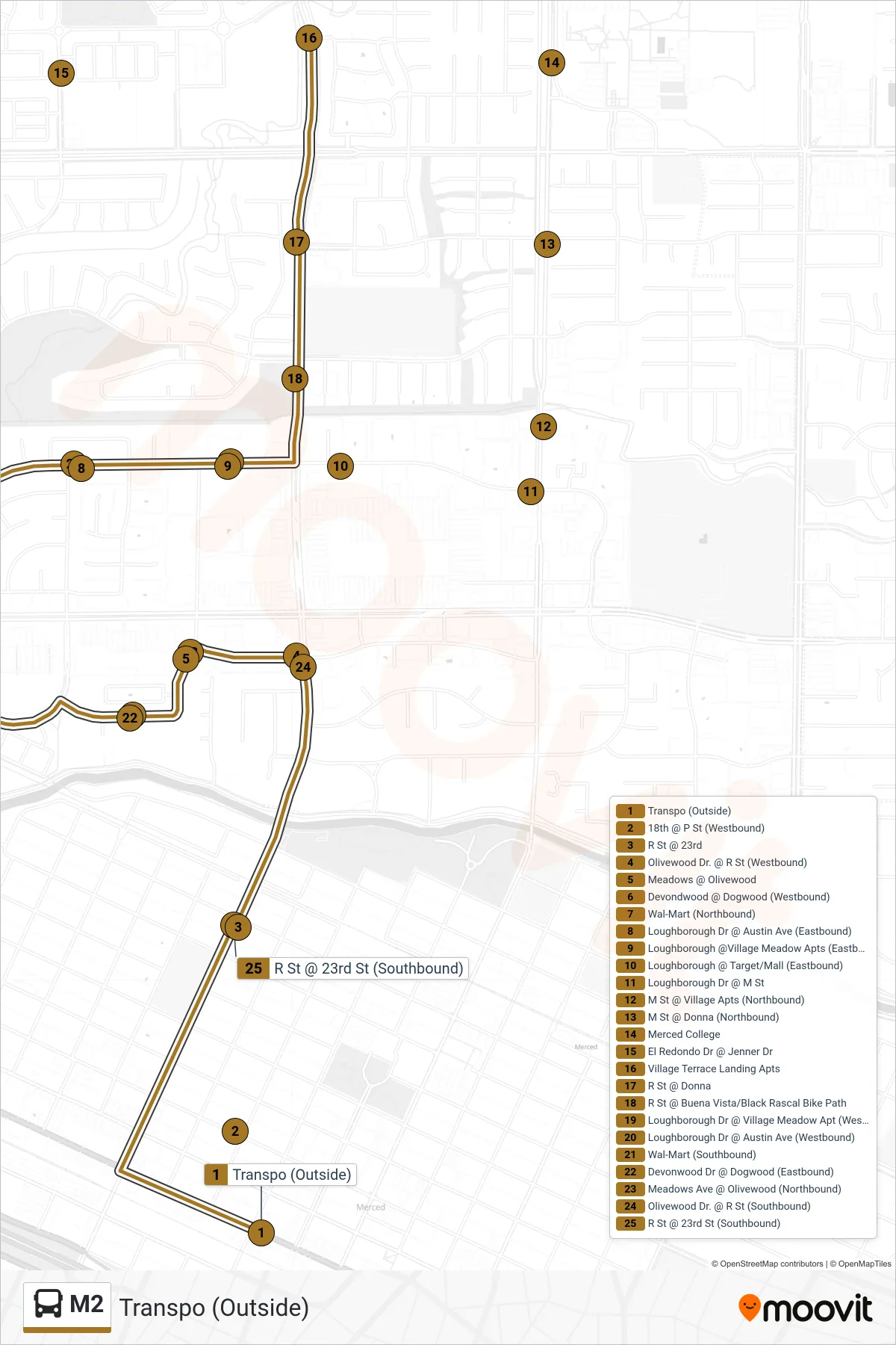
Stops list (M2 - Transpo (Outside))
- Transpo (Outside)
- 18th @ P St (Westbound)
- R St @ 23rd
- Olivewood Dr. @ R St (Westbound)
- Meadows @ Olivewood
- Devondwood @ Dogwood (Westbound)
- Wal-Mart (Northbound)
- Loughborough Dr @ Austin Ave (Eastbound)
- Loughborough @Village Meadow Apts (Eastbound)
- Loughborough @ Target/Mall (Eastbound)
- Loughborough Dr @ M St
- M St @ Village Apts (Northbound)
- M St @ Donna (Northbound)
- Merced College
- El Redondo Dr @ Jenner Dr
- Village Terrace Landing Apts
- R St @ Donna
- R St @ Buena Vista/Black Rascal Bike Path
- Loughborough Dr @ Village Meadow Apt (Westbound)
- Loughborough Dr @ Austin Ave (Westbound)
- Wal-Mart (Southbound)
- Devonwood Dr @ Dogwood (Eastbound)
- Meadows Ave @ Olivewood (Northbound)
- Olivewood Dr. @ R St (Southbound)
- R St @ 23rd St (Southbound)