
M22 Bus Route Map
View the M22 route map and see all M22 stops along the route. The map of M22 shows where the bus travels and the location of each stop, making it easy to understand the entire route at a glance.
Explore WMATA routes on the map and see where WMATA bus services operate. Use the M22 map to find bus stops and see how the M22 connects different areas along its trip.
All M22 stops on the map are displayed in route order, helping you follow the M22 bus from the first stop to the last.
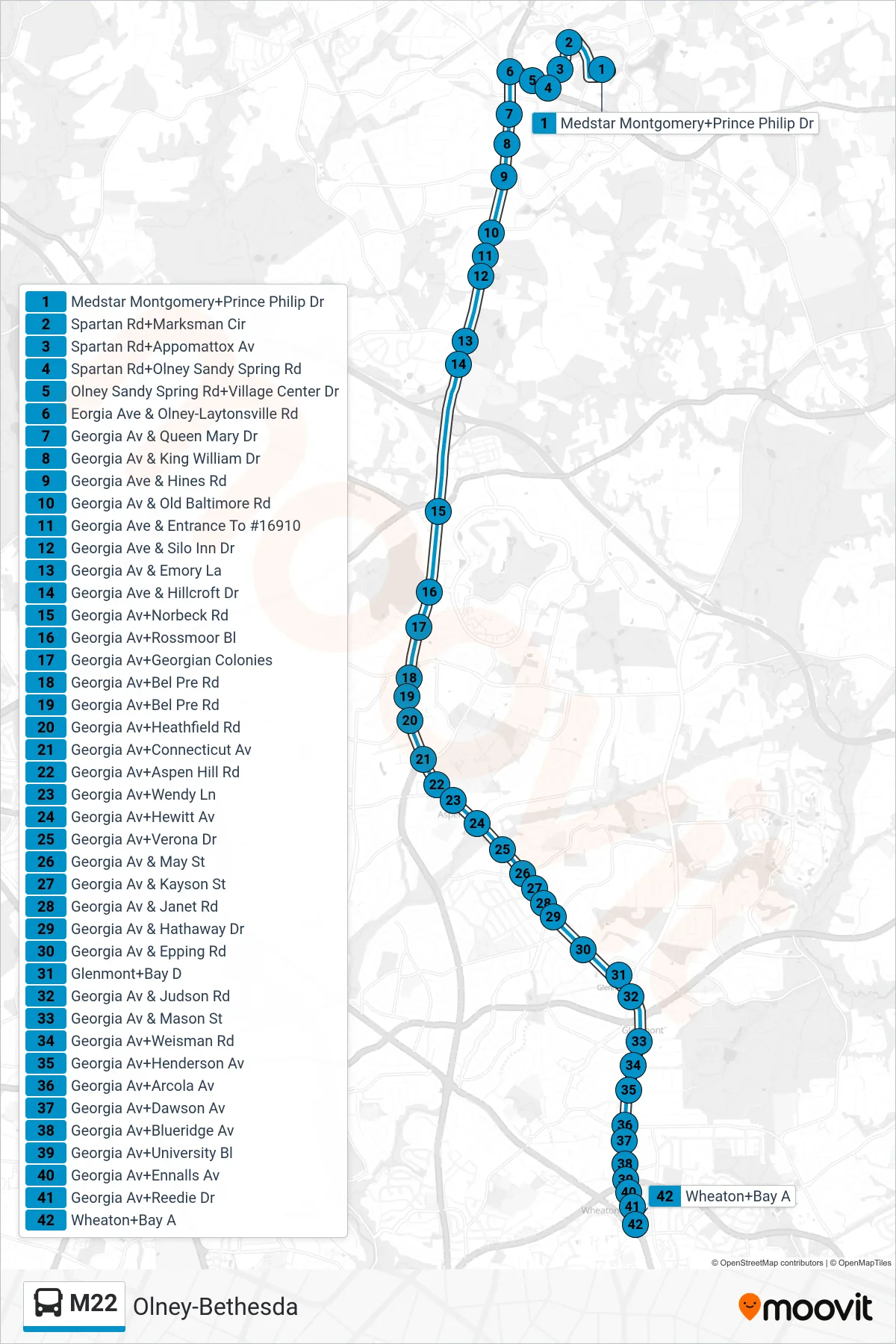
Stops list (M22 - South To Wheaton)
- Medstar Montgomery+Prince Philip Dr
- Spartan Rd+Marksman Cir
- Spartan Rd+Appomattox Av
- Spartan Rd+Olney Sandy Spring Rd
- Olney Sandy Spring Rd+Village Center Dr
- Eorgia Ave & Olney-Laytonsville Rd
- Georgia Av & Queen Mary Dr
- Georgia Av & King William Dr
- Georgia Ave & Hines Rd
- Georgia Av & Old Baltimore Rd
- Georgia Ave & Entrance To #16910
- Georgia Ave & Silo Inn Dr
- Georgia Av & Emory La
- Georgia Ave & Hillcroft Dr
- Georgia Av+Norbeck Rd
- Georgia Av+Rossmoor Bl
- Georgia Av+Georgian Colonies
- Georgia Av+Bel Pre Rd
- Georgia Av+Bel Pre Rd
- Georgia Av+Heathfield Rd
- Georgia Av+Connecticut Av
- Georgia Av+Aspen Hill Rd
- Georgia Av+Wendy Ln
- Georgia Av+Hewitt Av
- Georgia Av+Verona Dr
- Georgia Av & May St
- Georgia Av & Kayson St
- Georgia Av & Janet Rd
- Georgia Av & Hathaway Dr
- Georgia Av & Epping Rd
- Glenmont+Bay D
- Georgia Av & Judson Rd
- Georgia Av & Mason St
- Georgia Av+Weisman Rd
- Georgia Av+Henderson Av
- Georgia Av+Arcola Av
- Georgia Av+Dawson Av
- Georgia Av+Blueridge Av
- Georgia Av+University Bl
- Georgia Av+Ennalls Av
- Georgia Av+Reedie Dr
- Wheaton+Bay A