
M5 Light Rail Route Map
View the M5 route map and see all M5 stops along the route. The map of M5 shows where the light rail travels and the location of each stop, making it easy to understand the entire route at a glance.
Explore BVG routes on the map and see where BVG light rail services operate. Use the M5 map to find light rail stations and see how the M5 connects different areas along its trip.
All M5 stops on the map are displayed in route order, helping you follow the M5 light rail from the first station to the last.
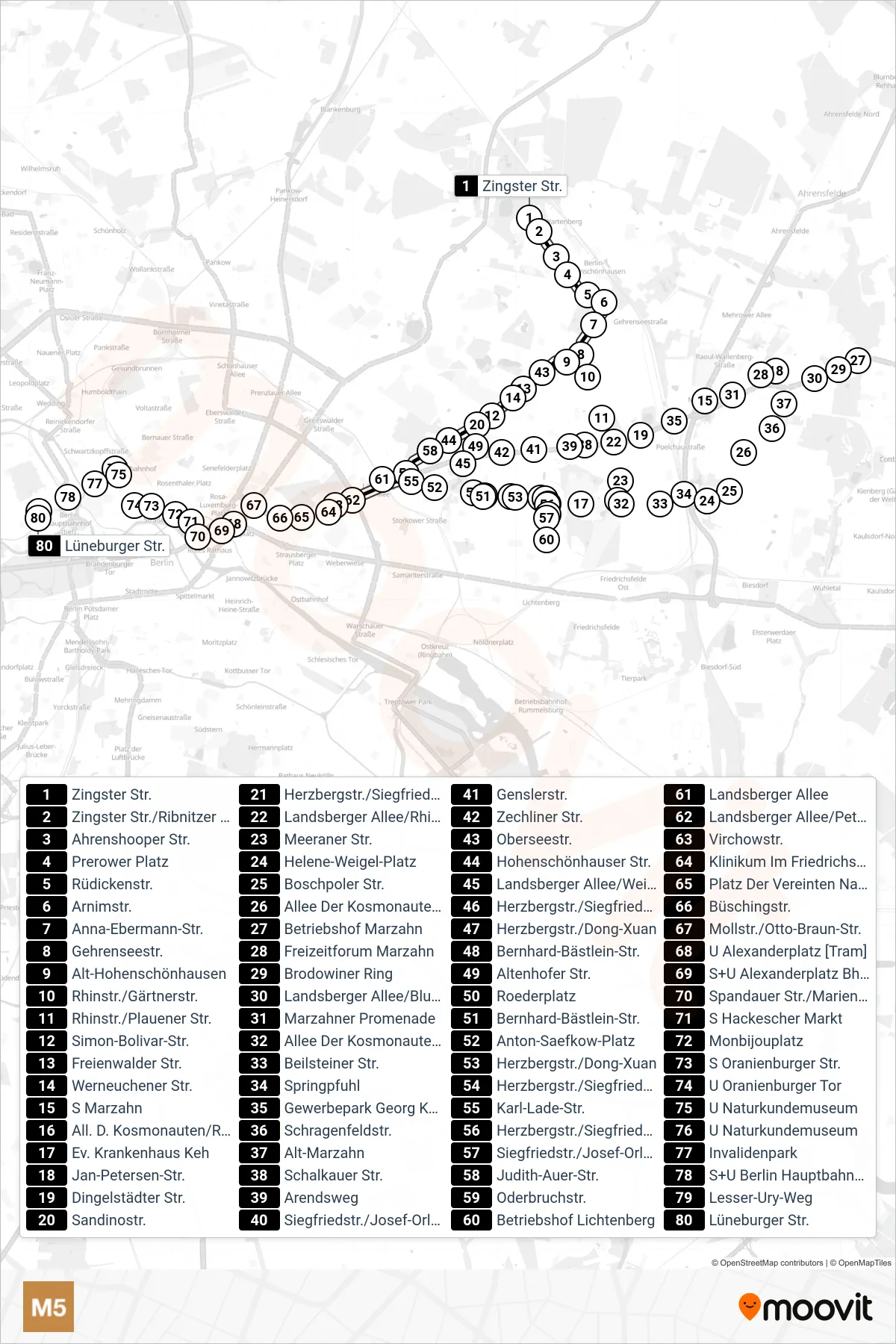

Stops list (M5 - Hohenschönhausen, Zingster Str.)
- Zingster Str.
- Zingster Str./Ribnitzer Str.
- Ahrenshooper Str.
- Prerower Platz
- Rüdickenstr.
- Arnimstr.
- Anna-Ebermann-Str.
- Gehrenseestr.
- Alt-Hohenschönhausen
- Rhinstr./Gärtnerstr.
- Rhinstr./Plauener Str.
- Oberseestr.
- Landsberger Allee/Rhinstr.
- Meeraner Str.
- Freienwalder Str.
- Werneuchener Str.
- Simon-Bolivar-Str.
- Sandinostr.
- Hohenschönhauser Str.
- All. D. Kosmonauten/Rhinstr. [Pos 5-6]
- Ev. Krankenhaus Keh
- Siegfriedstr./Josef-Orlopp-Str.
- Judith-Auer-Str.
- Siegfriedstr./Josef-Orlopp-Str.
- Herzbergstr./Siegfriedstr. [Siegfriedstr]
- Herzbergstr./Siegfriedstr. [Siegfriedstr]
- Herzbergstr./Siegfriedstr. [Siegfriedstr]
- Betriebshof Lichtenberg
- Herzbergstr./Dong-Xuan
- Bernhard-Bästlein-Str.
- Roederplatz
- Oderbruchstr.
- Anton-Saefkow-Platz
- Karl-Lade-Str.
- Landsberger Allee
- Landsberger Allee/Petersburger Str.
- Virchowstr.
- Klinikum Im Friedrichshain
- Platz Der Vereinten Nationen
- Büschingstr.
- Mollstr./Otto-Braun-Str.
- U Alexanderplatz [Tram]
- S+U Alexanderplatz Bhf/Gontardstr.
- Spandauer Str./Marienkirche
- S Hackescher Markt
- Monbijouplatz
- S Oranienburger Str.
- U Oranienburger Tor
- U Naturkundemuseum
- U Naturkundemuseum
- Invalidenpark
- S+U Berlin Hauptbahnhof
- Lesser-Ury-Weg
- Lüneburger Str.