
MARS Bus Route Map
View the MARS route map and see all MARS stops along the route. The map of MARS shows where the bus travels and the location of each stop, making it easy to understand the entire route at a glance.
Explore Valley Metro-Bus routes on the map and see where Valley Metro-Bus bus services operate. Use the MARS map to find bus stops and see how the MARS connects different areas along its trip.
All MARS stops on the map are displayed in route order, helping you follow the MARS bus from the first stop to the last.
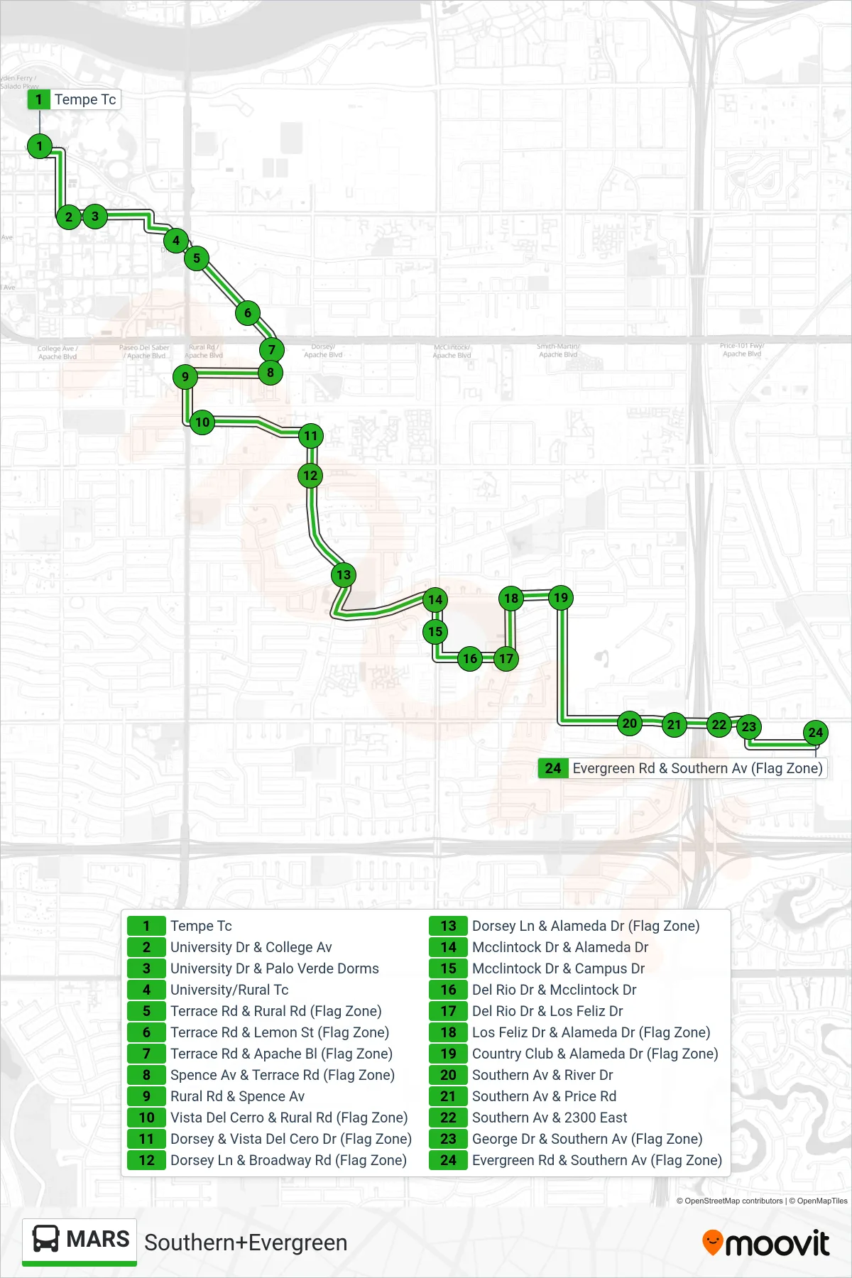
Stops list (MARS - Southern+Evergreen)
- Tempe Tc
- University Dr & College Av
- University Dr & Palo Verde Dorms
- University/Rural Tc
- Terrace Rd & Rural Rd (Flag Zone)
- Terrace Rd & Lemon St (Flag Zone)
- Terrace Rd & Apache Bl (Flag Zone)
- Spence Av & Terrace Rd (Flag Zone)
- Rural Rd & Spence Av
- Vista Del Cerro & Rural Rd (Flag Zone)
- Dorsey & Vista Del Cero Dr (Flag Zone)
- Dorsey Ln & Broadway Rd (Flag Zone)
- Dorsey Ln & Alameda Dr (Flag Zone)
- Dorsey Ln & Meyer Park (Flag Zone)
- Mcclintock Dr & Alameda Dr
- Mcclintock Dr & Campus Dr
- Del Rio Dr & Mcclintock Dr
- Del Rio Dr & Los Feliz Dr
- Los Feliz Dr & Alameda Dr (Flag Zone)
- Country Club & Alameda Dr (Flag Zone)
- Southern Av & River Dr
- Southern Av & Price Rd
- Southern Av & 2300 East
- George Dr & Southern Av (Flag Zone)
- Evergreen Rd & Southern Av (Flag Zone)