
MID-ISLAND LOOP Bus Route Map
View the MID-ISLAND LOOP route map and see all MID-ISLAND LOOP stops along the route. The map of MID-ISLAND LOOP shows where the bus travels and the location of each stop, making it easy to understand the entire route at a glance.
Explore Nantucket Regional Transit Authority routes on the map and see where Nantucket Regional Transit Authority bus services operate. Use the MID-ISLAND LOOP map to find bus stops and see how the MID-ISLAND LOOP connects different areas along its trip.
All MID-ISLAND LOOP stops on the map are displayed in route order, helping you follow the MID-ISLAND LOOP bus from the first stop to the last.
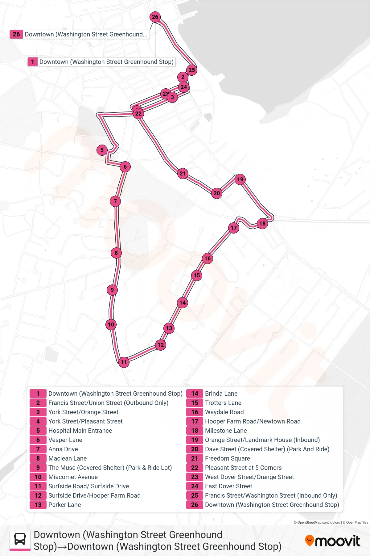
Stops list (MID-ISLAND LOOP - Downtown (Washington Street Greenhound Stop)→Downtown (Washington Street Greenhound Stop))
- Downtown (Washington Street Greenhound Stop)
- Francis Street/Union Street (Outbound Only)
- York Street/Orange Street
- York Street/Pleasant Street
- Hospital Main Entrance
- Vesper Lane
- Anna Drive
- Maclean Lane
- The Muse (Covered Shelter) (Park & Ride Lot)
- Miacomet Avenue
- Surfside Road/ Surfside Drive
- Surfside Drive/Hooper Farm Road
- Parker Lane
- Brinda Lane
- Trotters Lane
- Waydale Road
- Hooper Farm Road/Newtown Road
- Milestone Lane
- Orange Street/Landmark House (Inbound)
- Dave Street (Covered Shelter) (Park And Ride)
- Freedom Square
- Pleasant Street at 5 Corners
- West Dover Street/Orange Street
- East Dover Street
- Francis Street/Washington Street (Inbound Only)
- Downtown (Washington Street Greenhound Stop)