
MO2 Bus Route Map
View the MO2 route map and see all MO2 stops along the route. The map of MO2 shows where the bus travels and the location of each stop, making it easy to understand the entire route at a glance.
Explore Private nicht im VRN routes on the map and see where Private nicht im VRN bus services operate. Use the MO2 map to find bus stops and see how the MO2 connects different areas along its trip.
All MO2 stops on the map are displayed in route order, helping you follow the MO2 bus from the first stop to the last.
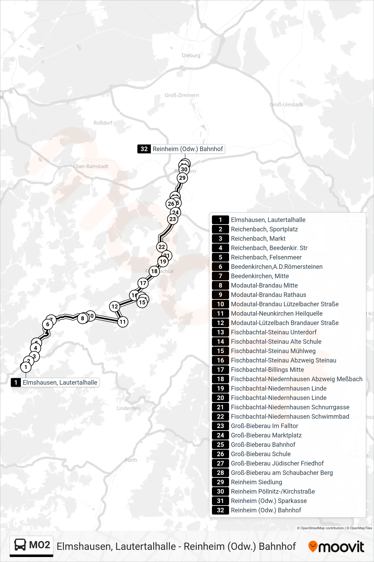
Stops list (MO2 - Reinheim (Odw.) Bahnhof)
- Elmshausen, Lautertalhalle
- Reichenbach, Sportplatz
- Reichenbach, Markt
- Reichenbach, Beedenkir. Str
- Reichenbach, Felsenmeer
- Beedenkirchen,A.D.Römersteinen
- Beedenkirchen, Mitte
- Modautal-Brandau Mitte
- Modautal-Brandau Rathaus
- Modautal-Brandau Lützelbacher Straße
- Modautal-Neunkirchen Heilquelle
- Modautal-Lützelbach Brandauer Straße
- Fischbachtal-Steinau Unterdorf
- Fischbachtal-Steinau Alte Schule
- Fischbachtal-Steinau Mühlweg
- Fischbachtal-Steinau Abzweig Steinau
- Fischbachtal-Billings Mitte
- Fischbachtal-Niedernhausen Abzweig Meßbach
- Fischbachtal-Niedernhausen Linde
- Fischbachtal-Niedernhausen Linde
- Fischbachtal-Niedernhausen Schnurrgasse
- Fischbachtal-Niedernhausen Schwimmbad
- Groß-Bieberau Im Falltor
- Groß-Bieberau Marktplatz
- Groß-Bieberau Bahnhof
- Groß-Bieberau Schule
- Groß-Bieberau Jüdischer Friedhof
- Groß-Bieberau am Schaubacher Berg
- Reinheim Siedlung
- Reinheim Pöllnitz-/Kirchstraße
- Reinheim (Odw.) Sparkasse
- Reinheim (Odw.) Bahnhof
Change direction
- Route Map - MO2 - Modautal-Brandau Rathaus
- Route Map - MO2 - Modautal-Lützelbach Brandauer Straße
- Route Map - MO2 - Fischbachtal-Niedernhausen Linde
- Route Map - MO2 - Elmshausen, Lautertalhalle
- Route Map - MO2 - Groß-Bieberau Schule
- Route Map - MO2 - Modautal-Ernsthofen Schule
- Route Map - MO2 - Modautal-Lützelbach Brandauer Straße
- Route Map - MO2 - Groß-Bieberau Schule