
MOLALLA CITY LOOP Bus Route Map
View the MOLALLA CITY LOOP route map and see all MOLALLA CITY LOOP stops along the route. The map of MOLALLA CITY LOOP shows where the bus travels and the location of each stop, making it easy to understand the entire route at a glance.
Explore South Clackamas Transportation District routes on the map and see where South Clackamas Transportation District bus services operate. Use the MOLALLA CITY LOOP map to find bus stops and see how the MOLALLA CITY LOOP connects different areas along its trip.
All MOLALLA CITY LOOP stops on the map are displayed in route order, helping you follow the MOLALLA CITY LOOP bus from the first stop to the last.
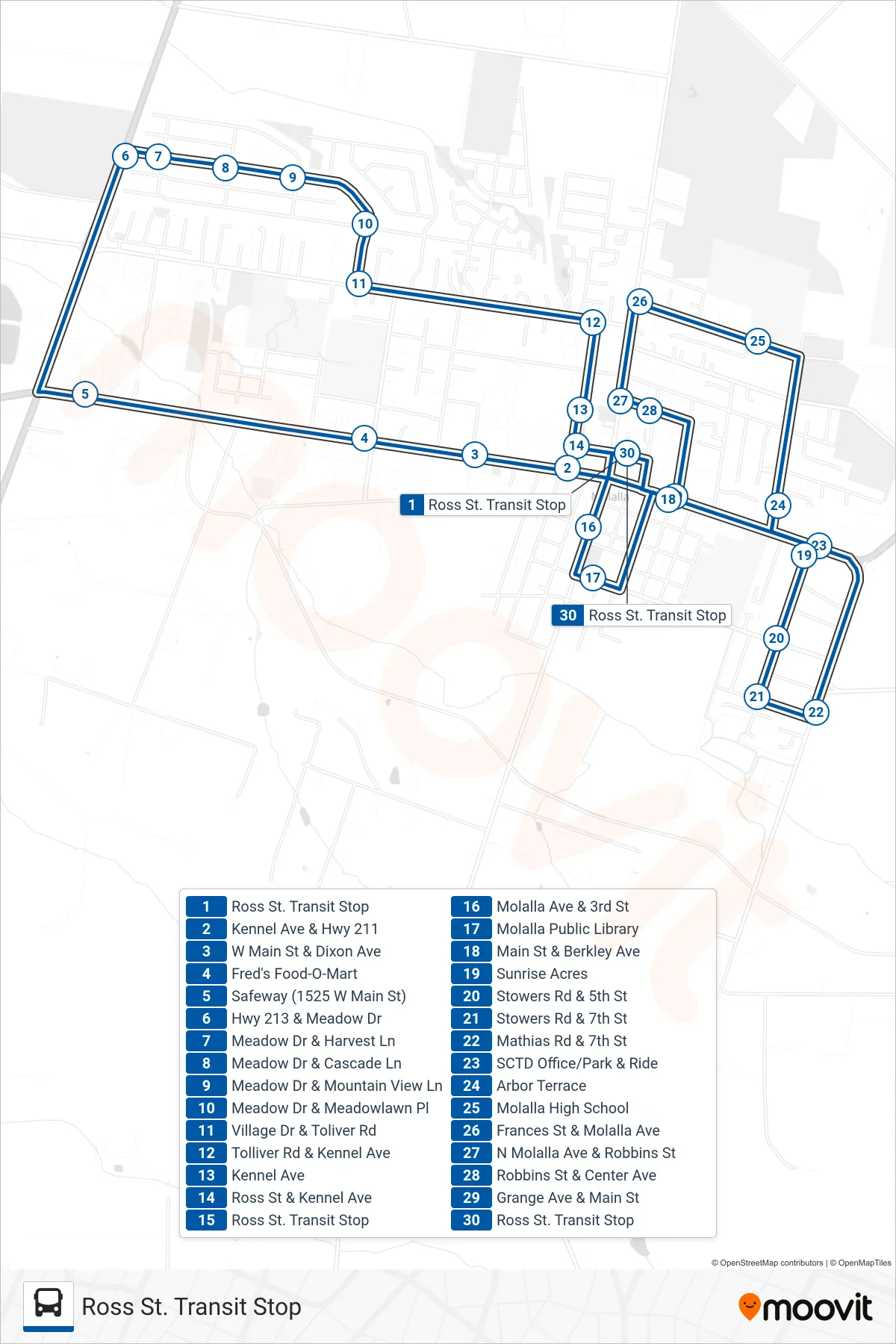
Stops list (MOLALLA CITY LOOP - Ross St. Transit Stop)
- Ross St. Transit Stop
- Kennel Ave & Hwy 211
- W Main St & Dixon Ave
- Fred's Food-O-Mart
- Safeway (1525 W Main St)
- Hwy 213 & Meadow Dr
- Meadow Dr & Harvest Ln
- Meadow Dr & Cascade Ln
- Meadow Dr & Mountain View Ln
- Meadow Dr & Meadowlawn Pl
- Village Dr & Toliver Rd
- Tolliver Rd & Kennel Ave
- Kennel Ave
- Ross St & Kennel Ave
- Ross St. Transit Stop
- Molalla Ave & 3rd St
- Molalla Public Library
- Main St & Berkley Ave
- Sunrise Acres
- Stowers Rd & 5th St
- Stowers Rd & 7th St
- Mathias Rd & 7th St
- SCTD Office/Park & Ride
- Arbor Terrace
- Molalla High School
- Frances St & Molalla Ave
- N Molalla Ave & Robbins St
- Robbins St & Center Ave
- Grange Ave & Main St
- Ross St. Transit Stop