
N Light Rail Route Map
View the N route map and see all N stops along the route. The map of N shows where the light rail travels and the location of each stop, making it easy to understand the entire route at a glance.
Explore Muni Metro routes on the map and see where Muni Metro light rail services operate. Use the N map to find light rail stations and see how the N connects different areas along its trip.
All N stops on the map are displayed in route order, helping you follow the N light rail from the first station to the last.
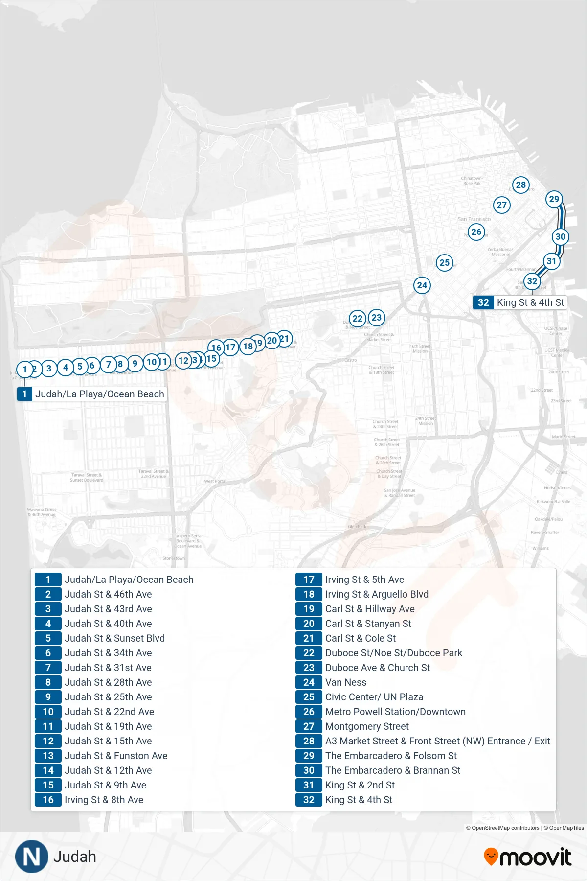
Stops list (N - Caltrain)
- Judah/La Playa/Ocean Beach
- Judah St & 46th Ave
- Judah St & 43rd Ave
- Judah St & 40th Ave
- Judah St & Sunset Blvd
- Judah St & 34th Ave
- Judah St & 31st Ave
- Judah St & 28th Ave
- Judah St & 25th Ave
- Judah St & 22nd Ave
- Judah St & 19th Ave
- Judah St & 15th Ave
- Judah St & Funston Ave
- Judah St & 12th Ave
- Judah St & 9th Ave
- Irving St & 8th Ave
- Irving St & 5th Ave
- Irving St & Arguello Blvd
- Carl St & Hillway Ave
- Carl St & Stanyan St
- Carl St & Cole St
- Duboce St/Noe St/Duboce Park
- Duboce Ave & Church St
- Van Ness
- Civic Center/ UN Plaza
- Metro Powell Station/Downtown
- Montgomery Street
- A3 Market Street & Front Street (NW) Entrance / Exit
- The Embarcadero & Folsom St
- The Embarcadero & Brannan St
- King St & 2nd St
- King St & 4th St