
N1 Bus Route Map
View the N1 route map and see all N1 stops along the route. The map of N1 shows where the bus travels and the location of each stop, making it easy to understand the entire route at a glance.
Explore SWB Stadtwerke Bonn Verkehrs GmbH routes on the map and see where SWB Stadtwerke Bonn Verkehrs GmbH bus services operate. Use the N1 map to find bus stops and see how the N1 connects different areas along its trip.
All N1 stops on the map are displayed in route order, helping you follow the N1 bus from the first stop to the last.
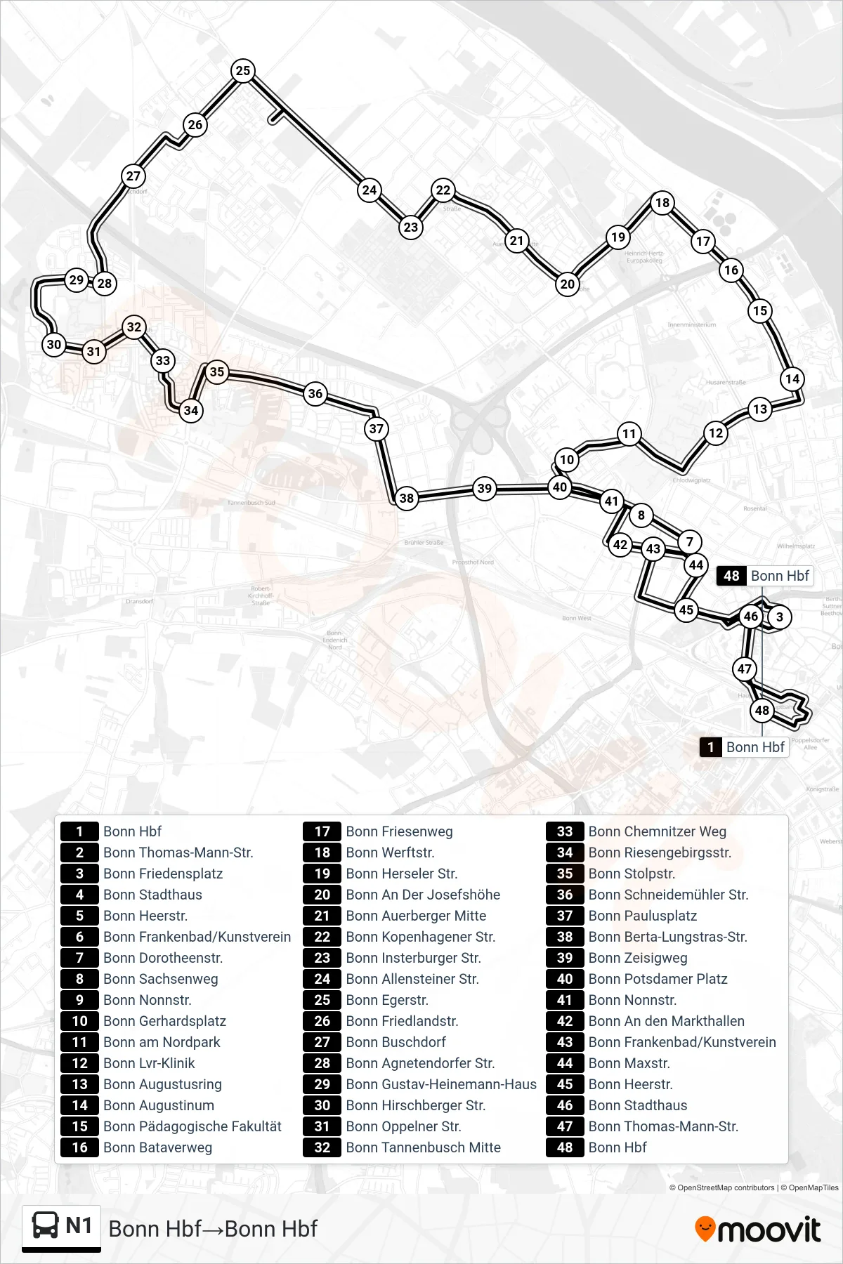
Stops list (N1 - Bonn Hbf→Bonn Hbf)
- Bonn Hbf
- Bonn Thomas-Mann-Str.
- Bonn Friedensplatz
- Bonn Stadthaus
- Bonn Heerstr.
- Bonn Frankenbad/Kunstverein
- Bonn Dorotheenstr.
- Bonn Sachsenweg
- Bonn Nonnstr.
- Bonn Gerhardsplatz
- Bonn am Nordpark
- Bonn Lvr-Klinik
- Bonn Augustusring
- Bonn Augustinum
- Bonn Pädagogische Fakultät
- Bonn Bataverweg
- Bonn Friesenweg
- Bonn Werftstr.
- Bonn Herseler Str.
- Bonn An Der Josefshöhe
- Bonn Auerberger Mitte
- Bonn Kopenhagener Str.
- Bonn Insterburger Str.
- Bonn Allensteiner Str.
- Bonn Egerstr.
- Bonn Friedlandstr.
- Bonn Buschdorf
- Bonn Agnetendorfer Str.
- Bonn Gustav-Heinemann-Haus
- Bonn Hirschberger Str.
- Bonn Oppelner Str.
- Bonn Tannenbusch Mitte
- Bonn Chemnitzer Weg
- Bonn Riesengebirgsstr.
- Bonn Stolpstr.
- Bonn Schneidemühler Str.
- Bonn Paulusplatz
- Bonn Berta-Lungstras-Str.
- Bonn Zeisigweg
- Bonn Potsdamer Platz
- Bonn Nonnstr.
- Bonn An den Markthallen
- Bonn Frankenbad/Kunstverein
- Bonn Maxstr.
- Bonn Heerstr.
- Bonn Stadthaus
- Bonn Thomas-Mann-Str.
- Bonn Hbf