
N1 Bus Route Map
View the N1 route map and see all N1 stops along the route. The map of N1 shows where the bus travels and the location of each stop, making it easy to understand the entire route at a glance.
Explore Regionalverkehr Münsterland GmbH routes on the map and see where Regionalverkehr Münsterland GmbH bus services operate. Use the N1 map to find bus stops and see how the N1 connects different areas along its trip.
All N1 stops on the map are displayed in route order, helping you follow the N1 bus from the first stop to the last.
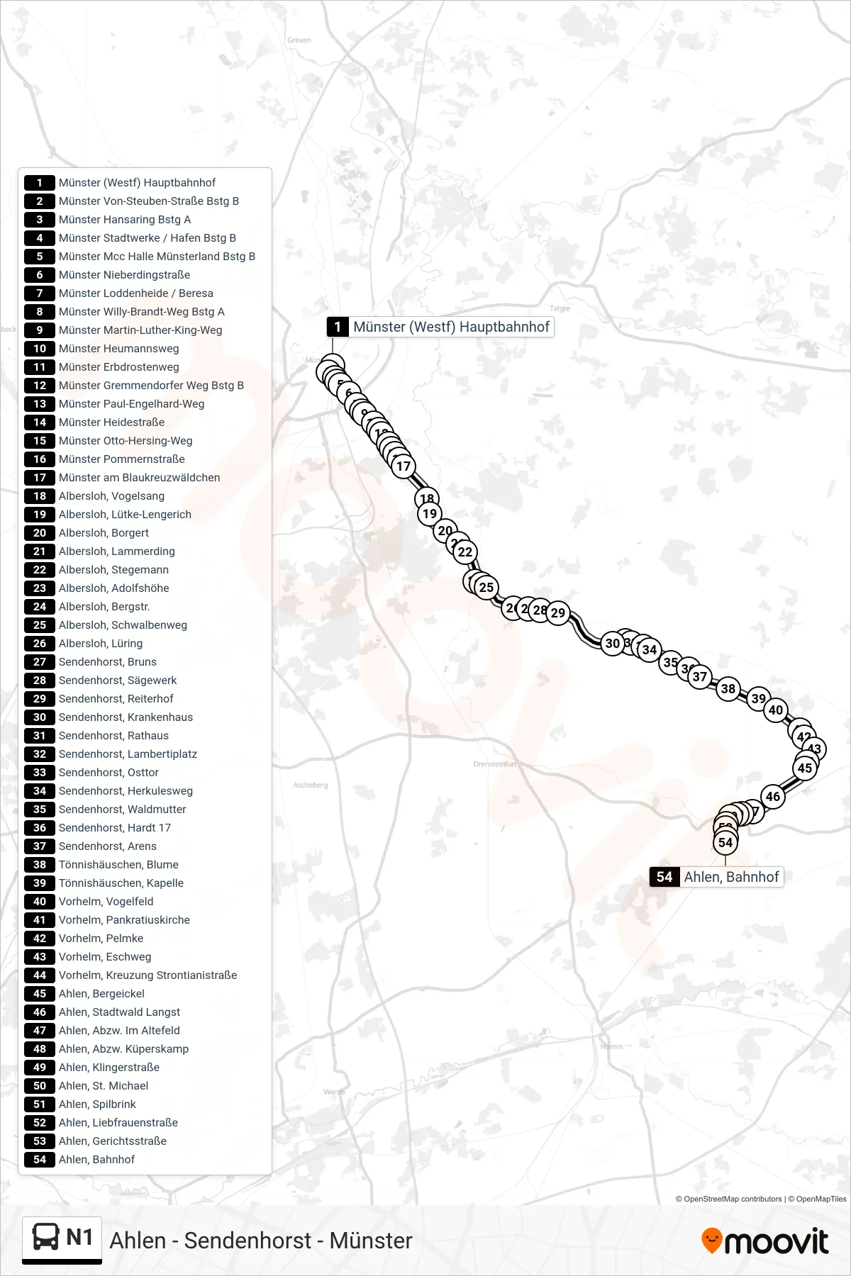
Stops list (N1 - Ahlen, Bahnhof)
- Münster (Westf) Hauptbahnhof
- Münster Von-Steuben-Straße Bstg B
- Münster Hansaring Bstg A
- Münster Stadtwerke / Hafen Bstg B
- Münster Mcc Halle Münsterland Bstg B
- Münster Nieberdingstraße
- Münster Loddenheide / Beresa
- Münster Willy-Brandt-Weg Bstg A
- Münster Martin-Luther-King-Weg
- Münster Heumannsweg
- Münster Erbdrostenweg
- Münster Gremmendorfer Weg Bstg B
- Münster Paul-Engelhard-Weg
- Münster Heidestraße
- Münster Otto-Hersing-Weg
- Münster Pommernstraße
- Münster am Blaukreuzwäldchen
- Albersloh, Vogelsang
- Albersloh, Lütke-Lengerich
- Albersloh, Borgert
- Albersloh, Lammerding
- Albersloh, Stegemann
- Albersloh, Adolfshöhe
- Albersloh, Bergstr.
- Albersloh, Schwalbenweg
- Albersloh, Lüring
- Sendenhorst, Bruns
- Sendenhorst, Sägewerk
- Sendenhorst, Reiterhof
- Sendenhorst, Krankenhaus
- Sendenhorst, Rathaus
- Sendenhorst, Lambertiplatz
- Sendenhorst, Osttor
- Sendenhorst, Herkulesweg
- Sendenhorst, Waldmutter
- Sendenhorst, Hardt 17
- Sendenhorst, Arens
- Tönnishäuschen, Blume
- Tönnishäuschen, Kapelle
- Vorhelm, Vogelfeld
- Vorhelm, Pankratiuskirche
- Vorhelm, Pelmke
- Vorhelm, Eschweg
- Vorhelm, Kreuzung Strontianistraße
- Ahlen, Bergeickel
- Ahlen, Stadtwald Langst
- Ahlen, Abzw. Im Altefeld
- Ahlen, Abzw. Küperskamp
- Ahlen, Klingerstraße
- Ahlen, St. Michael
- Ahlen, Spilbrink
- Ahlen, Liebfrauenstraße
- Ahlen, Gerichtsstraße
- Ahlen, Bahnhof