
N2 Bus Route Map
View the N2 route map and see all N2 stops along the route. The map of N2 shows where the bus travels and the location of each stop, making it easy to understand the entire route at a glance.
Explore SWB Stadtwerke Bonn Verkehrs GmbH routes on the map and see where SWB Stadtwerke Bonn Verkehrs GmbH bus services operate. Use the N2 map to find bus stops and see how the N2 connects different areas along its trip.
All N2 stops on the map are displayed in route order, helping you follow the N2 bus from the first stop to the last.
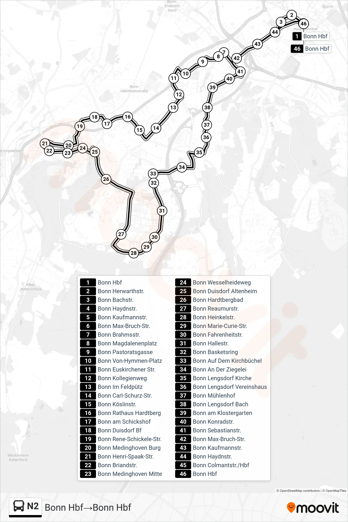
Stops list (N2 - Bonn Hbf→Bonn Hbf)
- Bonn Hbf
- Bonn Herwarthstr.
- Bonn Bachstr.
- Bonn Haydnstr.
- Bonn Kaufmannstr.
- Bonn Max-Bruch-Str.
- Bonn Brahmsstr.
- Bonn Magdalenenplatz
- Bonn Pastoratsgasse
- Bonn Von-Hymmen-Platz
- Bonn Euskirchener Str.
- Bonn Kollegienweg
- Bonn Im Feldpütz
- Bonn Carl-Schurz-Str.
- Bonn Köslinstr.
- Bonn Rathaus Hardtberg
- Bonn am Schickshof
- Bonn Duisdorf Bf
- Bonn Rene-Schickele-Str.
- Bonn Medinghoven Burg
- Bonn Henri-Spaak-Str.
- Bonn Briandstr.
- Bonn Medinghoven Mitte
- Bonn Wesselheideweg
- Bonn Duisdorf Altenheim
- Bonn Hardtbergbad
- Bonn Reaumurstr.
- Bonn Heinkelstr.
- Bonn Marie-Curie-Str.
- Bonn Fahrenheitstr.
- Bonn Hallestr.
- Bonn Basketsring
- Bonn Auf Dem Kirchbüchel
- Bonn An Der Ziegelei
- Bonn Lengsdorf Kirche
- Bonn Lengsdorf Vereinshaus
- Bonn Mühlenhof
- Bonn Lengsdorf Bach
- Bonn am Klostergarten
- Bonn Konradstr.
- Bonn Sebastianstr.
- Bonn Max-Bruch-Str.
- Bonn Kaufmannstr.
- Bonn Haydnstr.
- Bonn Colmantstr./Hbf
- Bonn Hbf