
N30 Bus Route Map
View the N30 route map and see all N30 stops along the route. The map of N30 shows where the bus travels and the location of each stop, making it easy to understand the entire route at a glance.
Explore KVG Zickenheiner GmbH routes on the map and see where KVG Zickenheiner GmbH bus services operate. Use the N30 map to find bus stops and see how the N30 connects different areas along its trip.
All N30 stops on the map are displayed in route order, helping you follow the N30 bus from the first stop to the last.
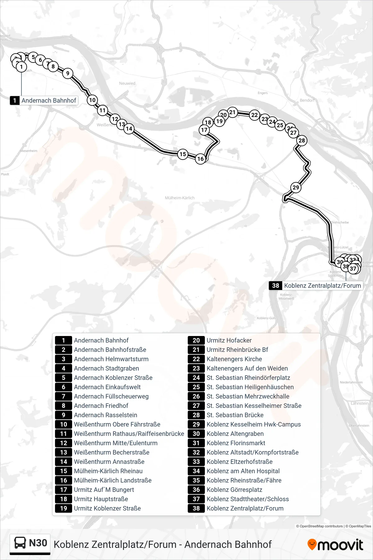
Stops list (N30 - Koblenz Zentralplatz/Forum)
- Andernach Bahnhof
- Andernach Bahnhofstraße
- Andernach Helmwartsturm
- Andernach Stadtgraben
- Andernach Koblenzer Straße
- Andernach Einkaufswelt
- Andernach Füllscheuerweg
- Andernach Friedhof
- Andernach Rasselstein
- Weißenthurm Obere Fährstraße
- Weißenthurm Rathaus/Raiffeisenbrücke
- Weißenthurm Mitte/Eulenturm
- Weißenthurm Becherstraße
- Weißenthurm Annastraße
- Mülheim-Kärlich Rheinau
- Mülheim-Kärlich Landstraße
- Urmitz Auf´M Bungert
- Urmitz Hauptstraße
- Urmitz Koblenzer Straße
- Urmitz Hofacker
- Urmitz Rheinbrücke Bf
- Kaltenengers Kirche
- Kaltenengers Auf den Weiden
- St. Sebastian Rheindörferplatz
- St. Sebastian Heiligenhäuschen
- St. Sebastian Mehrzweckhalle
- St. Sebastian Kesselheimer Straße
- St. Sebastian Brücke
- Koblenz Kesselheim Hwk-Campus
- Koblenz Altengraben
- Koblenz Florinsmarkt
- Koblenz Altstadt/Kornpfortstraße
- Koblenz Eltzerhofstraße
- Koblenz am Alten Hospital
- Koblenz Rheinstraße/Fähre
- Koblenz Görresplatz
- Koblenz Stadttheater/Schloss
- Koblenz Zentralplatz/Forum