
N4 Bus Route Map
View the N4 route map and see all N4 stops along the route. The map of N4 shows where the bus travels and the location of each stop, making it easy to understand the entire route at a glance.
Explore Bus Átha Cliath – Dublin Bus routes on the map and see where Bus Átha Cliath – Dublin Bus bus services operate. Use the N4 map to find bus stops and see how the N4 connects different areas along its trip.
All N4 stops on the map are displayed in route order, helping you follow the N4 bus from the first stop to the last.
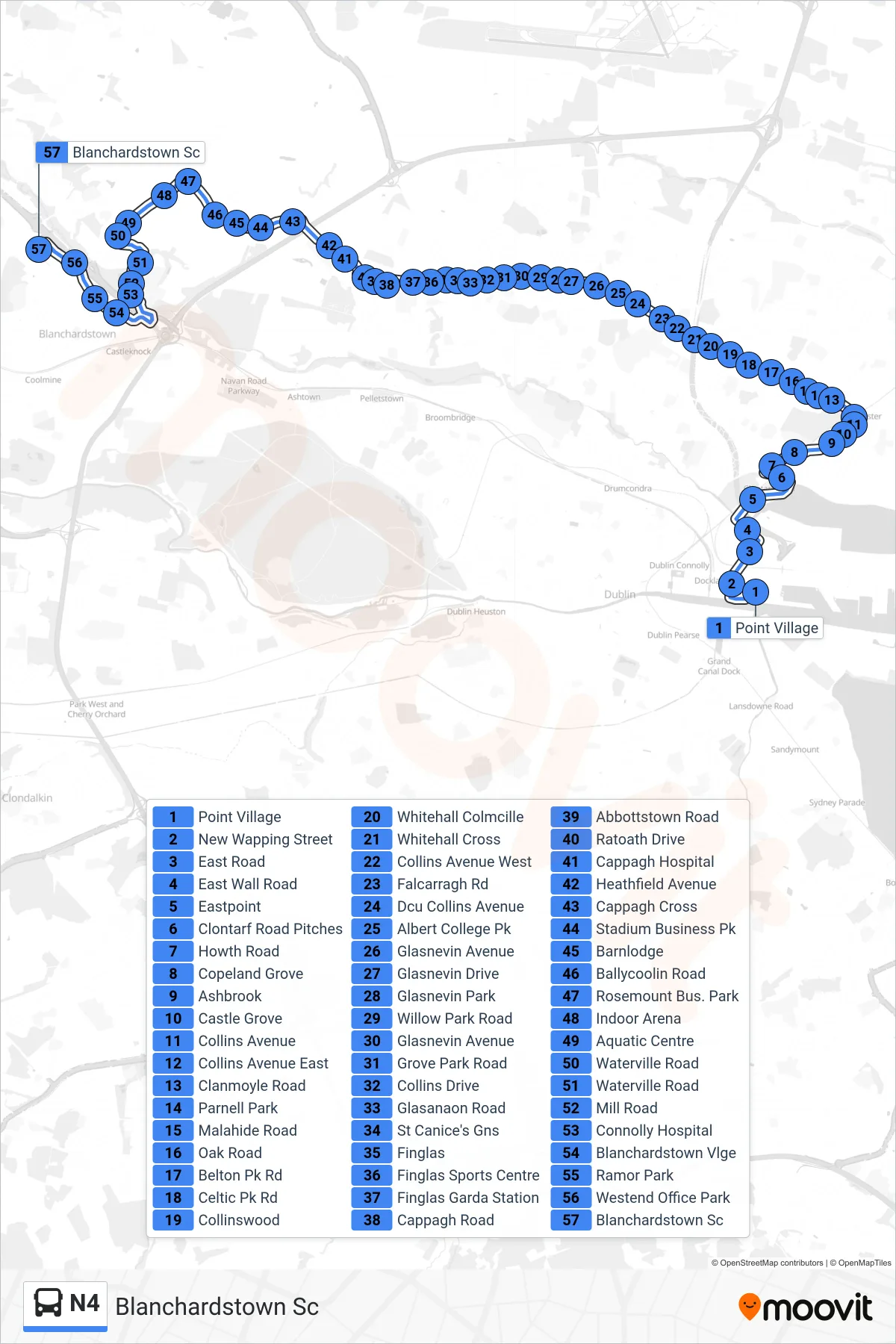
Stops list (N4 - Blanchardstown Sc)
- Point Village
- New Wapping Street
- East Road
- East Wall Road
- Eastpoint
- Clontarf Road Pitches
- Howth Road
- Copeland Grove
- Ashbrook
- Castle Grove
- Collins Avenue
- Collins Avenue East
- Clanmoyle Road
- Parnell Park
- Malahide Road
- Oak Road
- Belton Pk Rd
- Celtic Pk Rd
- Collinswood
- Whitehall Colmcille
- Whitehall Cross
- Collins Avenue West
- Falcarragh Rd
- Dcu Collins Avenue
- Albert College Pk
- Glasnevin Avenue
- Glasnevin Drive
- Glasnevin Park
- Willow Park Road
- Glasnevin Avenue
- Grove Park Road
- Collins Drive
- Glasanaon Road
- St Canice's Gns
- Finglas
- Finglas Sports Centre
- Finglas Garda Station
- Cappagh Road
- Abbottstown Road
- Ratoath Drive
- Cappagh Hospital
- Heathfield Avenue
- Cappagh Cross
- Stadium Business Pk
- Barnlodge
- Ballycoolin Road
- Rosemount Bus. Park
- Indoor Arena
- Aquatic Centre
- Waterville Road
- Waterville Road
- Mill Road
- Connolly Hospital
- Blanchardstown Vlge
- Ramor Park
- Westend Office Park
- Blanchardstown Sc