
N42 Bus Route Map
View the N42 route map and see all N42 stops along the route. The map of N42 shows where the bus travels and the location of each stop, making it easy to understand the entire route at a glance.
Explore wupsi wupsi GmbH routes on the map and see where wupsi wupsi GmbH bus services operate. Use the N42 map to find bus stops and see how the N42 connects different areas along its trip.
All N42 stops on the map are displayed in route order, helping you follow the N42 bus from the first stop to the last.
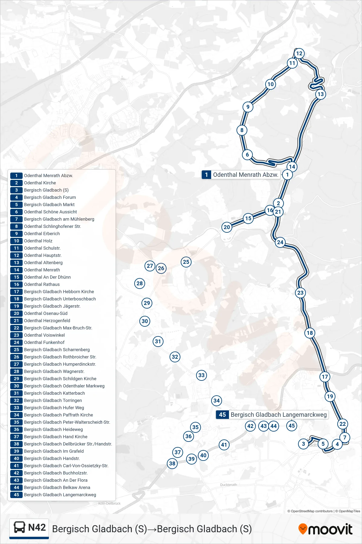
Stops list (N42 - Bergisch Gladbach (S)→Bergisch Gladbach (S))
- Bergisch Gladbach (S)
- Bergisch Gladbach Markt
- Bergisch Gladbach Forum
- Bergisch Gladbach am Mühlenberg
- Bergisch Gladbach Max-Bruch-Str.
- Bergisch Gladbach Jägerstr.
- Bergisch Gladbach Hebborn Kirche
- Bergisch Gladbach Unterboschbach
- Odenthal Voiswinkel
- Odenthal Funkenhof
- Odenthal Herzogenfeld
- Odenthal Kirche
- Odenthal Menrath Abzw.
- Odenthal Schöne Aussicht
- Odenthal Schlinghofener Str.
- Odenthal Erberich
- Odenthal Holz
- Odenthal Schulstr.
- Odenthal Hauptstr.
- Odenthal Altenberg
- Odenthal Menrath
- Odenthal Kirche
- Odenthal Rathaus
- Odenthal An Der Dhünn
- Odenthal Osenau-Süd
- Bergisch Gladbach Scharrenberg
- Bergisch Gladbach Brahmsstr.
- Bergisch Gladbach Schildgen Kirche
- Bergisch Gladbach Odenthaler Markweg
- Bergisch Gladbach Katterbach
- Bergisch Gladbach Torringen
- Bergisch Gladbach Hufer Weg
- Bergisch Gladbach Paffrath Kirche
- Bergisch Gladbach Peter-Walterscheidt-Str.
- Bergisch Gladbach Heideweg
- Bergisch Gladbach Hand Kirche
- Bergisch Gladbach Dellbrücker Str./Handstr.
- Bergisch Gladbach Im Grafeld
- Bergisch Gladbach Handstr.
- Bergisch Gladbach Carl-Von-Ossietzky-Str.
- Bergisch Gladbach Buchholzstr.
- Bergisch Gladbach An Der Flora
- Bergisch Gladbach Belkaw Arena
- Bergisch Gladbach Langemarckweg
- Bergisch Gladbach (S)