
N44 Bus Route Map
View the N44 route map and see all N44 stops along the route. The map of N44 shows where the bus travels and the location of each stop, making it easy to understand the entire route at a glance.
Explore wupsi wupsi GmbH routes on the map and see where wupsi wupsi GmbH bus services operate. Use the N44 map to find bus stops and see how the N44 connects different areas along its trip.
All N44 stops on the map are displayed in route order, helping you follow the N44 bus from the first stop to the last.
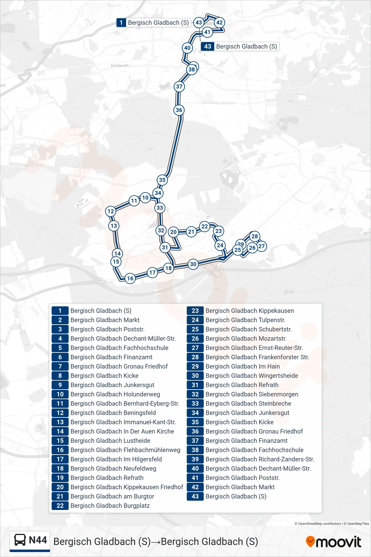
Stops list (N44 - Bergisch Gladbach (S)→Bergisch Gladbach (S))
- Bergisch Gladbach (S)
- Bergisch Gladbach Markt
- Bergisch Gladbach Poststr.
- Bergisch Gladbach Dechant-Müller-Str.
- Bergisch Gladbach Fachhochschule
- Bergisch Gladbach Finanzamt
- Bergisch Gladbach Gronau Friedhof
- Bergisch Gladbach Kicke
- Bergisch Gladbach Junkersgut
- Bergisch Gladbach Holunderweg
- Bergisch Gladbach Bernhard-Eyberg-Str.
- Bergisch Gladbach Beningsfeld
- Bergisch Gladbach Immanuel-Kant-Str.
- Bergisch Gladbach In Der Auen Kirche
- Bergisch Gladbach Lustheide
- Bergisch Gladbach Flehbachmühlenweg
- Bergisch Gladbach Im Hilgersfeld
- Bergisch Gladbach Neufeldweg
- Bergisch Gladbach Refrath
- Bergisch Gladbach Kippekausen Friedhof
- Bergisch Gladbach am Burgtor
- Bergisch Gladbach Burgplatz
- Bergisch Gladbach Kippekausen
- Bergisch Gladbach Tulpenstr.
- Bergisch Gladbach Schubertstr.
- Bergisch Gladbach Mozartstr.
- Bergisch Gladbach Ernst-Reuter-Str.
- Bergisch Gladbach Frankenforster Str.
- Bergisch Gladbach Im Hain
- Bergisch Gladbach Wingertsheide
- Bergisch Gladbach Refrath
- Bergisch Gladbach Siebenmorgen
- Bergisch Gladbach Steinbreche
- Bergisch Gladbach Junkersgut
- Bergisch Gladbach Kicke
- Bergisch Gladbach Gronau Friedhof
- Bergisch Gladbach Finanzamt
- Bergisch Gladbach Fachhochschule
- Bergisch Gladbach Richard-Zanders-Str.
- Bergisch Gladbach Dechant-Müller-Str.
- Bergisch Gladbach Poststr.
- Bergisch Gladbach Markt
- Bergisch Gladbach (S)