
N5 Bus Route Map
View the N5 route map and see all N5 stops along the route. The map of N5 shows where the bus travels and the location of each stop, making it easy to understand the entire route at a glance.
Explore SWB Stadtwerke Bonn Verkehrs GmbH routes on the map and see where SWB Stadtwerke Bonn Verkehrs GmbH bus services operate. Use the N5 map to find bus stops and see how the N5 connects different areas along its trip.
All N5 stops on the map are displayed in route order, helping you follow the N5 bus from the first stop to the last.
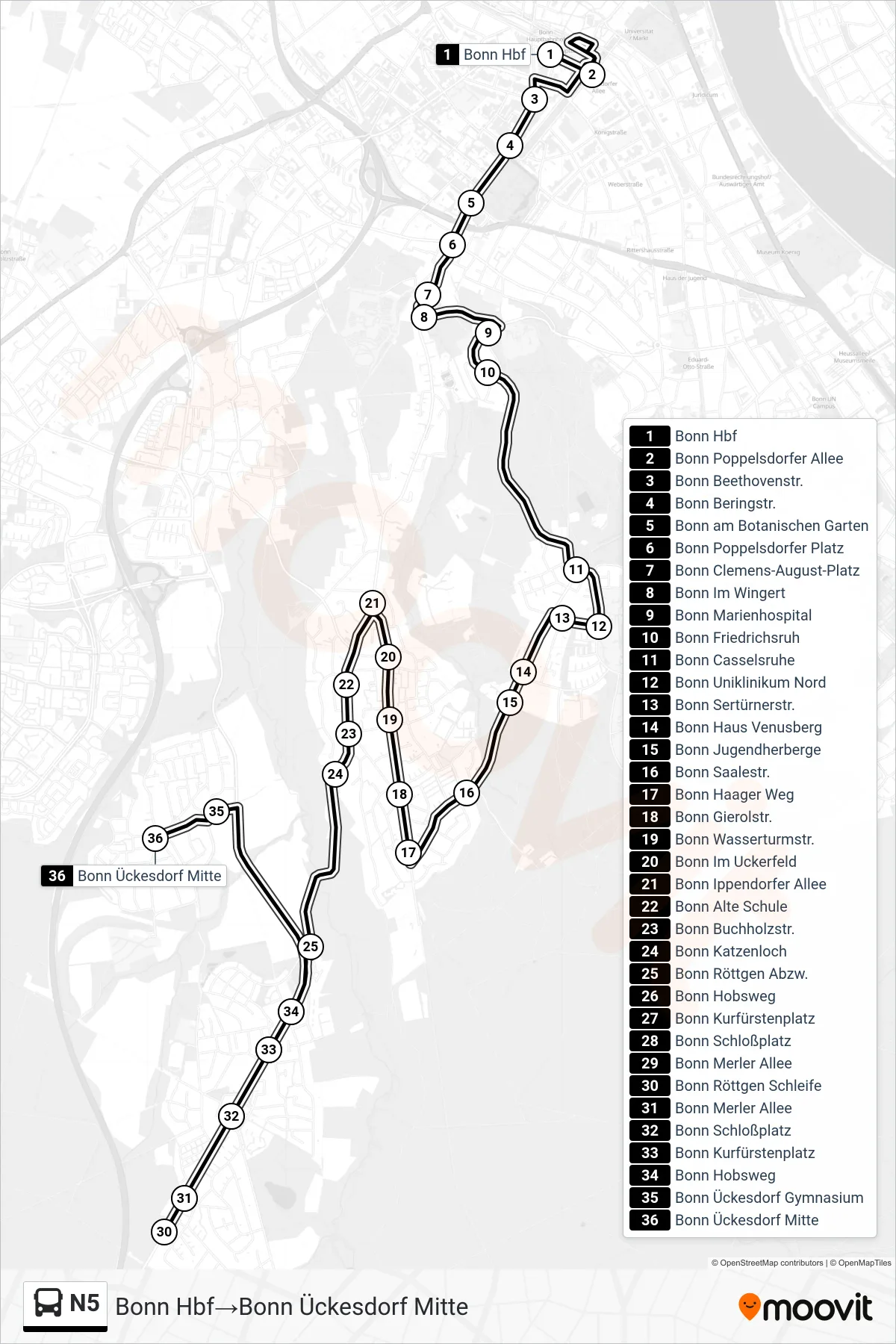
Stops list (N5 - Bonn Hbf→Bonn Ückesdorf Mitte)
- Bonn Hbf
- Bonn Poppelsdorfer Allee
- Bonn Beethovenstr.
- Bonn Beringstr.
- Bonn am Botanischen Garten
- Bonn Poppelsdorfer Platz
- Bonn Clemens-August-Platz
- Bonn Im Wingert
- Bonn Marienhospital
- Bonn Friedrichsruh
- Bonn Casselsruhe
- Bonn Uniklinikum Nord
- Bonn Sertürnerstr.
- Bonn Haus Venusberg
- Bonn Jugendherberge
- Bonn Saalestr.
- Bonn Haager Weg
- Bonn Gierolstr.
- Bonn Wasserturmstr.
- Bonn Im Uckerfeld
- Bonn Ippendorfer Allee
- Bonn Alte Schule
- Bonn Buchholzstr.
- Bonn Katzenloch
- Bonn Röttgen Abzw.
- Bonn Hobsweg
- Bonn Kurfürstenplatz
- Bonn Schloßplatz
- Bonn Merler Allee
- Bonn Röttgen Schleife
- Bonn Merler Allee
- Bonn Schloßplatz
- Bonn Kurfürstenplatz
- Bonn Hobsweg
- Bonn Ückesdorf Gymnasium
- Bonn Ückesdorf Mitte