
NC Bus Route Map
View the NC route map and see all NC stops along the route. The map of NC shows where the bus travels and the location of each stop, making it easy to understand the entire route at a glance.
Explore University of Georgia routes on the map and see where University of Georgia bus services operate. Use the NC map to find bus stops and see how the NC connects different areas along its trip.
All NC stops on the map are displayed in route order, helping you follow the NC bus from the first stop to the last.
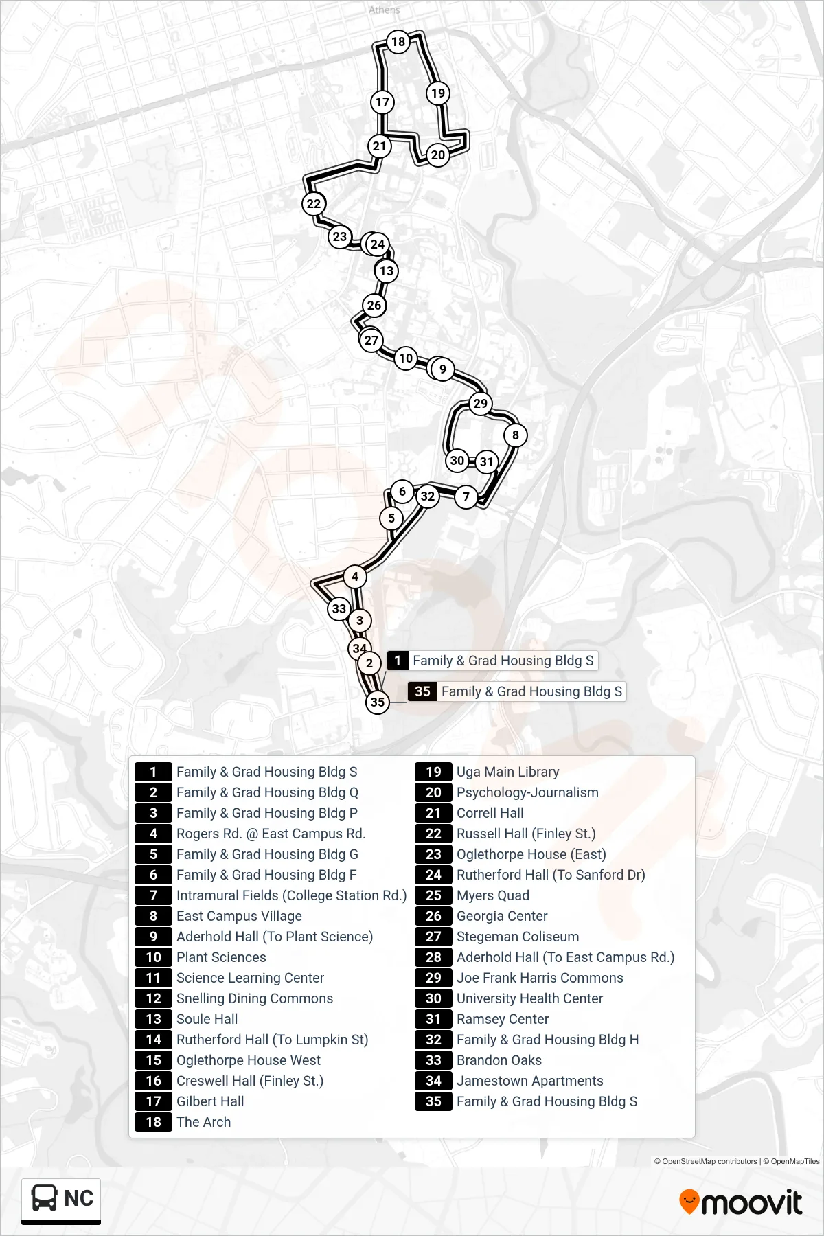
Stops list (NC - )
- Family & Grad Housing Bldg S
- Family & Grad Housing Bldg Q
- Family & Grad Housing Bldg P
- Rogers Rd. @ East Campus Rd.
- Family & Grad Housing Bldg G
- Family & Grad Housing Bldg F
- Intramural Fields (College Station Rd.)
- East Campus Village
- Aderhold Hall (To Plant Science)
- Plant Sciences
- Science Learning Center
- Snelling Dining Commons
- Soule Hall
- Rutherford Hall (To Lumpkin St)
- Oglethorpe House West
- Creswell Hall (Finley St.)
- Gilbert Hall
- The Arch
- Uga Main Library
- Psychology-Journalism
- Correll Hall
- Russell Hall (Finley St.)
- Oglethorpe House (East)
- Rutherford Hall (To Sanford Dr)
- Myers Quad
- Georgia Center
- Stegeman Coliseum
- Aderhold Hall (To East Campus Rd.)
- Joe Frank Harris Commons
- University Health Center
- Ramsey Center
- Family & Grad Housing Bldg H
- Brandon Oaks
- Jamestown Apartments
- Family & Grad Housing Bldg S