
NE1 Bus Route Map
View the NE1 route map and see all NE1 stops along the route. The map of NE1 shows where the bus travels and the location of each stop, making it easy to understand the entire route at a glance.
Explore BOGESTRA BUS routes on the map and see where BOGESTRA BUS bus services operate. Use the NE1 map to find bus stops and see how the NE1 connects different areas along its trip.
All NE1 stops on the map are displayed in route order, helping you follow the NE1 bus from the first stop to the last.
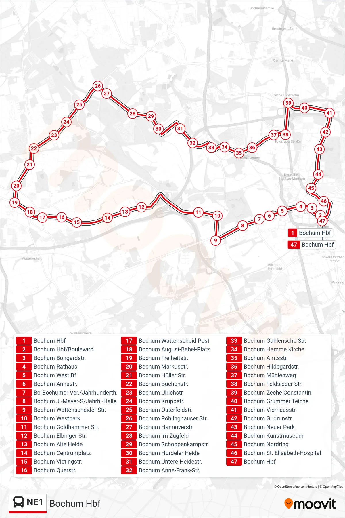
Stops list (NE1 - Bochum Hbf)
- Bochum Hbf
- Bochum Hbf/Boulevard
- Bochum Bongardstr.
- Bochum Rathaus
- Bochum West Bf
- Bochum Annastr.
- Bo-Bochumer Ver./Jahrhunderth.
- Bochum J.-Mayer-S/Jahrh.-Halle
- Bochum Wattenscheider Str.
- Bochum Westpark
- Bochum Goldhammer Str.
- Bochum Elbinger Str.
- Bochum Alte Heide
- Bochum Centrumplatz
- Bochum Vietingstr.
- Bochum Querstr.
- Bochum Wattenscheid Post
- Bochum August-Bebel-Platz
- Bochum Freiheitstr.
- Bochum Markusstr.
- Bochum Hüller Str.
- Bochum Buchenstr.
- Bochum Ulrichstr.
- Bochum Kruppstr.
- Bochum Osterfeldstr.
- Bochum Röhlinghauser Str.
- Bochum Hannoverstr.
- Bochum Im Zugfeld
- Bochum Schoppenkampstr.
- Bochum Hordeler Heide
- Bochum Untere Heidestr.
- Bochum Anne-Frank-Str.
- Bochum Gahlensche Str.
- Bochum Hamme Kirche
- Bochum Amtsstr.
- Bochum Hildegardstr.
- Bochum Mühlenweg
- Bochum Feldsieper Str.
- Bochum Zeche Constantin
- Bochum Grummer Teiche
- Bochum Vierhausstr.
- Bochum Gudrunstr.
- Bochum Neuer Park
- Bochum Kunstmuseum
- Bochum Nordring
- Bochum St. Elisabeth-Hospital
- Bochum Hbf