
NE1 Bus Route Map
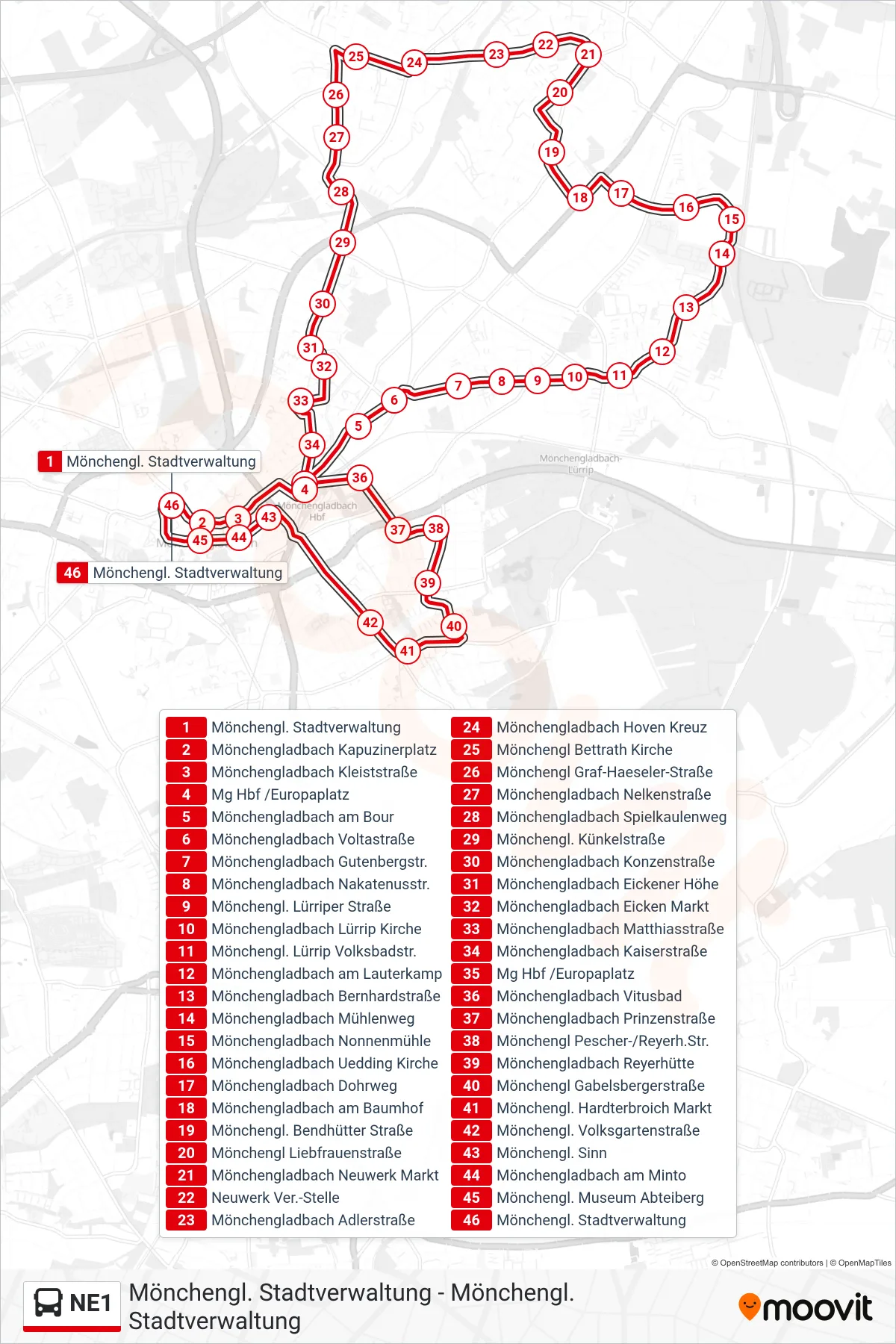
View the NE1 route map and see all NE1 stops along the route. The map of NE1 shows where the bus travels and the location of each stop, making it easy to understand the entire route at a glance.
Explore NEW routes on the map and see where NEW bus services operate. Use the NE1 map to find bus stops and see how the NE1 connects different areas along its trip.
All NE1 stops on the map are displayed in route order, helping you follow the NE1 bus from the first stop to the last.
Stops list (NE1 - Mönchengl. Stadtverwaltung)
- Mönchengl. Stadtverwaltung
- Mönchengladbach Kapuzinerplatz
- Mönchengladbach Kleiststraße
- Mg Hbf /Europaplatz
- Mönchengladbach am Bour
- Mönchengladbach Voltastraße
- Mönchengladbach Gutenbergstr.
- Mönchengladbach Nakatenusstr.
- Mönchengl. Lürriper Straße
- Mönchengladbach Lürrip Kirche
- Mönchengl. Lürrip Volksbadstr.
- Mönchengladbach am Lauterkamp
- Mönchengladbach Bernhardstraße
- Mönchengladbach Mühlenweg
- Mönchengladbach Nonnenmühle
- Mönchengladbach Uedding Kirche
- Mönchengladbach Dohrweg
- Mönchengladbach am Baumhof
- Mönchengl. Bendhütter Straße
- Mönchengl Liebfrauenstraße
- Mönchengladbach Neuwerk Markt
- Neuwerk Ver.-Stelle
- Mönchengladbach Adlerstraße
- Mönchengladbach Hoven Kreuz
- Mönchengl Bettrath Kirche
- Mönchengl Graf-Haeseler-Straße
- Mönchengladbach Nelkenstraße
- Mönchengladbach Spielkaulenweg
- Mönchengl. Künkelstraße
- Mönchengladbach Konzenstraße
- Mönchengladbach Eickener Höhe
- Mönchengladbach Eicken Markt
- Mönchengladbach Matthiasstraße
- Mönchengladbach Kaiserstraße
- Mg Hbf /Europaplatz
- Mönchengladbach Vitusbad
- Mönchengladbach Prinzenstraße
- Mönchengl Pescher-/Reyerh.Str.
- Mönchengladbach Reyerhütte
- Mönchengl Gabelsbergerstraße
- Mönchengl. Hardterbroich Markt
- Mönchengl. Volksgartenstraße
- Mönchengl. Sinn
- Mönchengladbach am Minto
- Mönchengl. Museum Abteiberg
- Mönchengl. Stadtverwaltung