
NE18 Bus Route Map
View the NE18 route map and see all NE18 stops along the route. The map of NE18 shows where the bus travels and the location of each stop, making it easy to understand the entire route at a glance.
Explore BOGESTRA BUS routes on the map and see where BOGESTRA BUS bus services operate. Use the NE18 map to find bus stops and see how the NE18 connects different areas along its trip.
All NE18 stops on the map are displayed in route order, helping you follow the NE18 bus from the first stop to the last.
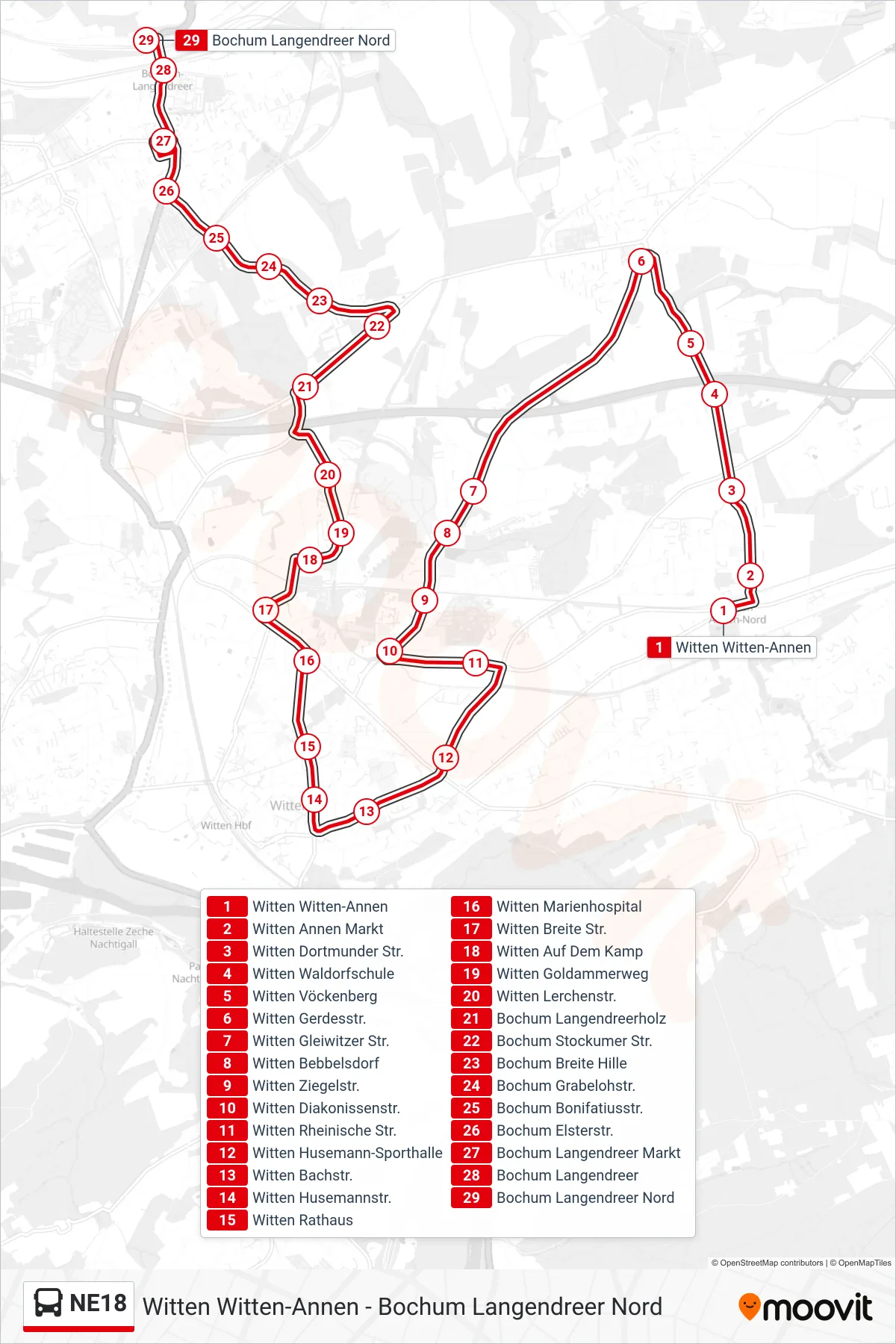
Stops list (NE18 - Bochum Langendreer Nord)
- Witten Witten-Annen
- Witten Annen Markt
- Witten Dortmunder Str.
- Witten Waldorfschule
- Witten Vöckenberg
- Witten Gerdesstr.
- Witten Gleiwitzer Str.
- Witten Bebbelsdorf
- Witten Ziegelstr.
- Witten Diakonissenstr.
- Witten Rheinische Str.
- Witten Husemann-Sporthalle
- Witten Bachstr.
- Witten Husemannstr.
- Witten Rathaus
- Witten Marienhospital
- Witten Breite Str.
- Witten Auf Dem Kamp
- Witten Goldammerweg
- Witten Lerchenstr.
- Bochum Langendreerholz
- Bochum Stockumer Str.
- Bochum Breite Hille
- Bochum Grabelohstr.
- Bochum Bonifatiusstr.
- Bochum Elsterstr.
- Bochum Langendreer Markt
- Bochum Langendreer
- Bochum Langendreer Nord