
NE2 Bus Route Map
View the NE2 route map and see all NE2 stops along the route. The map of NE2 shows where the bus travels and the location of each stop, making it easy to understand the entire route at a glance.
Explore BOGESTRA BUS routes on the map and see where BOGESTRA BUS bus services operate. Use the NE2 map to find bus stops and see how the NE2 connects different areas along its trip.
All NE2 stops on the map are displayed in route order, helping you follow the NE2 bus from the first stop to the last.
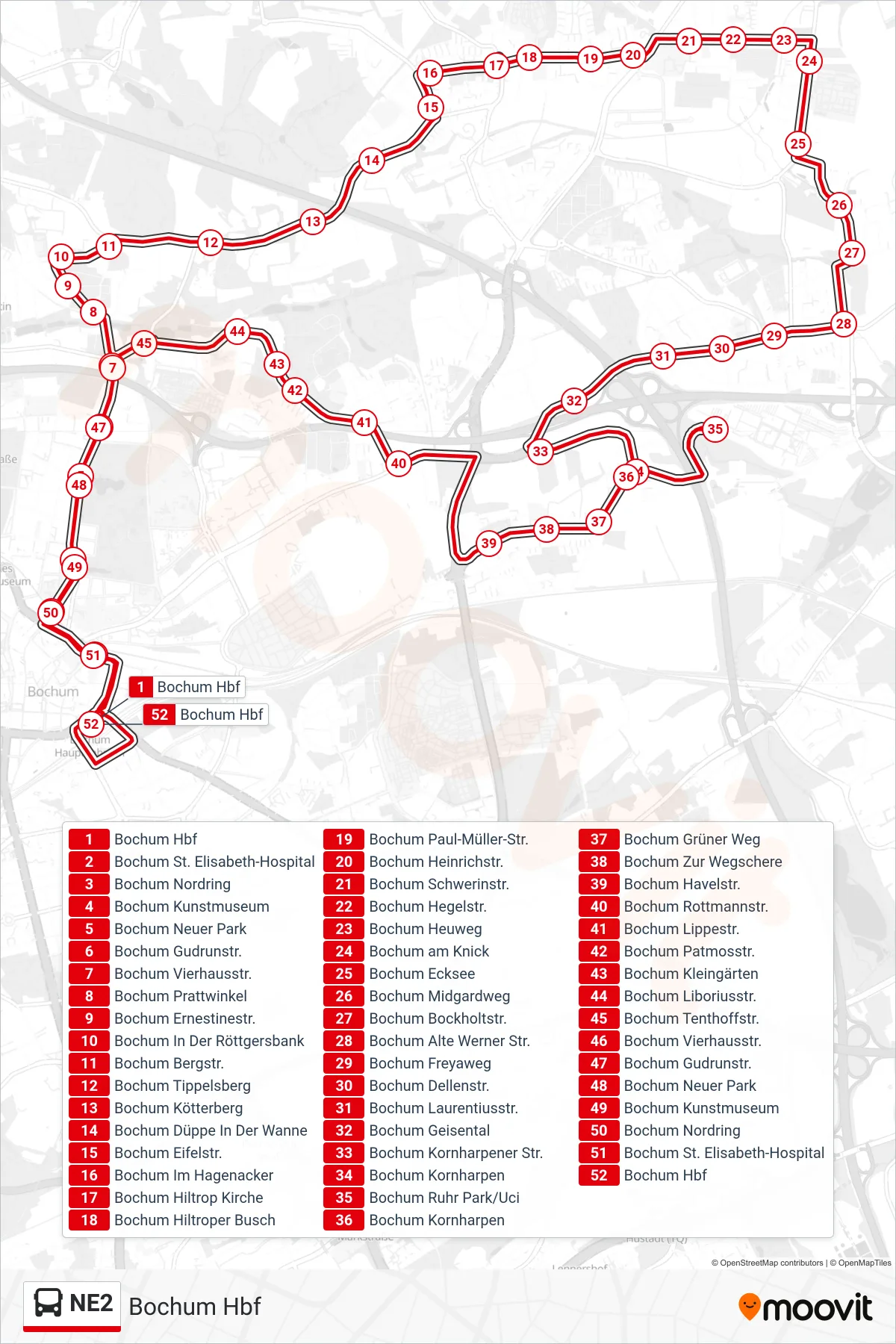
Stops list (NE2 - Bochum Hbf)
- Bochum Hbf
- Bochum St. Elisabeth-Hospital
- Bochum Nordring
- Bochum Kunstmuseum
- Bochum Neuer Park
- Bochum Gudrunstr.
- Bochum Vierhausstr.
- Bochum Prattwinkel
- Bochum Ernestinestr.
- Bochum In Der Röttgersbank
- Bochum Bergstr.
- Bochum Tippelsberg
- Bochum Kötterberg
- Bochum Düppe In Der Wanne
- Bochum Eifelstr.
- Bochum Im Hagenacker
- Bochum Hiltrop Kirche
- Bochum Hiltroper Busch
- Bochum Paul-Müller-Str.
- Bochum Heinrichstr.
- Bochum Schwerinstr.
- Bochum Hegelstr.
- Bochum Heuweg
- Bochum am Knick
- Bochum Ecksee
- Bochum Midgardweg
- Bochum Bockholtstr.
- Bochum Alte Werner Str.
- Bochum Freyaweg
- Bochum Dellenstr.
- Bochum Laurentiusstr.
- Bochum Geisental
- Bochum Kornharpener Str.
- Bochum Kornharpen
- Bochum Ruhr Park/Uci
- Bochum Kornharpen
- Bochum Grüner Weg
- Bochum Zur Wegschere
- Bochum Havelstr.
- Bochum Rottmannstr.
- Bochum Lippestr.
- Bochum Patmosstr.
- Bochum Kleingärten
- Bochum Liboriusstr.
- Bochum Tenthoffstr.
- Bochum Vierhausstr.
- Bochum Gudrunstr.
- Bochum Neuer Park
- Bochum Kunstmuseum
- Bochum Nordring
- Bochum St. Elisabeth-Hospital
- Bochum Hbf