
NE2 Bus Route Map
View the NE2 route map and see all NE2 stops along the route. The map of NE2 shows where the bus travels and the location of each stop, making it easy to understand the entire route at a glance.
Explore DSW Bus routes on the map and see where DSW Bus bus services operate. Use the NE2 map to find bus stops and see how the NE2 connects different areas along its trip.
All NE2 stops on the map are displayed in route order, helping you follow the NE2 bus from the first stop to the last.
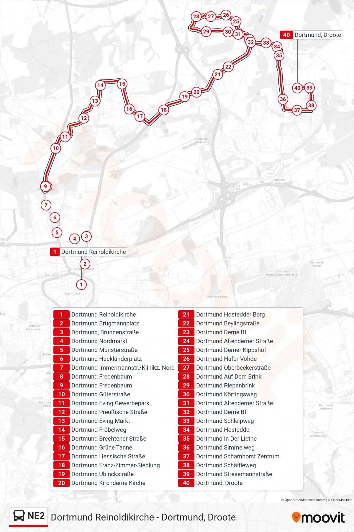
Stops list (NE2 - Dortmund, Droote)
- Dortmund Reinoldikirche
- Dortmund Brügmannplatz
- Dortmund, Brunnenstraße
- Dortmund Nordmarkt
- Dortmund Münsterstraße
- Dortmund Hackländerplatz
- Dortmund Immermannstr./Klinikz. Nord
- Dortmund Fredenbaum
- Dortmund Fredenbaum
- Dortmund Güterstraße
- Dortmund Eving Gewerbepark
- Dortmund Preußische Straße
- Dortmund Eving Markt
- Dortmund Fröbelweg
- Dortmund Brechtener Straße
- Dortmund Grüne Tanne
- Dortmund Hessische Straße
- Dortmund Franz-Zimmer-Siedlung
- Dortmund Ubinckstraße
- Dortmund Kirchderne Kirche
- Dortmund Hostedder Berg
- Dortmund Beylingstraße
- Dortmund Derne Bf
- Dortmund Altenderner Straße
- Dortmund Derner Kippshof
- Dortmund Hafer-Vöhde
- Dortmund Oberbeckerstraße
- Dortmund Auf Dem Brink
- Dortmund Piepenbrink
- Dortmund Körtingsweg
- Dortmund Altenderner Straße
- Dortmund Derne Bf
- Dortmund Schleipweg
- Dortmund Hostedde
- Dortmund In Der Liethe
- Dortmund Simmelweg
- Dortmund Scharnhorst Zentrum
- Dortmund Schäffleweg
- Dortmund Stresemannstraße
- Dortmund, Droote