
NE2 Bus Route Map
View the NE2 route map and see all NE2 stops along the route. The map of NE2 shows where the bus travels and the location of each stop, making it easy to understand the entire route at a glance.
Explore Vestische routes on the map and see where Vestische bus services operate. Use the NE2 map to find bus stops and see how the NE2 connects different areas along its trip.
All NE2 stops on the map are displayed in route order, helping you follow the NE2 bus from the first stop to the last.
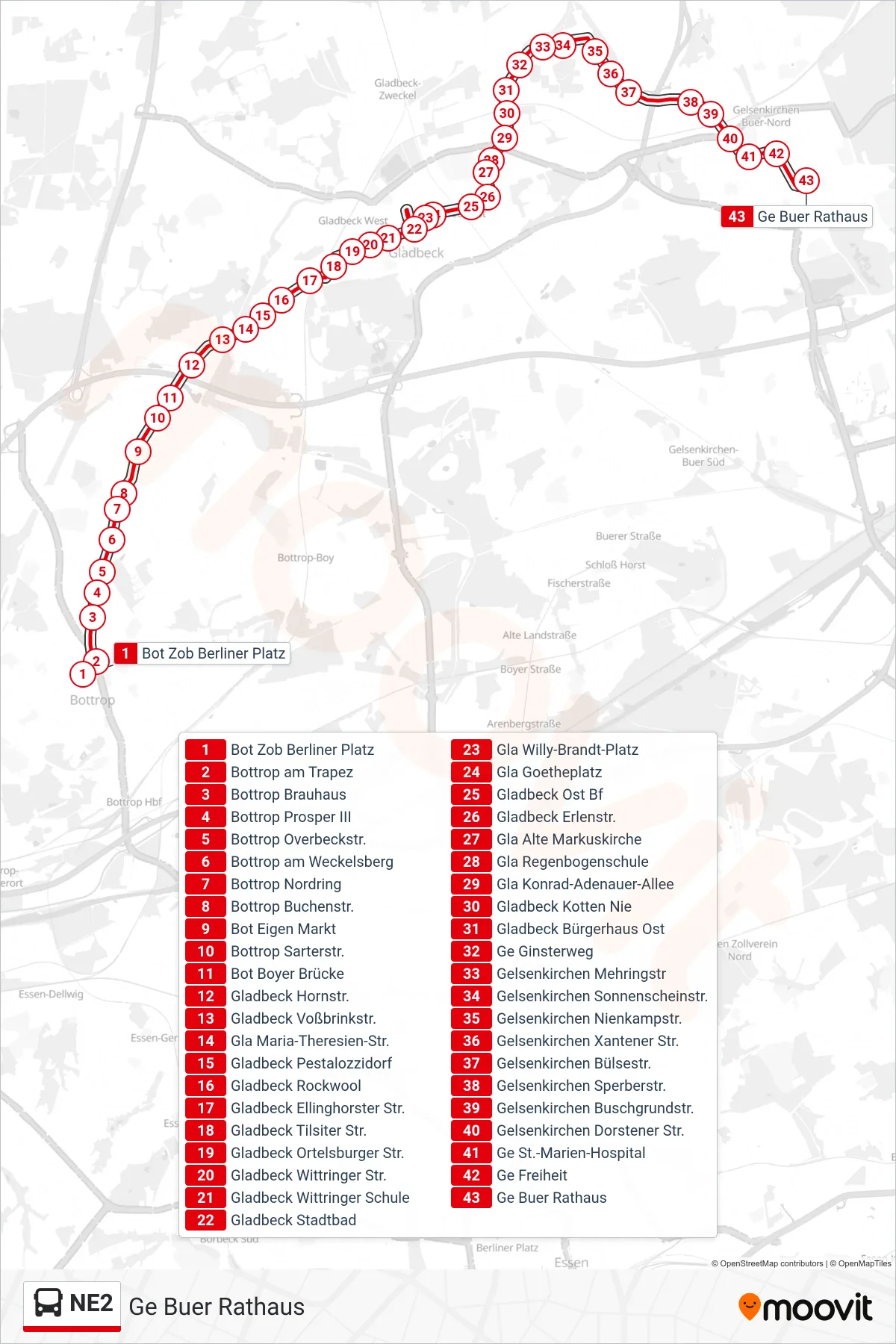
Stops list (NE2 - Ge Buer Rathaus)
- Bot Zob Berliner Platz
- Bottrop am Trapez
- Bottrop Brauhaus
- Bottrop Prosper III
- Bottrop Overbeckstr.
- Bottrop am Weckelsberg
- Bottrop Nordring
- Bottrop Buchenstr.
- Bot Eigen Markt
- Bottrop Sarterstr.
- Bot Boyer Brücke
- Gladbeck Hornstr.
- Gladbeck Voßbrinkstr.
- Gla Maria-Theresien-Str.
- Gladbeck Pestalozzidorf
- Gladbeck Rockwool
- Gladbeck Ellinghorster Str.
- Gladbeck Tilsiter Str.
- Gladbeck Ortelsburger Str.
- Gladbeck Wittringer Str.
- Gladbeck Wittringer Schule
- Gladbeck Stadtbad
- Gla Willy-Brandt-Platz
- Gla Goetheplatz
- Gladbeck Ost Bf
- Gladbeck Erlenstr.
- Gla Alte Markuskirche
- Gla Regenbogenschule
- Gla Konrad-Adenauer-Allee
- Gladbeck Kotten Nie
- Gladbeck Bürgerhaus Ost
- Ge Ginsterweg
- Gelsenkirchen Mehringstr
- Gelsenkirchen Sonnenscheinstr.
- Gelsenkirchen Nienkampstr.
- Gelsenkirchen Xantener Str.
- Gelsenkirchen Bülsestr.
- Gelsenkirchen Sperberstr.
- Gelsenkirchen Buschgrundstr.
- Gelsenkirchen Dorstener Str.
- Ge St.-Marien-Hospital
- Ge Freiheit
- Ge Buer Rathaus