
NE27 Bus Route Map
View the NE27 route map and see all NE27 stops along the route. The map of NE27 shows where the bus travels and the location of each stop, making it easy to understand the entire route at a glance.
Explore VER routes on the map and see where VER bus services operate. Use the NE27 map to find bus stops and see how the NE27 connects different areas along its trip.
All NE27 stops on the map are displayed in route order, helping you follow the NE27 bus from the first stop to the last.
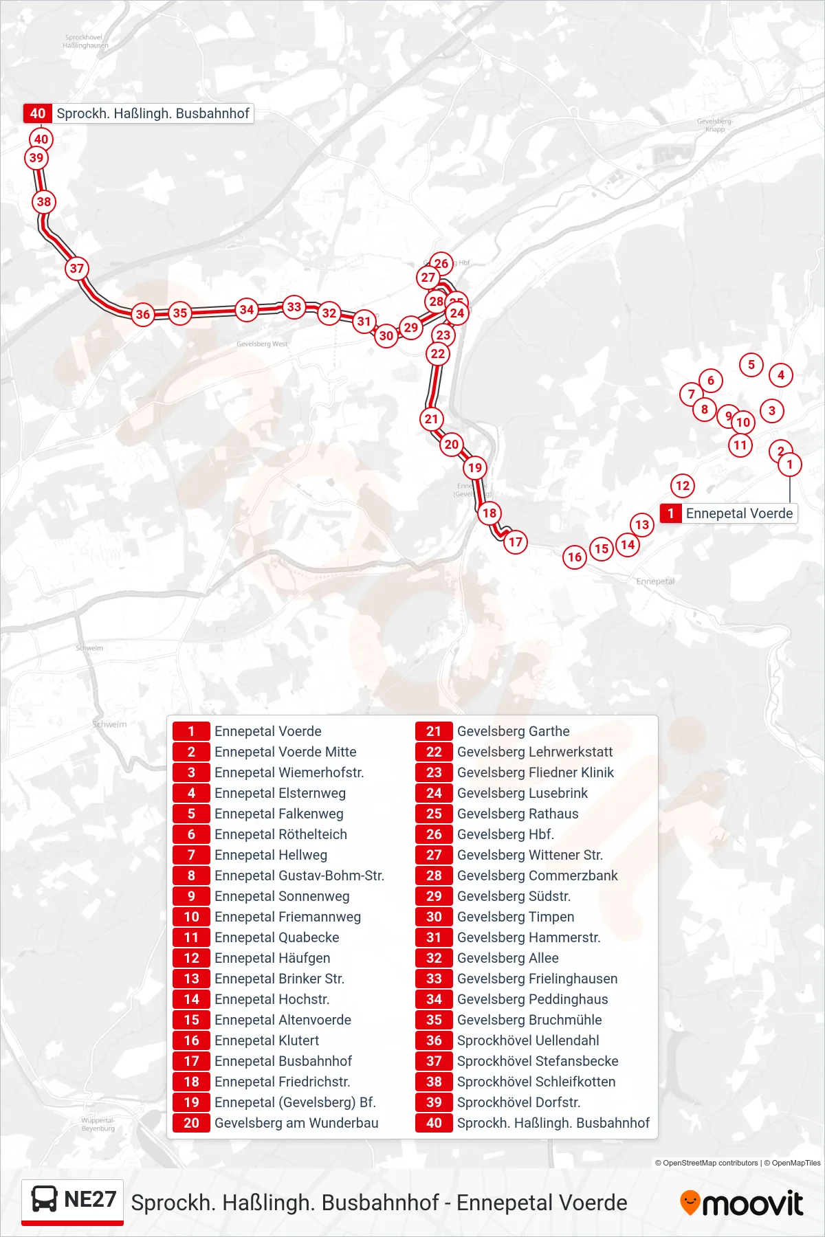
Stops list (NE27 - Sprockh. Haßlingh. Busbahnhof)
- Ennepetal Voerde
- Ennepetal Voerde Mitte
- Ennepetal Wiemerhofstr.
- Ennepetal Elsternweg
- Ennepetal Falkenweg
- Ennepetal Röthelteich
- Ennepetal Hellweg
- Ennepetal Gustav-Bohm-Str.
- Ennepetal Sonnenweg
- Ennepetal Friemannweg
- Ennepetal Quabecke
- Ennepetal Häufgen
- Ennepetal Brinker Str.
- Ennepetal Hochstr.
- Ennepetal Altenvoerde
- Ennepetal Klutert
- Ennepetal Busbahnhof
- Ennepetal Friedrichstr.
- Ennepetal (Gevelsberg) Bf.
- Gevelsberg am Wunderbau
- Gevelsberg Garthe
- Gevelsberg Lehrwerkstatt
- Gevelsberg Fliedner Klinik
- Gevelsberg Lusebrink
- Gevelsberg Rathaus
- Gevelsberg Hbf.
- Gevelsberg Wittener Str.
- Gevelsberg Commerzbank
- Gevelsberg Südstr.
- Gevelsberg Timpen
- Gevelsberg Hammerstr.
- Gevelsberg Allee
- Gevelsberg Frielinghausen
- Gevelsberg Peddinghaus
- Gevelsberg Bruchmühle
- Sprockhövel Uellendahl
- Sprockhövel Stefansbecke
- Sprockhövel Schleifkotten
- Sprockhövel Dorfstr.
- Sprockh. Haßlingh. Busbahnhof