
NE3 Bus Route Map
View the NE3 route map and see all NE3 stops along the route. The map of NE3 shows where the bus travels and the location of each stop, making it easy to understand the entire route at a glance.
Explore Vestische routes on the map and see where Vestische bus services operate. Use the NE3 map to find bus stops and see how the NE3 connects different areas along its trip.
All NE3 stops on the map are displayed in route order, helping you follow the NE3 bus from the first stop to the last.
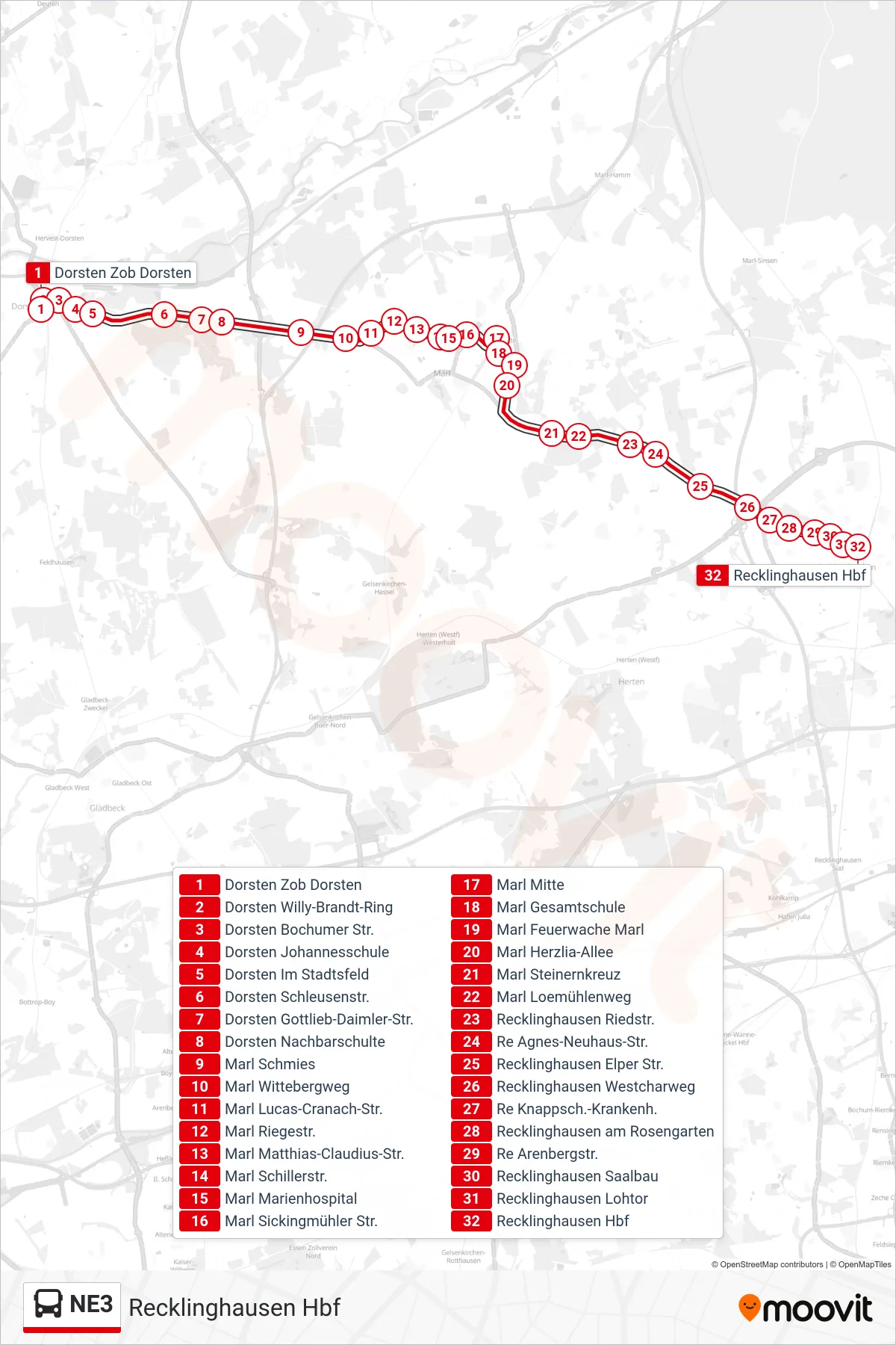
Stops list (NE3 - Recklinghausen Hbf)
- Dorsten Zob Dorsten
- Dorsten Willy-Brandt-Ring
- Dorsten Bochumer Str.
- Dorsten Johannesschule
- Dorsten Im Stadtsfeld
- Dorsten Schleusenstr.
- Dorsten Gottlieb-Daimler-Str.
- Dorsten Nachbarschulte
- Marl Schmies
- Marl Wittebergweg
- Marl Lucas-Cranach-Str.
- Marl Riegestr.
- Marl Matthias-Claudius-Str.
- Marl Schillerstr.
- Marl Marienhospital
- Marl Sickingmühler Str.
- Marl Mitte
- Marl Gesamtschule
- Marl Feuerwache Marl
- Marl Herzlia-Allee
- Marl Steinernkreuz
- Marl Loemühlenweg
- Recklinghausen Riedstr.
- Re Agnes-Neuhaus-Str.
- Recklinghausen Elper Str.
- Recklinghausen Westcharweg
- Re Knappsch.-Krankenh.
- Recklinghausen am Rosengarten
- Re Arenbergstr.
- Recklinghausen Saalbau
- Recklinghausen Lohtor
- Recklinghausen Hbf