
NE8 Bus Route Map
View the NE8 route map and see all NE8 stops along the route. The map of NE8 shows where the bus travels and the location of each stop, making it easy to understand the entire route at a glance.
Explore BOGESTRA BUS routes on the map and see where BOGESTRA BUS bus services operate. Use the NE8 map to find bus stops and see how the NE8 connects different areas along its trip.
All NE8 stops on the map are displayed in route order, helping you follow the NE8 bus from the first stop to the last.
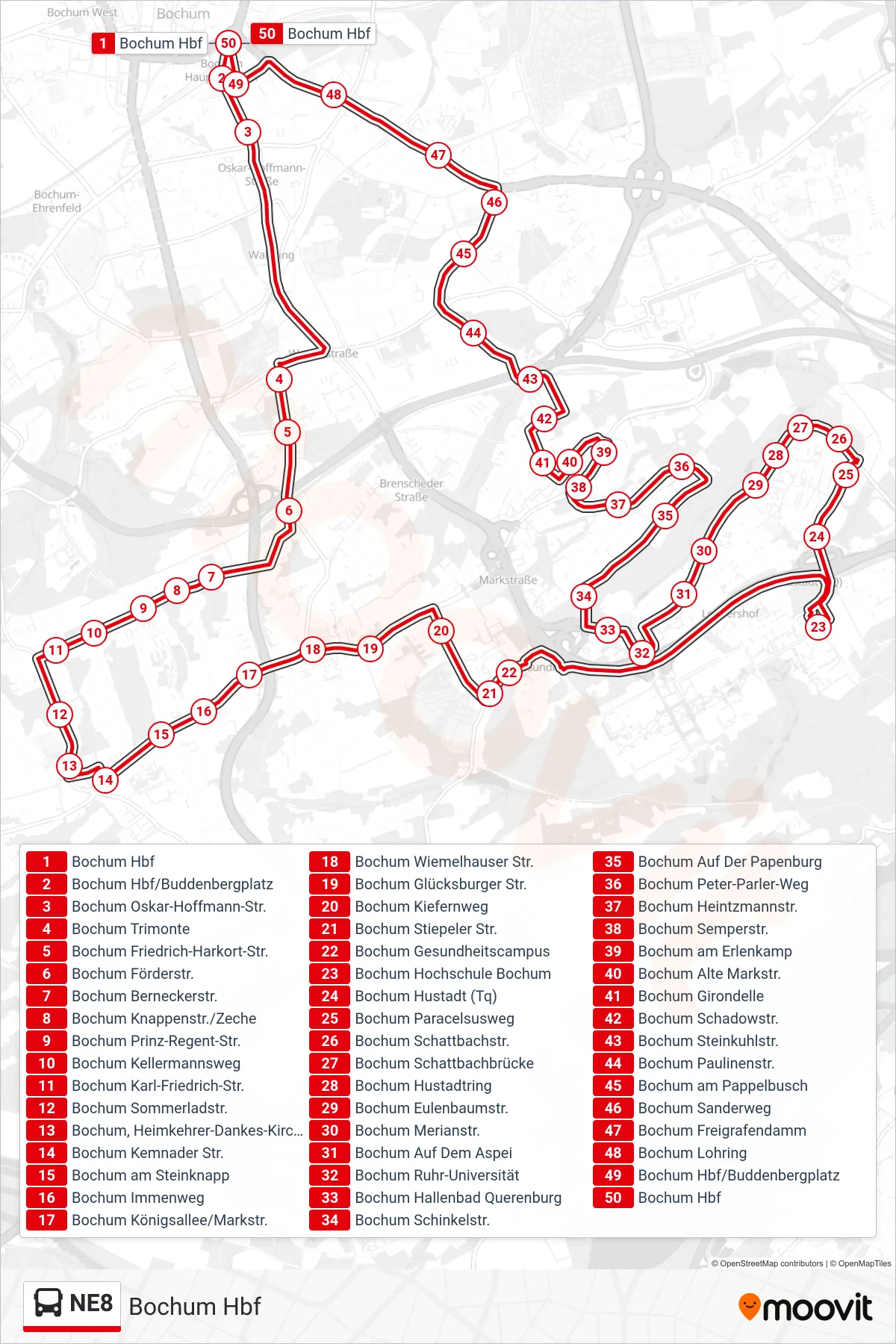
Stops list (NE8 - Bochum Hbf)
- Bochum Hbf
- Bochum Hbf/Buddenbergplatz
- Bochum Oskar-Hoffmann-Str.
- Bochum Trimonte
- Bochum Friedrich-Harkort-Str.
- Bochum Förderstr.
- Bochum Berneckerstr.
- Bochum Knappenstr./Zeche
- Bochum Prinz-Regent-Str.
- Bochum Kellermannsweg
- Bochum Karl-Friedrich-Str.
- Bochum Sommerladstr.
- Bochum, Heimkehrer-Dankes-Kirche
- Bochum Kemnader Str.
- Bochum am Steinknapp
- Bochum Immenweg
- Bochum Königsallee/Markstr.
- Bochum Wiemelhauser Str.
- Bochum Glücksburger Str.
- Bochum Kiefernweg
- Bochum Stiepeler Str.
- Bochum Gesundheitscampus
- Bochum Hochschule Bochum
- Bochum Hustadt (Tq)
- Bochum Paracelsusweg
- Bochum Schattbachstr.
- Bochum Schattbachbrücke
- Bochum Hustadtring
- Bochum Eulenbaumstr.
- Bochum Merianstr.
- Bochum Auf Dem Aspei
- Bochum Ruhr-Universität
- Bochum Hallenbad Querenburg
- Bochum Schinkelstr.
- Bochum Auf Der Papenburg
- Bochum Peter-Parler-Weg
- Bochum Heintzmannstr.
- Bochum Semperstr.
- Bochum am Erlenkamp
- Bochum Alte Markstr.
- Bochum Girondelle
- Bochum Schadowstr.
- Bochum Steinkuhlstr.
- Bochum Paulinenstr.
- Bochum am Pappelbusch
- Bochum Sanderweg
- Bochum Freigrafendamm
- Bochum Lohring
- Bochum Hbf/Buddenbergplatz
- Bochum Hbf