
NE 1 Bus Route Map
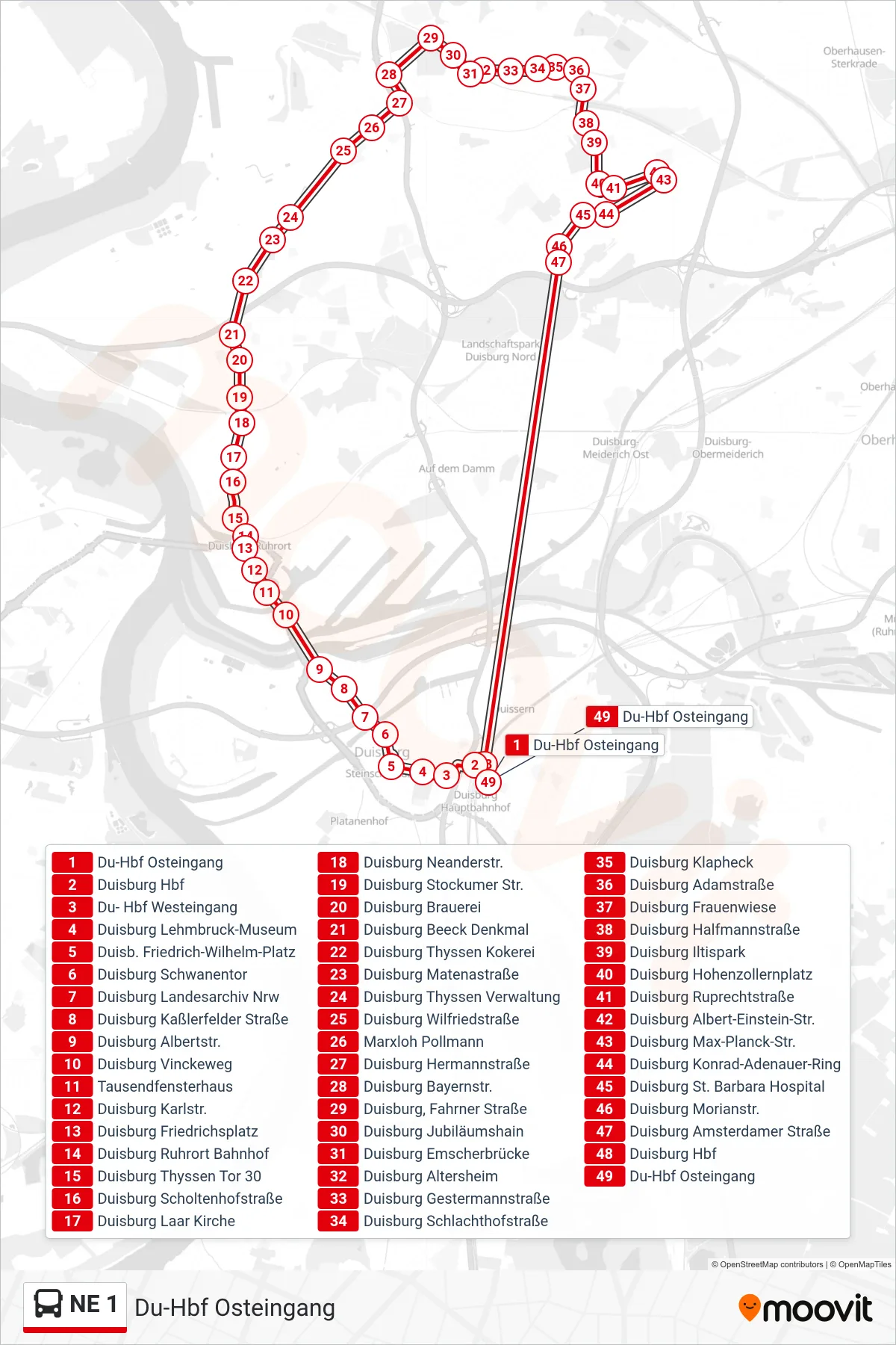
View the NE 1 route map and see all NE 1 stops along the route. The map of NE 1 shows where the bus travels and the location of each stop, making it easy to understand the entire route at a glance.
Explore DVG AG routes on the map and see where DVG AG bus services operate. Use the NE 1 map to find bus stops and see how the NE 1 connects different areas along its trip.
All NE 1 stops on the map are displayed in route order, helping you follow the NE 1 bus from the first stop to the last.
Stops list (NE 1 - Du-Hbf Osteingang)
- Du-Hbf Osteingang
- Duisburg Hbf
- Du- Hbf Westeingang
- Duisburg Lehmbruck-Museum
- Duisb. Friedrich-Wilhelm-Platz
- Duisburg Schwanentor
- Duisburg Landesarchiv Nrw
- Duisburg Kaßlerfelder Straße
- Duisburg Albertstr.
- Duisburg Vinckeweg
- Tausendfensterhaus
- Duisburg Karlstr.
- Duisburg Friedrichsplatz
- Duisburg Ruhrort Bahnhof
- Duisburg Thyssen Tor 30
- Duisburg Scholtenhofstraße
- Duisburg Laar Kirche
- Duisburg Neanderstr.
- Duisburg Stockumer Str.
- Duisburg Brauerei
- Duisburg Beeck Denkmal
- Duisburg Thyssen Kokerei
- Duisburg Matenastraße
- Duisburg Thyssen Verwaltung
- Duisburg Wilfriedstraße
- Marxloh Pollmann
- Duisburg Hermannstraße
- Duisburg Bayernstr.
- Duisburg, Fahrner Straße
- Duisburg Jubiläumshain
- Duisburg Emscherbrücke
- Duisburg Altersheim
- Duisburg Gestermannstraße
- Duisburg Schlachthofstraße
- Duisburg Klapheck
- Duisburg Adamstraße
- Duisburg Frauenwiese
- Duisburg Halfmannstraße
- Duisburg Iltispark
- Duisburg Hohenzollernplatz
- Duisburg Ruprechtstraße
- Duisburg Albert-Einstein-Str.
- Duisburg Max-Planck-Str.
- Duisburg Konrad-Adenauer-Ring
- Duisburg St. Barbara Hospital
- Duisburg Morianstr.
- Duisburg Amsterdamer Straße
- Duisburg Hbf
- Du-Hbf Osteingang